
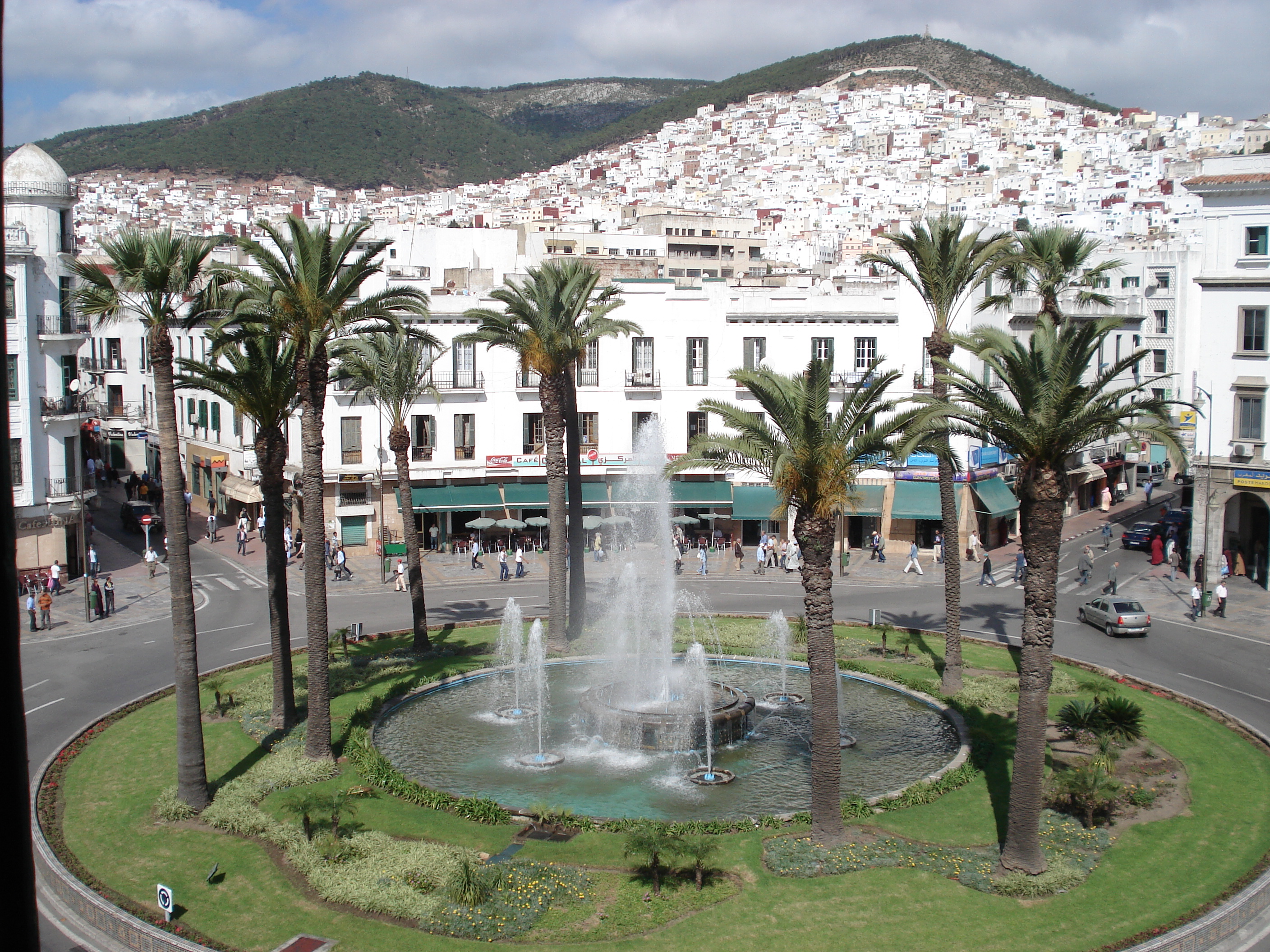
A Mediterranean port city in northern Morocco, Tétouan is a living archive of Moorish and Andalusian heritage, shaped by waves of settlement from Roman times through the exodus of Muslims and Jews from Granada in 1492.
At a glance
Tétouan sits on the Martil Valley, about 60 kilometres south-southeast of Tangier and a few miles south of the Strait of Gibraltar. With a 2024 population of 469,465, it ranks among Morocco’s two major Mediterranean ports. The medina is inscribed on UNESCO’s World Heritage list since 1997 and participates in the UNESCO Creative Cities Network for Crafts and Folk Art.
History
The first settlements appeared in the 3rd century BC among the ancient Mauretanians. Phoenician traders followed, and by the Roman period the site—known as Tamuda—became a colony under Emperor Augustus.
The Marinids initiated the medieval city in the late 13th century with a casbah and mosque. In 1305, Sultan Abu Thabit Amir fortified and expanded the settlement, though Castilian raids around the early 15th century temporarily destroyed it.
Tétouan’s modern identity crystallized after 1492. Ali al-Mandri, an emigrant from the fallen Nasrid Granada, rebuilt and fortified the city. Countless thousands of Muslims (Moriscos) and Jews (Marranos) from Andalusia followed, making Tétouan a major center of Andalusian civilization. The city earned the epithet “Granada’s Daughter”—families still preserve keys to their ancestral Granada homes. Sephardic Jews called it “Pequeña Jerusalén” (Little Jerusalem).
From 1913 to 1956, Tétouan served as capital of the Spanish protectorate of Morocco, governed by a Khalifa and Spanish High Commissioner. Independence arrived in 1956.
What you see
The medina, or old city, preserves the architectural fusion of Moorish and Andalusian traditions. The Marinid casbah and mosque anchor the medieval core, while later structures reflect the Ottoman and Moroccan styles introduced by Granada’s refugees. Whitewashed walls and narrow streets characterize the UNESCO-listed quarter.
Cultural significance
Tétouan embodies the cultural bridge between al-Andalus and North Africa. It received and absorbed the artistic, intellectual, and craftwork traditions of Andalusian exiles, becoming a repository of Sephardic and Morisco heritage. Today it remains a multicultural center where Muslim, Christian, and Jewish histories intersect, though Christian and Jewish communities have declined sharply in recent decades. Recognition as a UNESCO Creative City acknowledges its enduring crafts and folk-art traditions.
Key facts
- Country: Morocco
- Coordinates: 35.57°N, 5.37°W
- Population: 469,465 (2024)
- UNESCO World Heritage Site: Medina of Tétouan (inscribed 1997)
- UNESCO Creative Cities Network: Crafts and Folk Art (2017)
Practical information & getting there
Tétouan is accessible by road from Tangier, approximately 60 kilometres to the northwest. The city serves as a Mediterranean port and regional transport hub. For current opening hours, admission fees, and guided-tour information, consult local tourism authorities or the city’s official visitor resources.
Sources & resources
Find it on the map
See this place and what’s around it →📷 Become a Cultural Heritage Online photographer
Share your photos of places: they stay published under your name as the author. The more they're seen, the more you get noticed — and soon a contest will reward the most appreciated photos.
Log in or sign up free to add a photo