
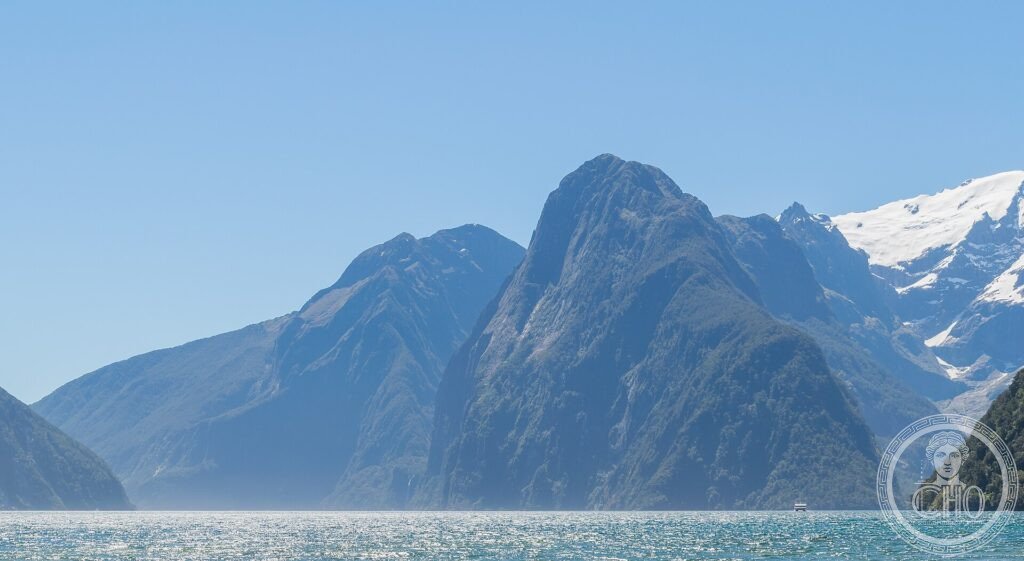
Nel sud-ovest dell’Isola del Sud, ghiacciai antichi hanno scolpito fiordi profondissimi, valli a U e laghi specchianti, dominati dalle Alpi Meridionali. Te Wahipounamu — “il luogo della pietra verde” nella lingua Māori — è una natura grandiosa e quasi intatta, erede dei paesaggi dell’antico Gondwana.
At a glance
Te Wahipounamu, “the place of greenstone” in Māori, is a vast wilderness covering the south-western corner of New Zealand’s South Island. Carved by ice over millions of years, it is a landscape of deep fjords — among them the famous Milford Sound — glaciers descending toward rainforest, the peaks of the Southern Alps, mirror lakes and ancient beech forests. Preserving plants and animals descended from Gondwana, including rare flightless birds, it was inscribed by UNESCO in 1990.
Key facts
- UNESCO: World Heritage since 1990 (Te Wahipounamu – South West New Zealand)
- Fjords: deep glacier-carved inlets including Milford Sound
- Southern Alps: the mountain spine with Aoraki/Mount Cook
- Glaciers: ice descending close to rainforest
- Gondwanan life: ancient forests and rare flightless birds (kea, takahe)
- Greenstone: the pounamu (jade) prized by the Māori
History
Repeated ice ages carved this corner of New Zealand into its dramatic form, gouging the fjords of Fiordland and the U-shaped valleys and lakes beneath the Southern Alps. Isolated for millions of years since New Zealand split from Gondwana, the land kept ancient plants and a fauna of flightless birds — the kea, the kakapo, the rediscovered takahe — that evolved in the absence of land mammals.
For the Māori the region is the source of pounamu, the prized greenstone, and a place of deep significance, reflected in its name. Combining several national parks, the wilderness was inscribed by UNESCO in 1990 as one of the best surviving examples of the flora and landforms of ancient Gondwana.
What you see
The region’s wonders include Milford Sound, where sheer peaks like Mitre Peak rise straight from the water amid waterfalls, the glaciers of Westland reaching down toward rainforest, the Great Walks such as the Milford and Routeburn tracks, and the lakes and peaks around Aoraki/Mount Cook. Rare birds and beech forest fill the valleys.
The grandeur of the fjords and alps, almost untouched, is the splendour of Te Wahipounamu.
Practical information
- Area: several national parks; Milford Sound is the most visited point
- Best time: summer (December–March), though Fiordland is wet year-round
- Time needed: several days to explore
- Note: weather changes fast; book Great Walks well ahead
Getting there
Te Wahipounamu covers the south-west of the South Island of New Zealand. Gateways include Te Anau and Queenstown (for Fiordland) and the West Coast glacier towns. GPS: 44.50° S, 168.00° E.
Nearby
- Milford Sound — the most famous fjord
- Queenstown — the resort town and gateway
- Aoraki/Mount Cook — New Zealand’s highest peak
Sources
- UNESCO World Heritage Centre — “Te Wahipounamu – South West New Zealand” (ref. 551)
- New Zealand Department of Conservation (DOC) — official body
- Encyclopaedia Britannica — Fiordland; Southern Alps
Find it on the map
See this place and what’s around it →📷 Become a Cultural Heritage Online photographer
Share your photos of places: they stay published under your name as the author. The more they're seen, the more you get noticed — and soon a contest will reward the most appreciated photos.
Log in or sign up free to add a photo