
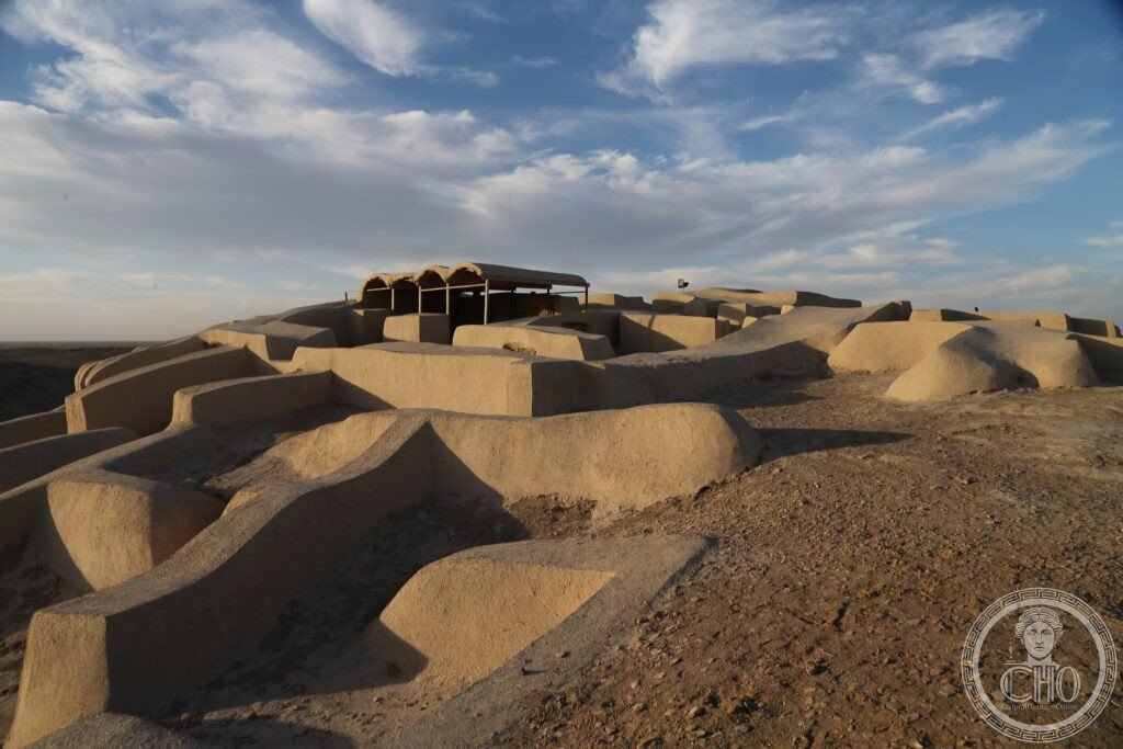
In the desert of eastern Iran lie the mudbrick remains of one of the Bronze Age’s largest cities, home to a civilisation that traded lapis lazuli across the ancient world and left behind the oldest known artificial eye, evidence of successful brain surgery, and what may be the earliest sequential animation ever painted.
At a glance
Shahr-i Sokhta, the “Burnt City”, sits in the Sistan desert of southeastern Iran. It was one of the largest urban centres of the Bronze Age Iranian plateau, built and rebuilt across roughly 1,400 years of occupation, each rebuilding following a fire that destroyed much of the settlement. The city belonged to the Helmand civilisation, the culture of the Helmand River basin spanning modern Afghanistan and southeastern Iran, quite distinct from the better-known Mesopotamian and Indus Valley traditions of the same period.
At its height the city is thought to have held around 25,000 people, making it one of the largest urban settlements anywhere in the world at that time. Excavations here have produced some of the most striking finds in ancient technology and medicine, including an artificial eye, evidence of skull surgery on a child who survived the operation, and a terracotta goblet whose painted sequence has been described as an early form of animation.
Key facts
- Location: Sistan region, Sistan-Baluchestan Province, southeastern Iran
- Extent: ruins cover roughly 150 hectares
- Period of occupation: approximately 3200-1800 BCE
- Peak population: estimated around 25,000, placing it among the largest cities of its era
- Status: UNESCO World Heritage Site, inscribed 2014
- Notable finds: the world’s oldest known artificial eye, an early trepanned skull, a decorated goblet with a proto-animated sequence, and one of the earliest known backgammon sets
History
Shahr-i Sokhta was not brought down by war or political collapse. Its decline followed environmental change in the Sistan basin: from around 2100 BCE the climate grew progressively drier, and the Helmand River’s reduced flow caused Lake Hamoun, which supplied the city’s water and supported its agriculture, to shrink. As the lake and its surrounding farmland dried out, the population dispersed, and by around 1800 BCE the city had been abandoned. The region’s fierce seasonal wind, blowing from the north for months at a time, further stripped away vegetation and buried the ruins in drifting sand.
What you see
The archaeological site lies to the southwest of Zabol and includes a small visitor centre. The most extensively excavated area is the residential district, where mudbrick house walls, hearths and storage rooms are visible. Nearby lie the remains of the industrial quarter, with workshops once used for cutting and polishing lapis lazuli, pottery kilns and textile production. The main cemetery, only partially excavated, has yielded tens of thousands of burials along with pottery, metal tools and the famous artificial eye.
The finest artefacts from the site, including a replica of the artificial eye and the painted animation goblet, are displayed at the Zabol National Museum in the nearby city.
Practical information
- Best time to visit: October to April, avoiding the summer months when the region’s strong seasonal wind and blowing sand make the site unpleasant
- Visa: most foreign visitors need an Iranian visa, arranged in advance through an embassy or the e-visa system
- On site: a small visitor centre and site manager; check the official heritage authority for current access arrangements
Getting there
Zabol has a domestic airport with occasional flights from Tehran, and can also be reached by road from Zahedan, the provincial capital, roughly 175 kilometres to the southwest, or from Mashhad further to the northwest. From Zabol the site itself lies some 57 kilometres southwest, reached by a road that is paved for most of the distance before becoming an unsurfaced track for the final stretch.
Nearby
- Lake Hamoun — about 30 km north; an intermittent lake fed by the Helmand River, which once sustained the ancient city and today alternates between a rich wetland, drawing flamingos, pelicans and cranes, and a dry dust flat depending on rainfall
- Zabol Wind Towers — in Zabol itself; traditional wind-catch towers built to cool underground chambers against the region’s fierce seasonal wind, among the oldest surviving passive cooling structures in Iran
Sources
- Wikipedia
- UNESCO
Find it on the map
See this place and what’s around it →📷 Become a Cultural Heritage Online photographer
Share your photos of places: they stay published under your name as the author. The more they're seen, the more you get noticed — and soon a contest will reward the most appreciated photos.
Log in or sign up free to add a photo