Parco Nazionale Sangay (sito naturale): vulcani eterni e foreste equatoriali delle Ande ecuadoriane
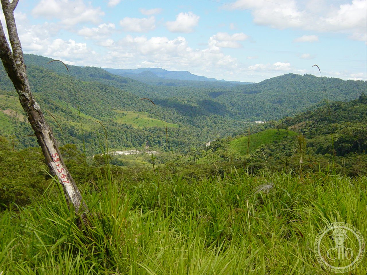
Sulle Ande ecuadoriane orientali, il Parco Nazionale Sangay racchiude in un unico perimetro protetto una delle più spettacolari successioni di ecosistemi del pianeta: dai ghiacciai eterni e i páramo alpini a 5.230 metri del vulcano Sangay — uno dei più attivi della Terra — fino alle foreste pluviali dell’Amazzonia a 900 metri di quota. Un gradiente di vegetazione che attraversa in pochi chilometri quello che in latitudine richiederebbe migliaia di chilometri di viaggio. Patrimonio UNESCO dal 1983, copre 517.765 ettari di Ande pristine.
At a glance
Sangay National Park is a protected area of 517,765 hectares in central-eastern Ecuador, spanning the provinces of Chimborazo, Bolívar, Cañar, Morona Santiago and Tungurahua. Its altitudinal range (900 to 5,230 m) encompasses every Andean ecosystem from Amazonian rainforest to sub-páramo, páramo and glaciated volcano summits. It contains two of the world’s most active volcanoes — Sangay (5,230 m) and Tungurahua (5,023 m) — as well as the older El Altar (5,320 m). UNESCO inscribed Sangay in 1983 for its exceptional natural beauty, geological dynamism and outstanding biodiversity.
Key facts
- UNESCO: World Heritage since 1983 (Sangay National Park, ref. 260)
- Area: 517,765 hectares
- Highest peak: El Altar, 5,320 m (ancient collapsed super-volcano)
- Active volcanoes: Sangay (5,230 m) — among the world’s most continuously active; Tungurahua (5,023 m, “The Black Giant”)
- Biodiversity: over 3,000 plant species, 340 bird species, spectacled bear, tapir, puma, jaguar
- Endangered list: placed on the UNESCO Endangered List 1992–2005 due to road-building and colonisation; removed after conservation improvements
History
The Sangay volcano — known to the indigenous Quechua as “Macas” or the mountain that roars — has been in near-continuous eruption since at least the 17th century. European explorers noted it throughout the colonial period; the German naturalist Eduard Spruce mapped parts of the region in the 1850s. The first confirmed ascent of Sangay was made in 1929 by American climbers Moore and Hall. The national park was established by Ecuador in 1979, covering a vast swath of the eastern Andes slope.
UNESCO inscription in 1983 recognised the park’s exceptional natural values. However, in 1992 Sangay was added to the UNESCO List of World Heritage in Danger because illegal road construction, colonisation and cattle ranching in the buffer zone threatened the park. Sustained conservation efforts by Ecuador, including law enforcement and community development programmes, led to its removal from the Danger List in 2005.
What you see
The park offers three distinct landscapes depending on access point. From Riobamba in the highlands: the páramo plateau with views of El Altar’s jagged caldera rim and the smoking cone of Tungurahua (often seen from as far as Baños). From Baños de Agua Santa, the popular gateway town: lava flows, steam vents and hot springs from Tungurahua’s recent eruptions. From Macas and the Morona Santiago side: lowland Amazonian forest with macaws, tapirs and howler monkeys.
The ascent of Sangay itself is one of Ecuador’s most challenging and dangerous climbs — the volcano frequently ejects rocks during eruptions. Guided treks in the páramo and El Altar area are safer and spectacular.
Practical information
- Gateways: Riobamba (highlands access, El Altar trek); Baños de Agua Santa (Tungurahua views); Macas (Amazonian side)
- Tungurahua: active and potentially dangerous; check IGEPN volcano alerts before approaching
- El Altar trek: 2–3 day circuit through páramo to the crater lake — stunning, requires guide and camping gear
- Best time: June–September (dry season in the highlands); Amazonian side is wet year-round
Getting there
Riobamba (gateway to El Altar and Sangay) is 225 km south of Quito by road or train. Baños de Agua Santa is 180 km from Quito (3 hrs by road). Macas is accessible by road from Riobamba via the spectacular Puyo–Macas highway. GPS (park centre): 1.83° S, 78.33° W.
Nearby
- Baños de Agua Santa — the adventure capital of Ecuador, 20 km from Tungurahua; rafting, zip-lines and hot springs
- Riobamba — the city with the famous Chimborazo volcano (6,263 m) nearby; Andean textiles market
- Cotopaxi National Park — the world’s highest active volcano (5,897 m), 80 km north
Sources
- UNESCO World Heritage Centre — “Sangay National Park” (ref. 260)
- Encyclopaedia Britannica — Sangay volcano and national park
- IGEPN (Instituto Geofísico, Escuela Politécnica Nacional) — volcano monitoring
Find it on the map
See this place and what’s around it →📷 Diventa un fotografo di Cultural Heritage Online
Condividi le tue foto dei luoghi: restano pubblicate con la tua firma come autore. Più vengono viste, più ti fai conoscere — e presto un concorso premierà le foto più apprezzate.
Accedi o registrati gratis per aggiungere una foto