
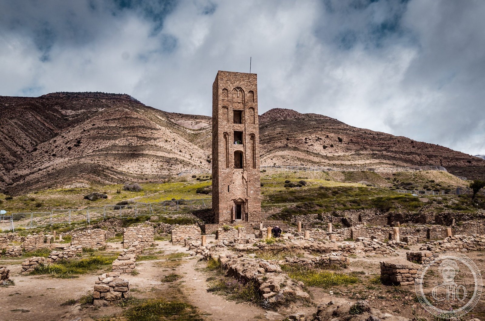
A fortified palatine city and the first capital of the Hammadid dynasty, now revealed in ruins high in the Hodna Mountains. UNESCO recognized it as an authentic picture of a fortified Muslim city.
At a glance
Qal’at Bani Hammad crowns a mountain plateau at 1,418 metres elevation, northeast of M’Sila in central Algeria. The site comprises a 7-kilometre defensive wall encircling residential complexes, administrative quarters, and one of the largest mosques constructed in medieval Algeria. Water abundant from surrounding peaks sustained the city through its dynastic period.
History
Built as the capital of the Hammadid dynasty in the 11th century, the city represented a centre of political and cultural power in the medieval Maghreb. Excavations have uncovered terracotta, jewels, coins and ceramics that document the refined civilization flourishing under Hammadid rule. The site was inscribed as a World Heritage Site in 1980.
What you see
Within the fortification walls stand four distinct residential complexes arranged with gardens and pavilions. The principal mosque rivals that of Mansurah in scale, featuring a 20-metre minaret designed in the style of the Grand Mosque of Kairouan. The emir’s palace, Dar al-Bahr, comprises three separate residences connected through landscaped spaces. Among notable artifacts are decorative fountains cast with lion motifs, suggesting the dynastic wealth and artistic ambition.
Cultural significance
Qal’at Bani Hammad stands as a rare surviving example of an 11th-century Islamic palatine fortress, offering insight into Hammadid urban planning, domestic architecture, and aesthetic values. The sophistication of its ceramics, metalwork and fountain design attests to the dynasty’s engagement with broader Mediterranean artistic currents. The site remains essential to understanding medieval North African history.
Key facts
- Country: Algeria
- Region: Hodna Mountains, northeast of M’Sila, approximately 225 km southeast of Algiers
- Elevation: 1,418 metres (4,652 ft)
- Coordinates: 35.81°N, 4.79°E
- UNESCO World Heritage Site: Inscribed 1980
- Fortification wall: 7 kilometres long
- Minaret height: 20 metres
Practical information & getting there
The site lies in the Hodna Mountains near the town of Maadid. Access is by road from M’Sila or Algiers. Consult current travel advisories and local tourism authorities for visiting conditions and accessible routes.
Sources & resources
Find it on the map
See this place and what’s around it →📷 Become a Cultural Heritage Online photographer
Share your photos of places: they stay published under your name as the author. The more they're seen, the more you get noticed — and soon a contest will reward the most appreciated photos.
Log in or sign up free to add a photo