
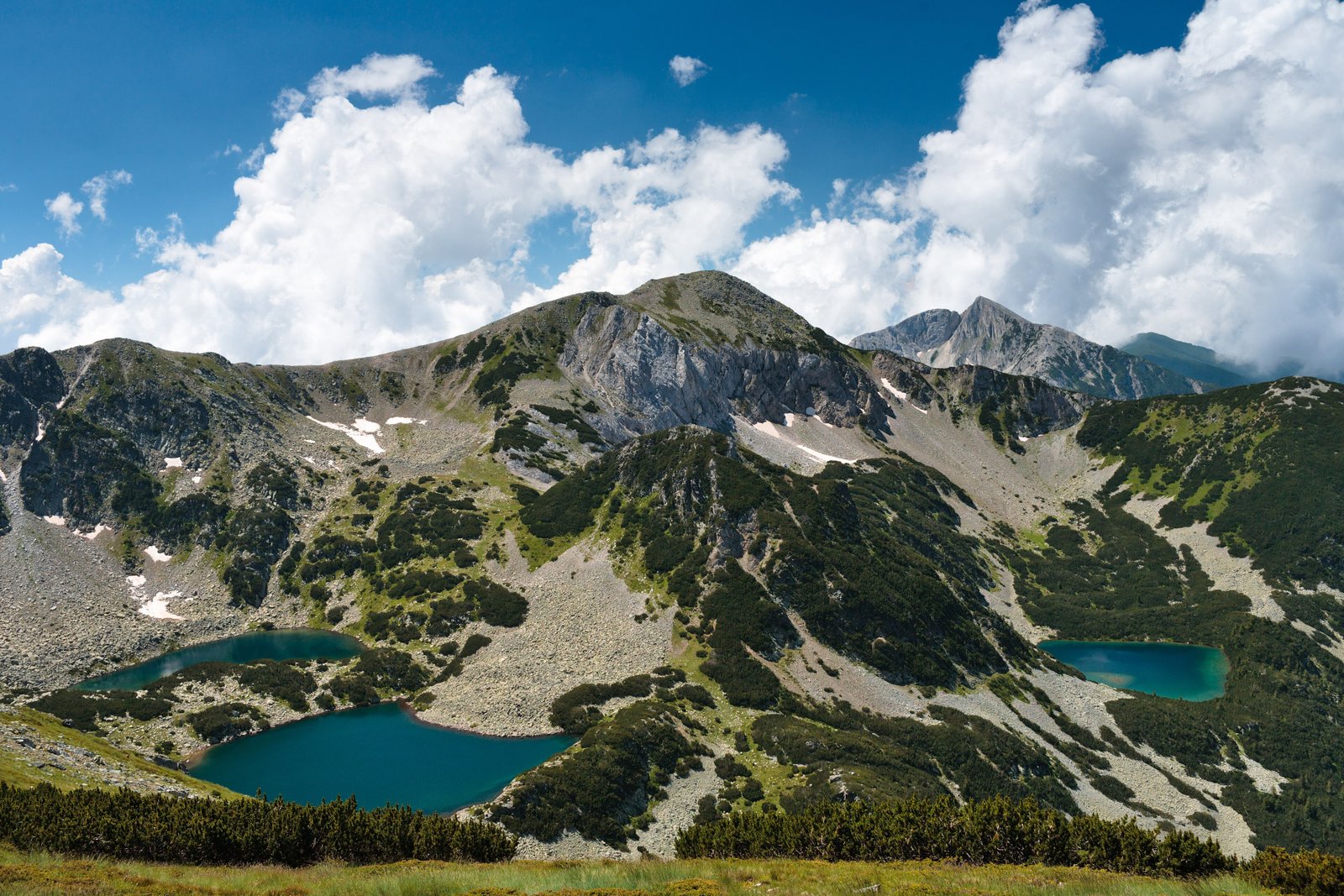
A wilderness of alpine peaks, glacial lakes, and ancient forests in southwestern Bulgaria, home to the Balkans’ third-highest mountain and Europe’s southernmost glaciers.
At a glance
Pirin National Park encompasses 403.56 square kilometers across the Pirin Mountains, one of three national parks in Bulgaria. Elevation ranges from 950 to 2,914 meters at Mount Vihren, the country’s second-highest summit. The park contains 118 glacial lakes, diverse forests covering 57% of its area, and spans the territory of seven municipalities with no permanent settlements.
History
Originally established as Vihren National Park in 1962, the park was designated a UNESCO World Heritage Site in 1983. Its territory has expanded multiple times since founding. Within its boundaries lie two nature reserves: Bayuvi Dupki–Dzhindzhiritsa, one of Bulgaria’s oldest reserves established in 1934, and Yulen. The entire park forms part of the EU’s Natura 2000 network and the UNESCO Man and Biosphere Programme.
What you see
The landscape is dominated by cirque valleys containing glacial lakes, the largest and deepest being Popovo Lake. Small glaciers persist here—Snezhnika and Banski Suhodol among them—marking Europe’s southernmost ice. Coniferous forests cover nearly 95% of the park’s woodland, with an average stand age of 85 years. Mount Vihren’s steep northern face defines the park’s dramatic topography.
Cultural significance
Pirin represents a critical refuge for temperate mountain biodiversity within the Rodope montane mixed forests ecoregion. The park harbors 45 mammal species, 159 bird species, and 11 reptile species. Bulgaria’s oldest tree, Baikushev’s pine—approximately 1,300 years old—stands within the park, a contemporary of Bulgaria’s state foundation in 681 CE. The southernmost European glaciers make it geologically exceptional.
Key facts
- Country: Bulgaria
- Region: Blagoevgrad Province, southwestern Bulgaria
- Area: 403.56 square kilometers
- Highest point: Mount Vihren, 2,914 meters
- Glacial lakes: 118
- Established: 1962
- UNESCO World Heritage Site: 1983
- Coordinates: 41.6722°N, 23.4878°E
Practical information & getting there
The park is accessed from towns in Blagoevgrad Province, with Bansko and Sandanski serving as primary gateways. No accommodations exist within park boundaries. Specific opening hours, entry fees, and current access conditions should be verified with local authorities before planning a visit.
Sources & resources
Find it on the map
See this place and what’s around it →📷 Become a Cultural Heritage Online photographer
Share your photos of places: they stay published under your name as the author. The more they're seen, the more you get noticed — and soon a contest will reward the most appreciated photos.
Log in or sign up free to add a photo