Pavlopetri
Pavlopetri is the oldest known submerged town in the world, a complete Bronze Age settlement lying 3–4 metres beneath the surface off the southern Peloponnese — its streets, building complexes, and cemeteries intact after 5,000 years under the sea.
At a glance
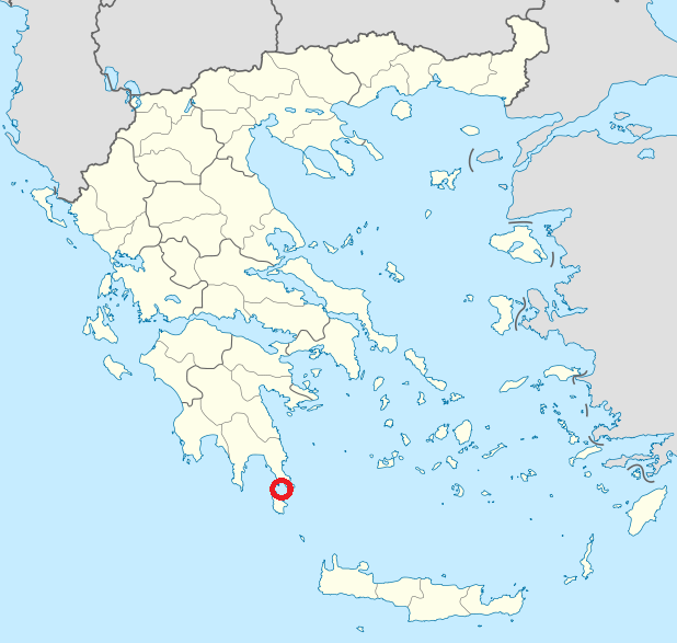
Discovered by accident in 1967, Pavlopetri sits just offshore from the island of Elafonisos in the gulf of Laconia. The site covers approximately 30,000 square metres and contains at least 15 building complexes, street systems, two chamber tombs, and several cist graves — all in remarkably good condition. Unlike most underwater sites, where structures are scattered and obscured, Pavlopetri presents a legible town plan that can be walked from end to end in a single dive. A 2009 re-survey using digital photogrammetry and acoustic imaging produced the first comprehensive three-dimensional plan of the site, revealing details missed by the original 1960s excavation.
Key facts
- Period: Continuous habitation c. 3500–1000 BC (Final Neolithic through Late Helladic/Mycenaean)
- Discovery: 1967, oceanographer Nicholas Flemming (University of Southampton)
- Depth / Scale: 3–4 metres deep; approximately 30,000 m² site area
- Status: Protected Greek national monument; under active study by the University of Nottingham and Greek Ephorate of Underwater Antiquities
- Access: Recreational diving permitted under supervision; no excavation by visitors
History
Nicholas Flemming, an oceanographer at the University of Southampton, first identified the site in August 1967 while conducting a hydrographic survey of the Laconian coast — spotting the regular stone features on the seabed and reporting them to the Greek Archaeological Service. Preliminary survey work in 1968–1969 by Flemming and a team from Cambridge established the basic outline: a Late Bronze Age (Mycenaean) settlement (c. 1600–1100 BC) overlaid on earlier Neolithic remains, making Pavlopetri the first scientifically documented underwater town anywhere in the world.
A high-resolution digital resurvey conducted in 2009–2011 by a collaborative team from the University of Nottingham and the Greek Ephorate of Underwater Antiquities — using DIDSON sonar and photogrammetric mapping — transformed understanding of the site. The survey revealed not only the Mycenaean-period buildings but evidence of Neolithic occupation underneath them and Classical-period reoccupation on top, confirming continuous human use for approximately 2,000 years before final submergence around 1000 BC. Tectonic land subsidence along the active fault lines of the southern Peloponnese — a coast still slowly sinking today — lowered the ground by roughly 4 metres, sealing the town under water before it could be robbed or built over.
The 2009 survey identified 15 distinct building complexes, a central square, and a possible megaron — the rectangular hall characteristic of Mycenaean elite architecture. Walls still stand up to 1.5 metres in places; in some buildings original floor surfaces survive. The town covers approximately 9 hectares and functioned as a working harbour for the Mycenaean palace economy, exporting wool, pottery, and olive oil into the wider Bronze Age Mediterranean trade network.
What you see
Entering the water at Pavlopetri, the first impression is of a grid rather than ruins: stone walls define rectangular spaces at regular intervals, running in consistent orientations that make clear this was a planned town, not a scattered farmstead. Walls built of local limestone blocks rise half a metre from the sand, and doorways — their thresholds still visible — open between rooms in sequences that suggest domestic organisation: a central hall, smaller side chambers, perhaps a courtyard. In calm conditions, when the sea is flat and sunlight filters down from 3 metres above, the light dances across the stone in a way that renders the geometry of the rooms almost architectural-blue.
The cemeteries at the southern edge of the site introduce a different scale of artefact: cist graves constructed of upright slabs, just large enough for a contracted burial, some still sealed by capstones. The two chamber tombs cut into the soft limestone bedrock are larger — corbelled spaces reached by a short dromos passage — and were clearly reserved for higher-status individuals. Alongside domestic and funerary structures, a road system links the major building complexes, its kerb stones still in place after three thousand years.
Practical information
- Best time to visit: May–October, when sea conditions are calm and water clarity is highest
- Access method: Snorkelling and recreational scuba diving; the site is shallow enough for confident snorkellers to see the major structures
- Duration: 60–90 minutes for a dive covering the main structures; longer for a full site circuit
- Snorkelling: The water is clear, shallow, and warm in summer — confident snorkellers can see the main stone foundations from the surface, making this one of the world’s most accessible ancient underwater sites without diving equipment.
- Advance booking: Local dive operators in Elafonisos and Neapoli offer guided dives; check with the Hellenic Centre for Marine Research for current access conditions
Getting there
The nearest major airport is Kalamata International (KLX), approximately 120 kilometres north-west by road. Athens International Airport (ATH) is a 4-hour drive. From the mainland town of Pounta, a short car ferry crosses to Elafonisos; the Pavlopetri site is visible from the ferry route and accessible on foot from the northern shore of the island within minutes.
Nearby
- Elafonisos — white-sand beaches among the finest in Greece, on the island directly above the site
- Monemvasia — the “Gibraltar of Greece”, a Byzantine fortress-town on a sea rock 40 km east
- Sparta — the ancient city and its Archaeological Museum, 80 km north through the Laconian valley
Sources
- Wikipedia: https://en.wikipedia.org/wiki/Pavlopetri
- University of Nottingham Pavlopetri Underwater Archaeology Project: nottingham.ac.uk/research/groups/pavlopetri
- Hellenic Ministry of Culture and Sports — Underwater Antiquities: culture.gov.gr
Find it on the map
See this place and what’s around it →📷 Diventa un fotografo di Cultural Heritage Online
Condividi le tue foto dei luoghi: restano pubblicate con la tua firma come autore. Più vengono viste, più ti fai conoscere — e presto un concorso premierà le foto più apprezzate.
Accedi o registrati gratis per aggiungere una foto