
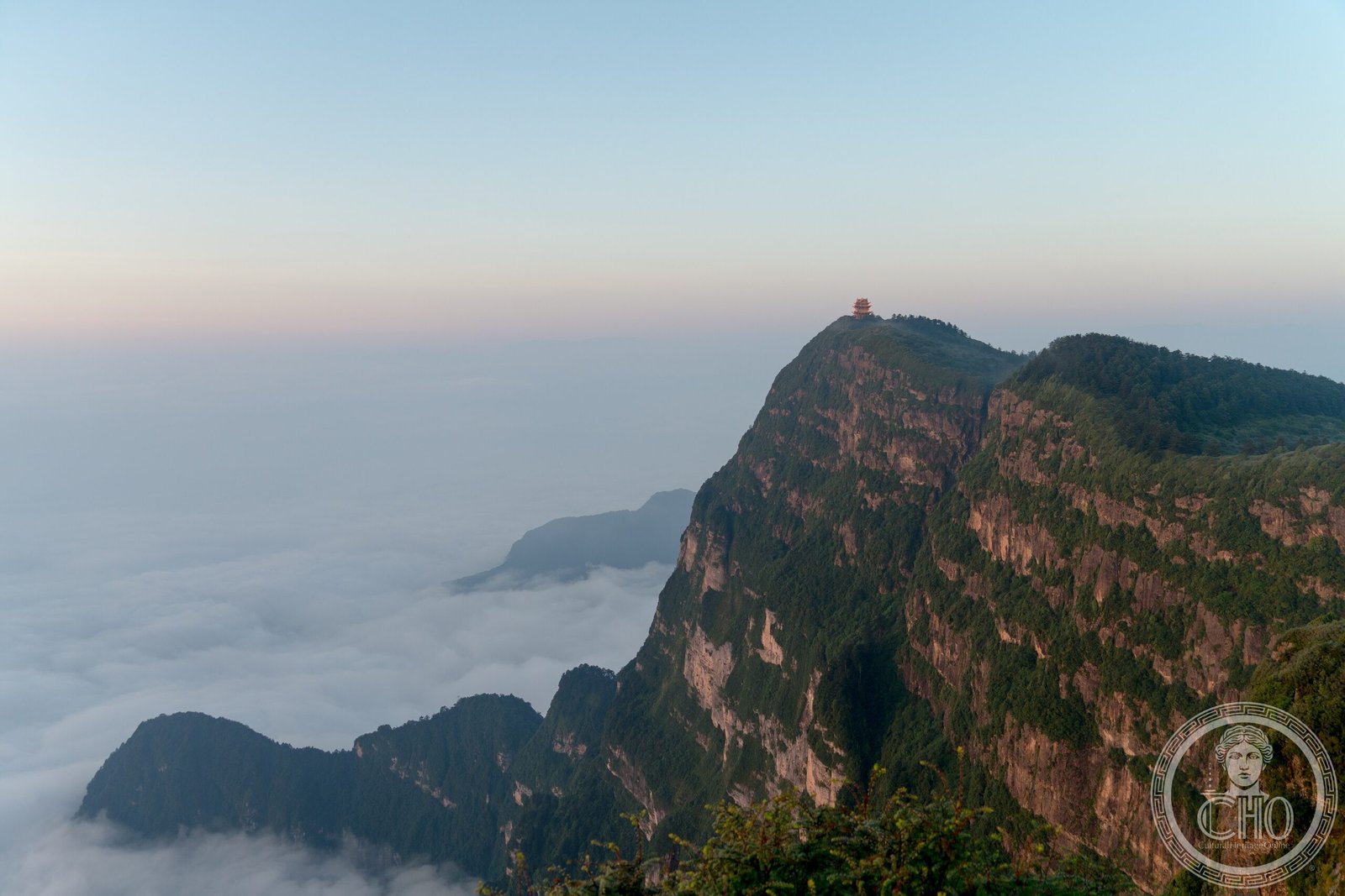
China’s highest sacred Buddhist mountain rises 3,099 metres above the Sichuan Basin, a spiritual destination shaped by ancient volcanic forces.
At a glance
Mount Emei commands the western rim of the Sichuan Basin as the highest of China’s Four Sacred Buddhist Mountains. Its geology reflects a dramatic past: the surrounding landscape forms part of the Permian Emeishan Large Igneous Province, created by massive volcanic eruptions during the Permian Period. The mountain anchors a region of significant spiritual and natural importance.
History
Mount Emei’s sacred status within Chinese Buddhism reflects centuries of pilgrimage and spiritual practice. The mountain’s distinctive volcanic origin shaped its geology long before its religious significance emerged. Recognition of its cultural importance culminated in UNESCO World Heritage designation in 1996, acknowledging both its natural features and its role in Buddhist tradition.
What you see
The mountain rises to 10,167 feet, dominating views across the Sichuan Basin. West of Mount Emei stretch the Daxiangling mountains. The surrounding terrain reveals evidence of the Emeishan Traps volcanic eruptions, with geological formations reflecting the igneous activity of the Permian Period spanning millions of years.
Cultural significance
Mount Emei holds profound importance in Chinese Buddhism as one of four sacred peaks. Its designation as a UNESCO World Heritage Site recognises the convergence of spiritual devotion and geological wonder. The mountain represents an intersection of natural history and religious practice in Chinese civilization.
Key facts
- Height: 3,099 metres (10,167 feet)
- Location: Sichuan Province, China; near Emeishan City in Leshan
- Coordinates: 29.52°N, 103.33°E
- UNESCO World Heritage Site: 1996
- Geological significance: Part of the Permian Emeishan Large Igneous Province
Practical information & getting there
Mount Emei lies near the county-level city of Emeishan, which is administered as part of Leshan prefecture-level city. The mountain is accessible from Sichuan’s major transport hubs. Check current conditions and climbing routes before planning a visit.
Sources & resources
Find it on the map
See this place and what’s around it →📷 Become a Cultural Heritage Online photographer
Share your photos of places: they stay published under your name as the author. The more they're seen, the more you get noticed — and soon a contest will reward the most appreciated photos.
Log in or sign up free to add a photoIs this page about you?
This page is read by travellers and heritage enthusiasts who find it on Google. Tell us how you are connected to this place and we will take it from there.