
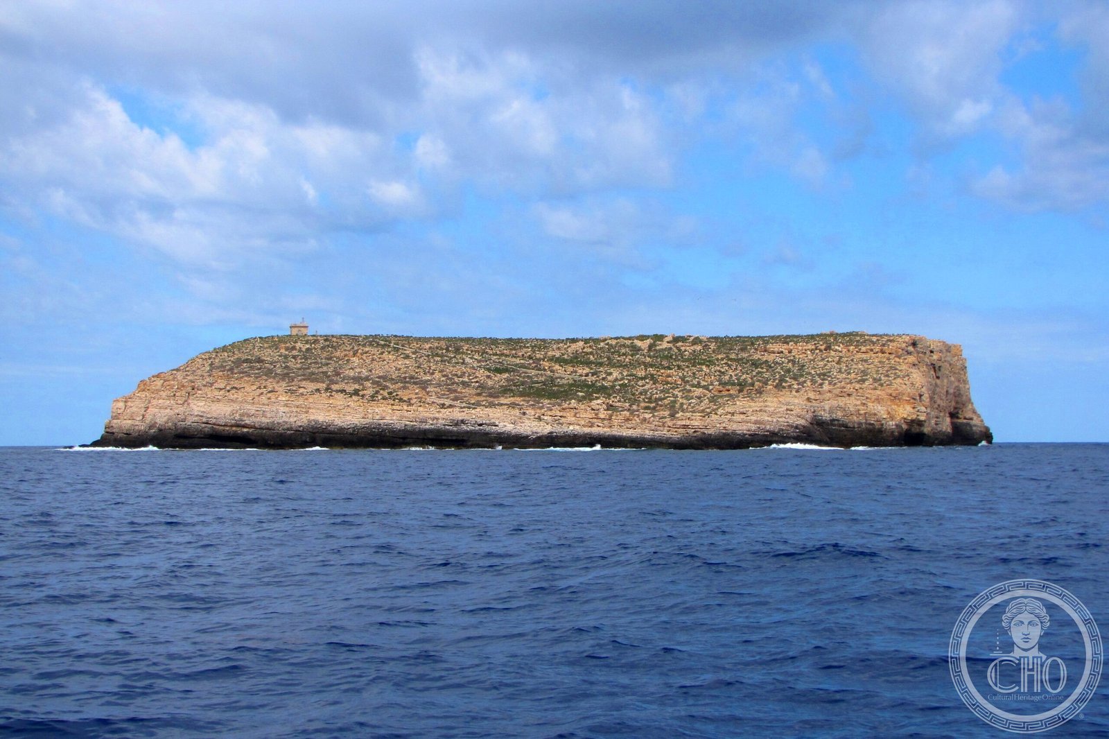
Lampione is the smallest and most westerly of the Pelagie Islands, an uninhabited rocky islet in the Strait of Sicily approximately 21 kilometres west of Lampedusa. Covering just 1.2 square kilometres of limestone rock, Lampione is administered as part of the comune of Lampedusa e Linosa and falls within the Riserva Naturale Orientata Isola di Lampedusa e Lampione. Its total lack of permanent habitation, combined with exceptional clarity of surrounding waters, makes it one of the finest and least disturbed diving destinations in the central Mediterranean.
At a glance
- Type
- Uninhabited rocky islet / Natural protected area
- Period
- Never permanently inhabited; historic lighthouse installed in the 19th century
- Style
- Bare limestone landscape; maritime heritage (lighthouse)
- Location
- Pelagie Islands, Province of Agrigento, Sicily, Italy
- Coordinates
- 35.5511° N, 12.3194° E
Overview
Lampione is essentially a flat-topped limestone platform rising abruptly from the sea, its cliffs dropping vertically into water of extraordinary transparency. It lies approximately 90 kilometres from the Tunisian coast and 21 kilometres west of Lampedusa, geologically part of the same Sicilian Channel shelf. The islet is entirely within the Pelagie Islands Nature Reserve, established by the Sicilian Region, and its waters form part of a protected marine zone where fishing is restricted and ecosystem disturbance minimised.
History
Lampione has no documented history of permanent settlement, though it served as a waypoint for Mediterranean traders and fishermen. A lighthouse — the Faro di Lampione — was erected in the 19th century to mark the hazardous western approach of the Pelagie archipelago for ships navigating between Malta, Tunisia, and Sicily; it is no longer staffed and operates automatically. The island briefly appeared in Italian strategic plans during World War II due to its position in the central Mediterranean, but was never developed. It has remained uninhabited since its lighthouse was automated.
What you see
The island’s surface is a wind-swept limestone plateau colonised by sparse halophytic vegetation — sea spurge, stonecrop, and sparse wild capers — with no trees or fresh water. The principal feature visible from the sea is the Faro di Lampione, a whitewashed lighthouse tower rising from the highest point of the islet. The cliffs descend directly into shallow rocky seabeds teeming with grouper, moray eel, amberjack, and barracuda, making the surrounding waters a magnet for scuba divers and free-divers. The seabed includes dramatic vertical walls dropping to depths of over 40 metres with gorgonian fans and rich invertebrate communities.
Cultural significance
Lampione’s significance is primarily ecological: as a completely uninhabited protected zone, it represents a rare benchmark of undisturbed Mediterranean coastal ecosystem. Together with Linosa and Lampedusa, it forms the Pelagie Islands nature reserve — Italy’s southernmost protected marine area and one of the key refugia for Mediterranean marine biodiversity. Its lighthouse is a heritage object of Italian navigational history, part of the network of 19th-century maritime infrastructure built to support trade routes in the Strait of Sicily.
Practical information
- Access
- Lampione is accessible only by private boat or organised diving excursion from Lampedusa; no ferry service
- Landing
- Landing on the islet may be restricted; check current reserve regulations before visiting
- Diving
- Excursions from Lampedusa diving centres depart in summer season; advance booking required
- Facilities
- None; bring all supplies including water
Getting there
Lampione is reached by boat from Lampedusa, approximately 1–2 hours by motorboat depending on sea conditions. Lampedusa is served by direct flights from Rome, Milan, Palermo, and Catania (seasonal), and by overnight ferry from Porto Empedocle (Agrigento). Diving centres on Lampedusa offer regular excursions to Lampione throughout the summer season (June–September); advance booking is strongly recommended.
Sources & resources
Find it on the map
See this place and what’s around it →📷 Become a Cultural Heritage Online photographer
Share your photos of places: they stay published under your name as the author. The more they're seen, the more you get noticed — and soon a contest will reward the most appreciated photos.
Log in or sign up free to add a photo