
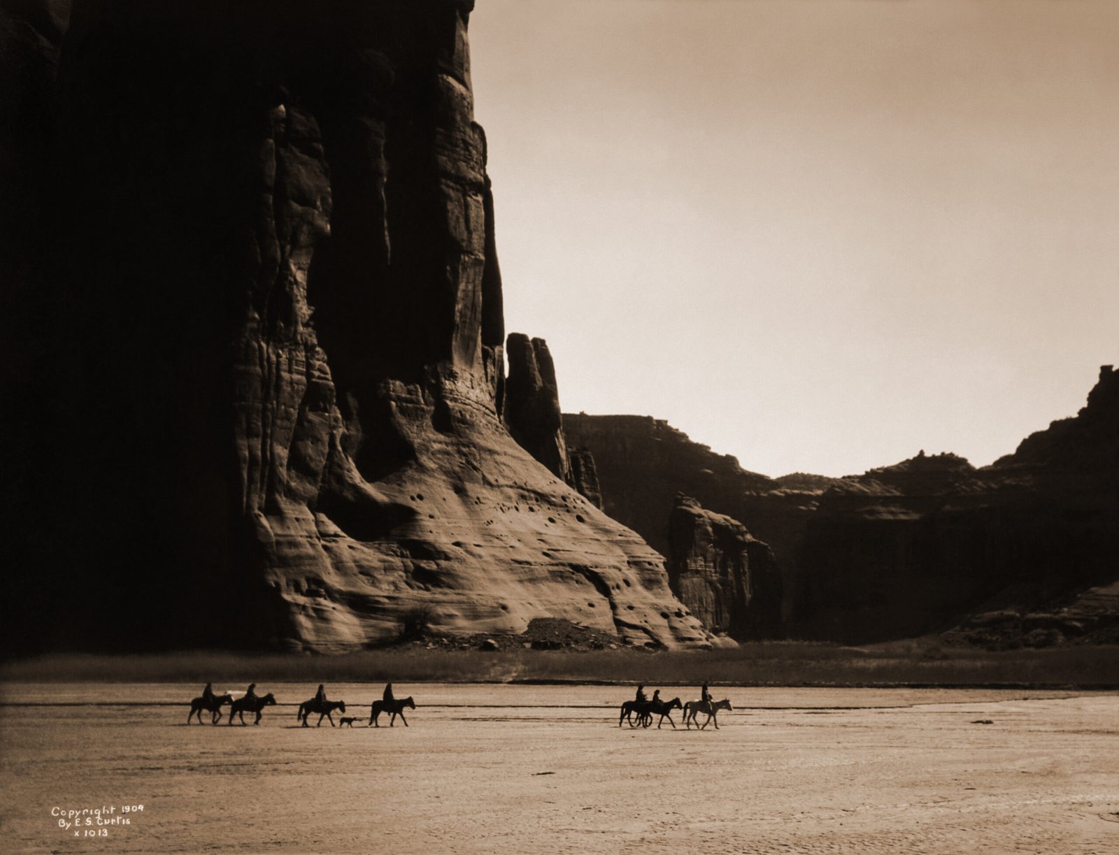
A complex of canyons carved deep into the Colorado Plateau of northeastern Arizona, Canyon de Chelly National Monument contains over 2,500 archaeological sites spanning 5,000 years of continuous human habitation. Uniquely among US national monuments, the canyon is still inhabited today: Navajo families farm its floor as they have since around 1700, their hogans and cornfields lying among the ruins of the Ancestral Puebloans who built cliff dwellings directly into the canyon walls rising 330 metres above.
A Stone Canvas of Human Time
The canyons take their name from the Navajo word Tseyi, meaning “rock canyon.” European maps rendered this as “de Chelly” (pronounced “de Shay”), a transliteration that endured. The main canyon runs approximately 34 kilometres east to west, joined by Canyon del Muerto (“Canyon of the Dead”) from the north, forming a Y-shaped system whose walls begin as low sandstone ledges near the mouth and rise to sheer vertical cliffs of 330 metres at the canyon heads.
The red Permian sandstone was deposited as ancient desert dunes some 250 million years ago. Wind and water eroded it into near-vertical walls streaked with dark desert varnish: iron and manganese oxides deposited by seeping water over millennia, creating black and brown stripes against the red stone that became canvases for the petroglyphs and pictographs left by every culture that passed through over five millennia.
5,000 Years of Continuous Habitation
The first documented inhabitants were Basketmaker people of around 2500 BC, who left evidence of pit houses on the canyon floor. The archaeological record then runs unbroken: Basketmaker II and III cultures, Developmental Pueblo, Classic Pueblo – each successive phase building on what came before. The canyon contains 2,500 identified sites in roughly 84 square kilometres, a density that is the direct result of this uninterrupted sequence of occupation spanning fifty centuries.
The peak of construction came during the Classic Pueblo period (c. 1060-1300 AD), when Ancestral Puebloan builders erected multi-storey cliff dwellings in the natural alcoves that pock the canyon walls. These alcoves, where softer rock has eroded behind harder caprock, offered natural shelter, defensive height, and south-facing solar orientation. Builders accessed them by toe-and-finger holds cut directly into vertical sandstone faces.
The White House Ruin
The most iconic structure in Canyon de Chelly is the White House Ruin, named for a white-plastered wall on its upper story that glows at certain hours. The complex consists of two connected structures: a four-storey ground-level building and a two-storey structure built directly into a 46-metre-high alcove above it, the two originally connected by a wooden ladder. Together they contained approximately 60 rooms and four kivas – ceremonial underground chambers.
The White House Ruin is the only site in the canyon that non-Navajo visitors may approach without a guide: a 2.5-kilometre round-trip trail descends 180 metres from the South Rim, crosses the canyon floor, and ends at the base of the cliff. The trail passes Navajo hogans, peach orchards descended from Spanish-planted trees, and canyon cottonwoods that turn gold in October – making it one of the most complete encounters with living archaeological landscape in North America.
The Long Walk of 1864
Canyon de Chelly is also the site of one of the defining tragedies of the American West. In January 1864, Colonel Kit Carson led US Army forces into the canyon on a campaign to force Navajo surrender. For weeks they destroyed everything the Navajo depended on for survival: fruit trees cut down, cornfields burned, livestock slaughtered, food stores eliminated. With no food and no shelter remaining, approximately 8,000 Navajo surrendered.
They were then marched 480 kilometres to Bosque Redondo in eastern New Mexico in what the Navajo call the Long Walk. The conditions at Fort Sumner were catastrophic: disease, drought, and crop failure killed hundreds annually over four years. In 1868, the US government signed the Treaty of Bosque Redondo, allowing the Navajo to return to their homeland – a moment the Navajo Nation considers foundational to its modern identity and sovereignty.
A Living Monument
What makes Canyon de Chelly fundamentally different from every other major archaeological site in the United States is that it remains inhabited. Approximately 40 Navajo families continue to farm the canyon floor as their ancestors have since around 1700. They plant corn, squash, and melons in the same alluvial soil the Ancestral Puebloans farmed. They maintain hogans in the canyon bottom, accessible only by a sandy road that becomes impassable when Chinle Wash runs high after rain.
The monument is jointly administered by the National Park Service and the Navajo Nation. Non-Navajo visitors may drive the canyon rims on paved roads, but to descend into the canyon (except on the White House Trail) requires a Navajo guide – a rule that enforces sovereignty over the homeland. Jeep tours, horse tours, and hiking tours are available through licensed Navajo operators based in Chinle.
Spider Rock and Sacred Landscape
At the junction of Canyon de Chelly and Monument Canyon rises Spider Rock: a sandstone spire 260 metres tall, free-standing within the canyon. In Navajo cosmology, Spider Rock is the home of Spider Woman (Na’ashjee’ii Asdzaa), the deity who taught the Navajo the art of weaving and who plays a central role in the Navajo creation narrative.
The canyon as a whole is considered sacred Navajo land – not a museum of the past but a living spiritual landscape whose power derives from continuity of habitation and ceremony. Petroglyphs and pictographs left by Ancestral Puebloans and Navajo artists form an overlapping visual record across the canyon walls that the canyon’s current residents can still read as their own history.
Practical Information
- Location
- Chinle, Arizona, Navajo Nation, USA
- GPS
- 36.1328° N, 109.4657° W
- Canyon floor access
- Navajo guide required except on White House Trail; licensed tours from Chinle
- Best season
- Spring (April-May) and autumn (September-October); summer flash floods can close canyon floor
- Admission
- No entry fee; guide fees apply for canyon floor tours
- Administration
- National Park Service in partnership with the Navajo Nation
Find it on the map
See this place and what’s around it →📷 Become a Cultural Heritage Online photographer
Share your photos of places: they stay published under your name as the author. The more they're seen, the more you get noticed — and soon a contest will reward the most appreciated photos.
Log in or sign up free to add a photo