
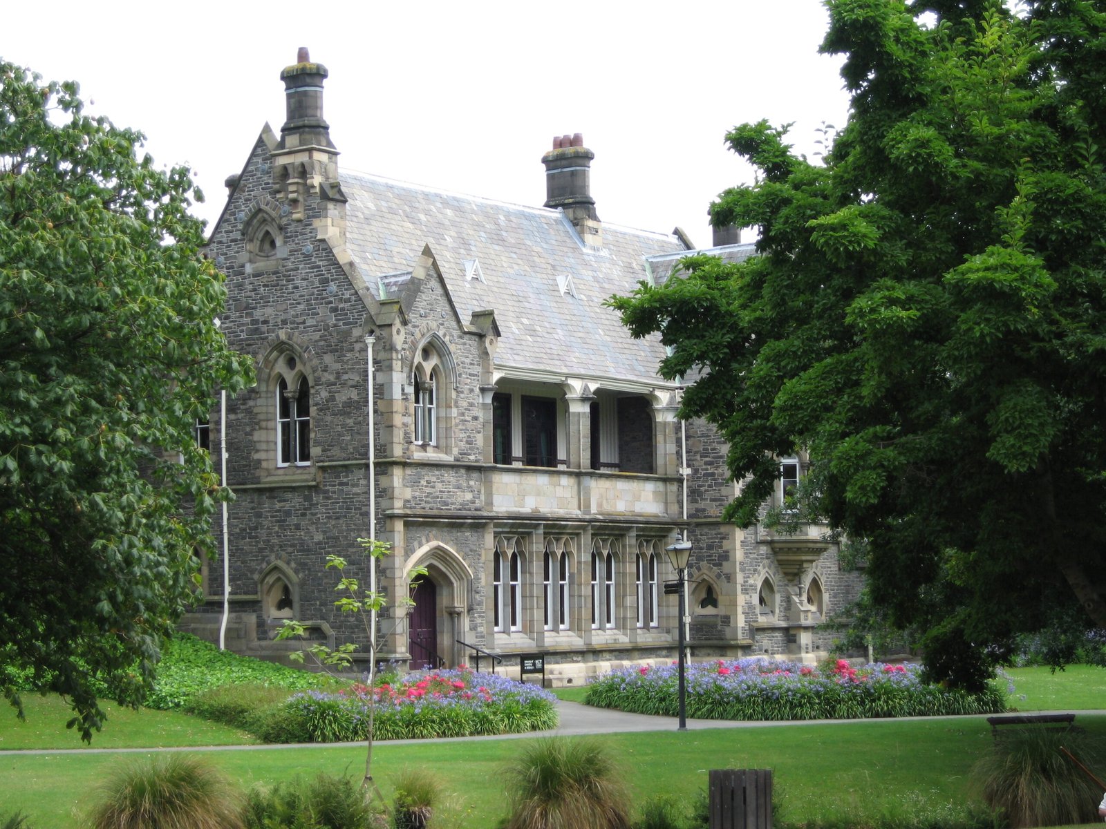
New Zealand’s sole surviving purpose-built provincial government complex, these buildings once housed the administration of the Canterbury Province during a pivotal era of colonial self-governance.
At a glance
The Canterbury Provincial Council Buildings represent a unique architectural legacy—the only provincial government buildings of their kind still standing in New Zealand. They served the Canterbury Province for over two decades before provincial government was abolished in 1876.
History
Constructed to house the Canterbury Provincial Council, these buildings administered the province from 1853 onwards. The provincial government system was a key feature of New Zealand’s early colonial period, devolving power to regional administrations. When the government abolished provincial governance in 1876, the Canterbury buildings endured as historical witnesses to that era—until the devastating February 2011 Christchurch earthquake substantially damaged the structures. The Christchurch City Council subsequently undertook partial demolition.
What you see
Designed as purpose-built government facilities, the buildings embodied the civic aspirations of mid-nineteenth-century colonial New Zealand. Their architectural significance lay not only in their original design but in their rarity—no comparable provincial council buildings survive elsewhere in the country.
Cultural significance
These buildings stand as a record of New Zealand’s provincial governance system and colonial administrative infrastructure. Their survival made them invaluable historical documents—until seismic damage threatened their preservation. The structures represent a lost chapter in the nation’s political organization and urban development.
Key facts
- Country: New Zealand
- City: Christchurch
- Period of operation: 1853–1876
- Coordinates: -43.5292, 172.634
- Status: Substantially damaged in February 2011 earthquake; partially demolished
Practical information & getting there
The buildings are located in Christchurch city centre. Due to earthquake damage and subsequent demolition, visitor access is limited. Check with Christchurch City Council for current site status before planning a visit.
Sources & resources
Find it on the map
See this place and what’s around it →📷 Become a Cultural Heritage Online photographer
Share your photos of places: they stay published under your name as the author. The more they're seen, the more you get noticed — and soon a contest will reward the most appreciated photos.
Log in or sign up free to add a photoDo you manage this place?
This page is read by travellers and heritage enthusiasts who find it on Google. Keep it accurate — and make it work for you. Free for non-profit heritage institutions.