
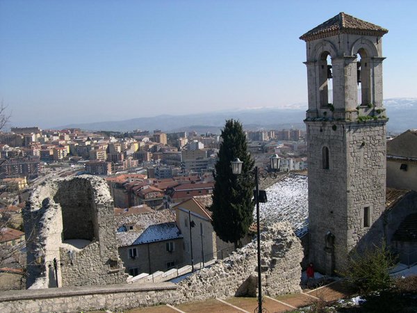
A medieval hilltop city rebuilt after the 1456 earthquake, Campobasso preserves layers of history in its churches, castle, and an extensive network of underground passages that once served military, commercial, and civilian purposes.
At a glance
Campobasso sits between the Biferno and Fortore rivers in the Molise region. Its historic center spans multiple centuries: the thirteenth-century church of San Leonardo, the fifteenth-century Monforte castle, and the neoclassical cathedral of the Holy Trinity. The city is also home to the University of Molise, a Carabinieri academy, a State Police school, and the archdiocese of Campobasso-Boiano.
History
Campobasso likely originated as a Lombard settlement. The catastrophic earthquake of 1456 transformed the city’s layout. Count Cola di Monforte designed a new, defensible urban plan with double walls and controlled gates. He ingeniously repurposed existing underground voids, connecting them into a functional network—a medieval “cobweb” of tunnels that enabled rapid troop movement and communication between towers and fortifications.
Through centuries, these subterranean spaces changed purpose. By the late fifteenth century, as the village expanded and customs regulations took hold under Ferrante d’Aragona, the hypogea became storage for flour, salt, and meat. During the Second World War, they served as air raid shelters. In the 1960s, their acoustic properties made them popular as discos and youth gathering spaces. Today, developers seek to adapt them as bars and restaurants.
What you see
The upper city displays monuments across centuries: San Leonardo’s thirteenth-century church, Monforte castle from the fifteenth century, and the later neoclassical Holy Trinity cathedral. Yet Campobasso’s most distinctive feature lies beneath street level. The hypogea—a labyrinth of passages extracted from the bedrock over centuries—represent a hidden architectural reality. Among these underground sections are ancient garrison walkways that once connected towers and walls across the hillside fortification.
Cultural significance
The city embodies multiple phases of Italian history: medieval defense, Renaissance expansion, wartime adaptation, and postmodern repurposing. The subterranean network is particularly significant as a testament to practical medieval engineering and adaptive reuse—proof that ancient infrastructure outlasts its original function.
Key facts
- Address: Piazza Vittorio Emanuele 29, Campobasso
- Coordinates: 41.5599°N, 14.6599°E
- Official website: http://www.comune.campobasso.it/
- Phone: 0874 4051
Practical information
Opening hours and ticket prices change through the year, so we do not republish them here: the current ones are on comune.campobasso.it. What does not change is where it is: Piazza Vittorio Emanuele 29, Campobasso, at 41.5599125487342, 14.659881591796873.
Getting there
Campobasso is accessible by train and road. The city center is compact and walkable. For detailed directions and parking information, visit the official website.
See the place
Sources & resources
Find it on the map
See this place and what’s around it →📷 Become a Cultural Heritage Online photographer
Share your photos of places: they stay published under your name as the author. The more they're seen, the more you get noticed — and soon a contest will reward the most appreciated photos.
Log in or sign up free to add a photo