Budj Bim Cultural Landscape
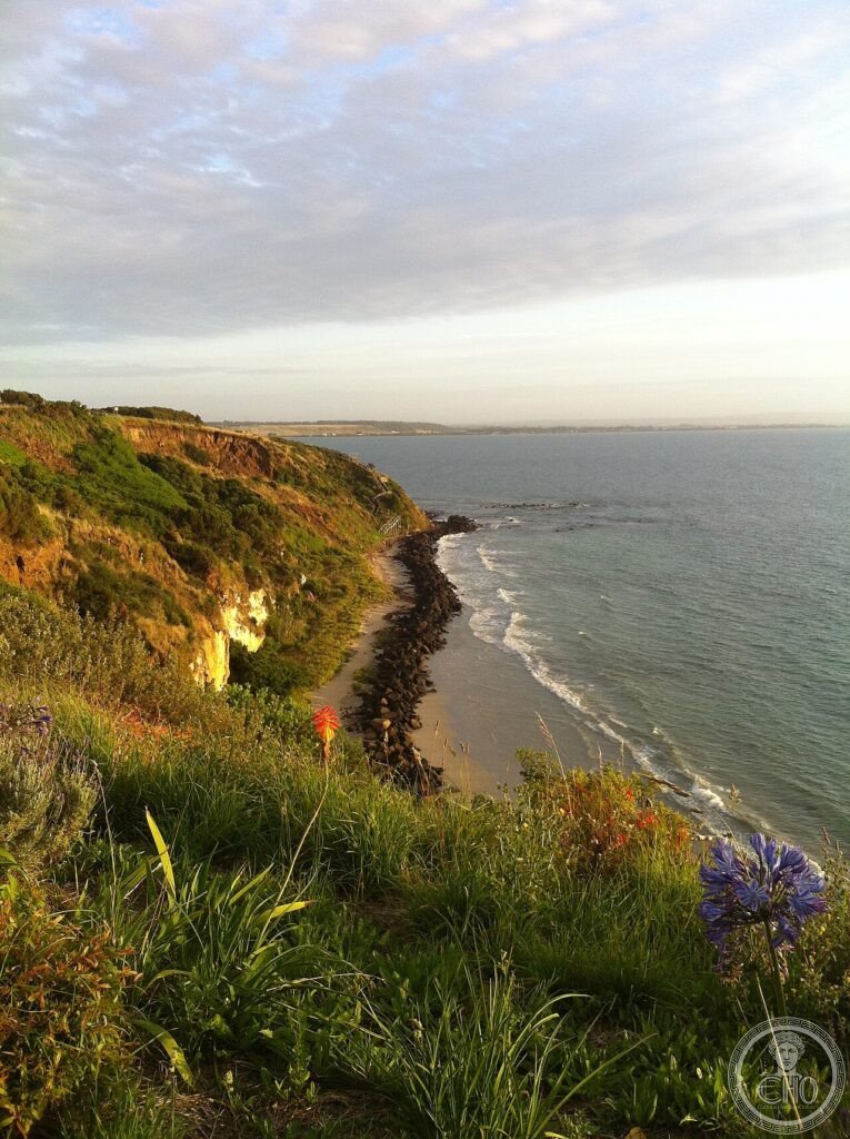
The world’s oldest known aquaculture system and the proof that the first Australians built permanent settlements millennia before European colonization — Budj Bim Cultural Landscape (western Victoria, Australia; the country of the Gunditjmara people; a volcanic landscape centered on Mount Eccles (Budj Bim — “high head” in Gunditjmara)) preserves the most extensive ancient eel aquaculture system ever discovered — 6,600-year-old stone channels, weirs, and ponds that managed the shortfin eel population of Tae Rak (Lake Condah) to provide the Gunditjmara with a reliable year-round food supply.
At a glance
Budj Bim Cultural Landscape (the most precisely Budj Bim single 6600 years shortfin eel Anguilla australis basalt channels weirs permanent villages Gunditjmara UNESCO heritage: the Budj Bim eel aquaculture system (the earliest known: the system was created approximately 6,600 years ago (carbon dating of organic material from the channel construction) — making it contemporaneous with the earliest farming civilizations of the Middle East and earlier than the pyramids of Egypt; the system manipulates the natural migration behavior of the shortfin eel (Anguilla australis): eels hatch in the Pacific Ocean and migrate to freshwater lakes and rivers to mature; the Gunditjmara built stone channels and weirs to direct the migrating eels into specific ponds where they could be harvested in controlled conditions; the system includes overflow channels (allowing the wetland ecosystem to remain healthy), holding ponds (where eels were kept alive for later consumption), and smoking chambers (for preservation); the eel aquaculture provided such abundant food that the Gunditjmara were able to live in permanent stone villages — overturning the colonial-era assumption that all Aboriginal Australians were nomadic hunter-gatherers) — the most precisely Budj Bim single 6600 years shortfin eel Anguilla australis basalt channels weirs permanent villages Gunditjmara UNESCO heritage in any UNESCO world heritage site; the permanent stone villages (the most precisely Budj Bim single stone hut foundations permanent villages 800 structures basket traps koyang smoking chambers Gunditjmara settled community heritage: the physical evidence for Gunditjmara sedentism (permanent rather than nomadic residence): over 800 identified stone hut foundations (circular; 3-5m diameter; basalt walls still standing 0.5-1m high) distributed around the aquaculture channels; each hut base is a permanent structure (not a temporary campsite); the distribution corresponds to specific family fishing rights over particular sections of the eel channels; the settlements are the best physical evidence in Australia of Aboriginal permanent residence — the most precisely Budj Bim single stone hut foundations permanent villages 800 structures basket traps koyang smoking chambers Gunditjmara settled community heritage in any UNESCO world heritage site)).
Key facts
- The 2019 UNESCO Inscription — Emergency Fast-Track: the most precisely Budj Bim single 2019 UNESCO emergency fast-track inscription bushfire Gunditjmara sovereignty cultural continuity heritage — the UNESCO inscription process for Budj Bim was unusually rapid — the standard UNESCO inscription process takes 5-7 years from nomination to inscription; Budj Bim was fast-tracked and inscribed in 2019 CE (the nomination having been submitted only in 2018 CE); the urgency was partly driven by the threat of bushfire (the site is surrounded by dry eucalyptus forest; devastating bushfires swept through the region in 2019 CE, burning approximately 80% of the inscribed area; the stone channels survived, but the forest and vegetation surrounding them were severely damaged); the UNESCO inscription was the first inscription of an exclusively Aboriginal Australian WHS
- Gunditjmara Sovereignty — Never Ceded: the most precisely Budj Bim single Gunditjmara Worn Gundidj Kirrae Whurrong peoples sovereignty native title land rights 2004 Victorian government heritage — the Gunditjmara people (the traditional custodians of the Budj Bim landscape; comprising several clans including the Worn Gundidj and Kirrae Whurrong) never signed a treaty with the British Crown (neither ceding sovereignty nor accepting permanent colonization in any formal legal act); in 2004 CE, the Victorian government granted the Gunditjmara native title rights over significant portions of their traditional country including the Budj Bim landscape; the eel aquaculture channels are managed by the Gunditjmara People Aboriginal Corporation
- GPS: 38.3200° S, 141.6000° E
History
The 1839-1844 resistance (the most precisely Budj Bim single 1839-1844 Eumerella War Gunditjmara pastoral settlement resistance squatters colonial Victoria heritage: after British colonizers began occupying western Victoria in the late 1830s CE, the Gunditjmara waged an effective guerrilla resistance against pastoral settlement (the Eumerella War; approximately 1839-1844 CE; the Gunditjmara attacked sheep runs and killed squatter-era settlers; the British authorities organized punitive expeditions (some of the most violent episodes of the Victorian Frontier Wars) to suppress the resistance; the Gunditjmara were ultimately confined to the Framlingham and Lake Condah reserves; but they retained connection to Budj Bim — the most precisely Budj Bim single 1839-1844 Eumerella War Gunditjmara pastoral settlement resistance squatters colonial Victoria heritage in any UNESCO world heritage site)).
What you see
Tae Rak Aquaculture Centre (the most precisely Budj Bim single Tae Rak Lake Condah aquaculture centre guided tours Gunditjmara ranger Tyrrendarra Budj Bim National Park eel channels weirs heritage: the principal visitor facility for Budj Bim is the Tae Rak Aquaculture Centre (near Lake Condah; a joint Parks Victoria and Gunditjmara Aboriginal Corporation facility; guided tours by Gunditjmara rangers (the most culturally rich experience; rangers demonstrate the eel trapping technique (woven koyang basket in the weir gap); explain the astronomical and ecological knowledge embedded in the channel design; and discuss the disruption and revival of the tradition; tours approximately AUD 50/person; advance booking recommended)); the Budj Bim National Park (Mount Eccles; the volcanic crater lake; the lava tube caves; 1h walk to the crater rim; AUD 10 entry) provides the geological context for the basalt that made the eel aquaculture possible — the most precisely Budj Bim single Tae Rak Lake Condah aquaculture centre guided tours Gunditjmara ranger Tyrrendarra Budj Bim National Park eel channels weirs heritage in any UNESCO world heritage site)).
Practical information
- Getting there: the nearest major city is Melbourne (320 km; 3.5h by car via the Princess Highway (A1)); the nearest regional city is Hamilton (50 km east; the access road to the Tae Rak Aquaculture Centre is via Condah; a 4WD vehicle is recommended in wet conditions); no public transport serves the site (a hire car from Melbourne or Hamilton is necessary); the Tae Rak Aquaculture Centre must be booked in advance through the Gunditjmara website; the best time to visit is September-April (spring to autumn; the Victorian winter (June-August) is cold and wet; the eel migration is most active September-November and March-April; the summer (December-February) has the highest risk of bushfire closure)
Getting there
Melbourne 320 km (3.5h drive). Book guided tour in advance (AUD 50). 4WD recommended. Best September-April. GPS: -38.3200, 141.6000.
Nearby
- Port Fairy — 55 km southwest; one of Victoria’s most charming 19th-century CE coastal towns (the National Trust-classified historic port; the wreck of the Admella (1859 CE; the worst maritime disaster in Victorian history); the annual Port Fairy Folk Festival (March; one of the best folk music festivals in Australia))
- Tower Hill Wildlife Reserve — 80 km south; the volcanic crater reserve near Warrnambool (the emu, kangaroo, and koala colony accessible within the volcanic caldera; the eruption that formed Tower Hill occurred approximately 30,000 years ago — within the oral memory of the Gunditjmara people, who preserve accounts of the eruption)
Sources
- Wikipedia, Budj Bim Cultural Landscape; Gunditjmara; Eumerella War, accessed June 2026
- UNESCO, Budj Bim Cultural Landscape, WHS reference 1577, inscribed 2019
Find it on the map
See this place and what’s around it →📷 Diventa un fotografo di Cultural Heritage Online
Condividi le tue foto dei luoghi: restano pubblicate con la tua firma come autore. Più vengono viste, più ti fai conoscere — e presto un concorso premierà le foto più apprezzate.
Accedi o registrati gratis per aggiungere una foto