
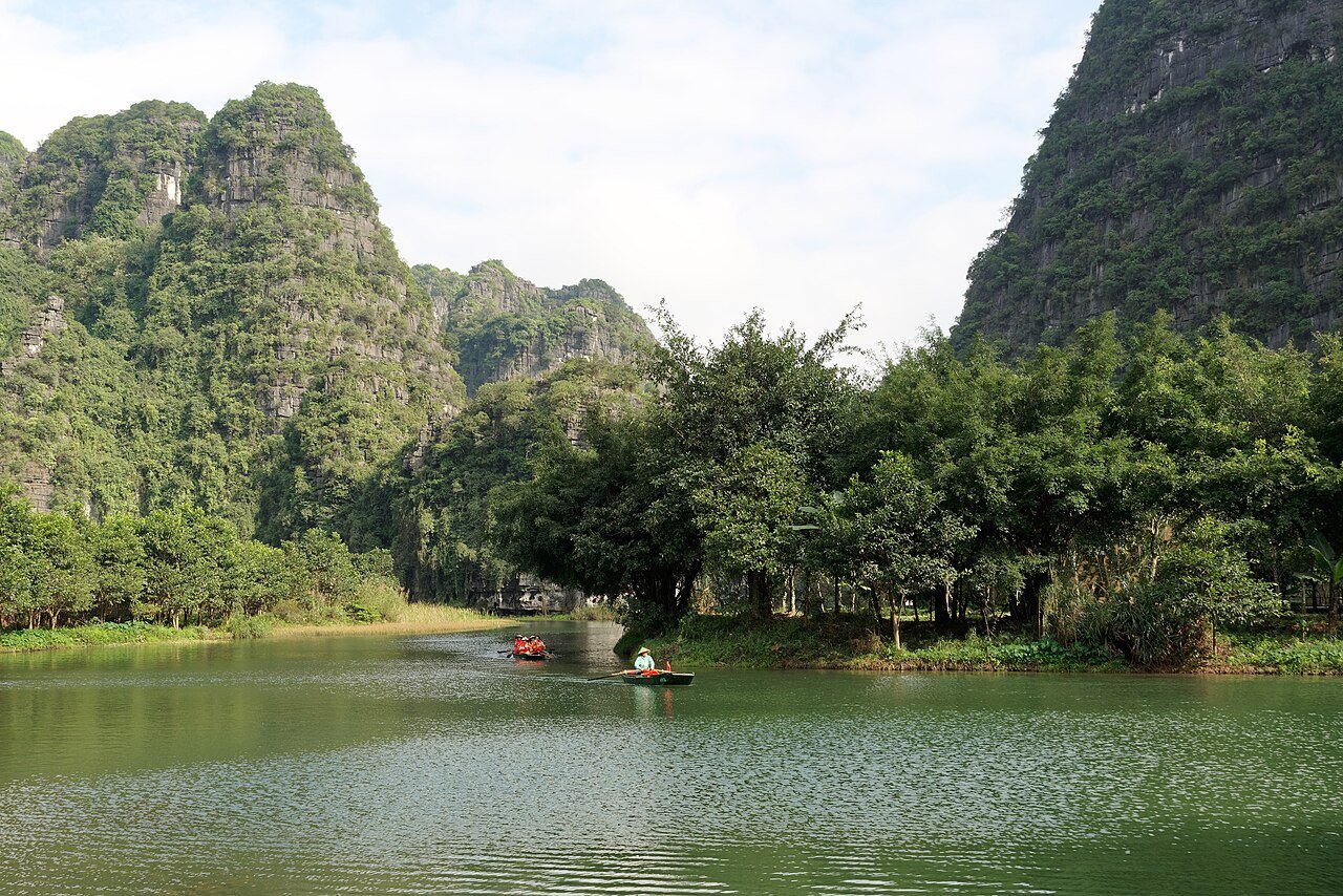
The nearest World Heritage site to Trang An is the Citadel of the Ho Dynasty, 34 km away in a straight line, followed by the Imperial Citadel of Thang Long in Hanoi (87 km) and the Yen Tu complex (107 km), all in Viet Nam. Trang An itself is a mixed cultural and natural property in Ninh Binh Province, inscribed in 2014 for a tower-karst landscape and for caves that hold more than 30,000 years of human occupation.
The World Heritage sites within reach of Trang An
The distances below are straight lines between the reference points that UNESCO publishes for each property, measured to the nearest component of a serial site. They show what is close, not how long the road takes.
| Site | Country | Distance | Inscribed | Type |
|---|---|---|---|---|
| Citadel of the Ho Dynasty | Viet Nam | 34 km | 2011 | Cultural |
| Central Sector of the Imperial Citadel of Thang Long – Hanoi | Viet Nam | 87 km | 2010 | Cultural |
| Yen Tu-Vinh Nghiem-Con Son, Kiep Bac Complex of Monuments and Landscapes | Viet Nam | 107 km | 2025 | Cultural |
| Ha Long Bay – Cat Ba Archipelago | Viet Nam | 146 km | 1994 | Natural |
| Megalithic Jar Sites in Xiengkhuang – Plain of Jars | Lao PDR | 243 km | 2019 | Cultural |
| Zuojiang Huashan Rock Art Cultural Landscape | China | 251 km | 2016 | Cultural |
Four of the six are Vietnamese, and together they read as a timeline. Trang An’s Hoa Lu was a capital in the 10th and 11th centuries, Thang Long was built in the 11th century by the Ly dynasty, the Tran dynasty ruled from the Yen Tu mountains in the 13th and 14th, and the Ho citadel dates from the 14th. Ha Long Bay is the natural twin: IUCN says Trang An would have resembled it in the times when the sea flooded the massif. The Plain of Jars (500 BCE to 500 CE) and the Zuojiang rock art (5th century BCE to 2nd century CE) are the far neighbours, both from the last centuries BCE and early centuries CE.
Why do experts call Trang An the clearest end-stage karst in the tropics?
UNESCO describes forest-mantled limestone towers up to 200 m high, linked in places by ridges that enclose deep depressions filled with waterways, connected by cave passages. Deep dissection of an uplifted massif over five million years produced cones, towers, cockpits and poljes. Visitors travel in traditional sampans rowed by local guides.
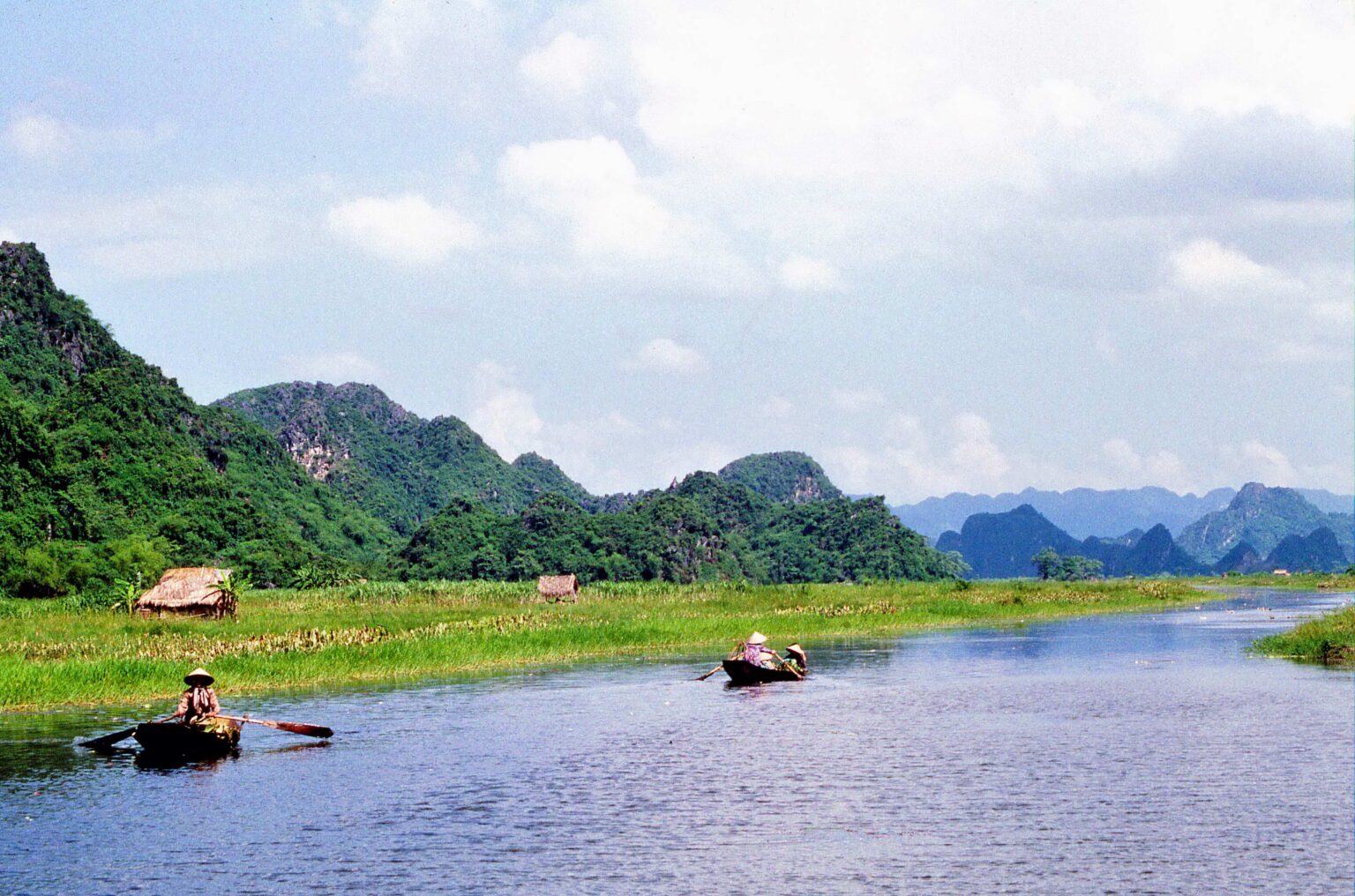
IUCN’s technical evaluation tested this against 77 other karst areas. It found that of seven humid-tropical karst properties then on the List, Trang An is the only one with totally autogenic (rain-fed) karst, and called it “almost certainly the world’s clearest demonstration in the landscape of the final stages of the humid tropical karst geomorphic cycle”. A comparative study it cites describes Trang An as a “bijou” site: small, but exquisite.
What do the caves of Trang An actually show?
According to ICOMOS, excavation since 2007 has reached 9 of the 29 caves identified in the massif. The deposits span roughly 33,000 years, from the Mai Da Ong Hay rock-shelter back at about 33,000 BP, through Trong cave at 24,438 BP, to Moi cave at about 1,200 BP. The people hunted animals from cattle to monkeys and giant squirrels, and ate seeds, fruits and tubers and, above all, mountain and freshwater snails, which points to seasonal use of the caves.
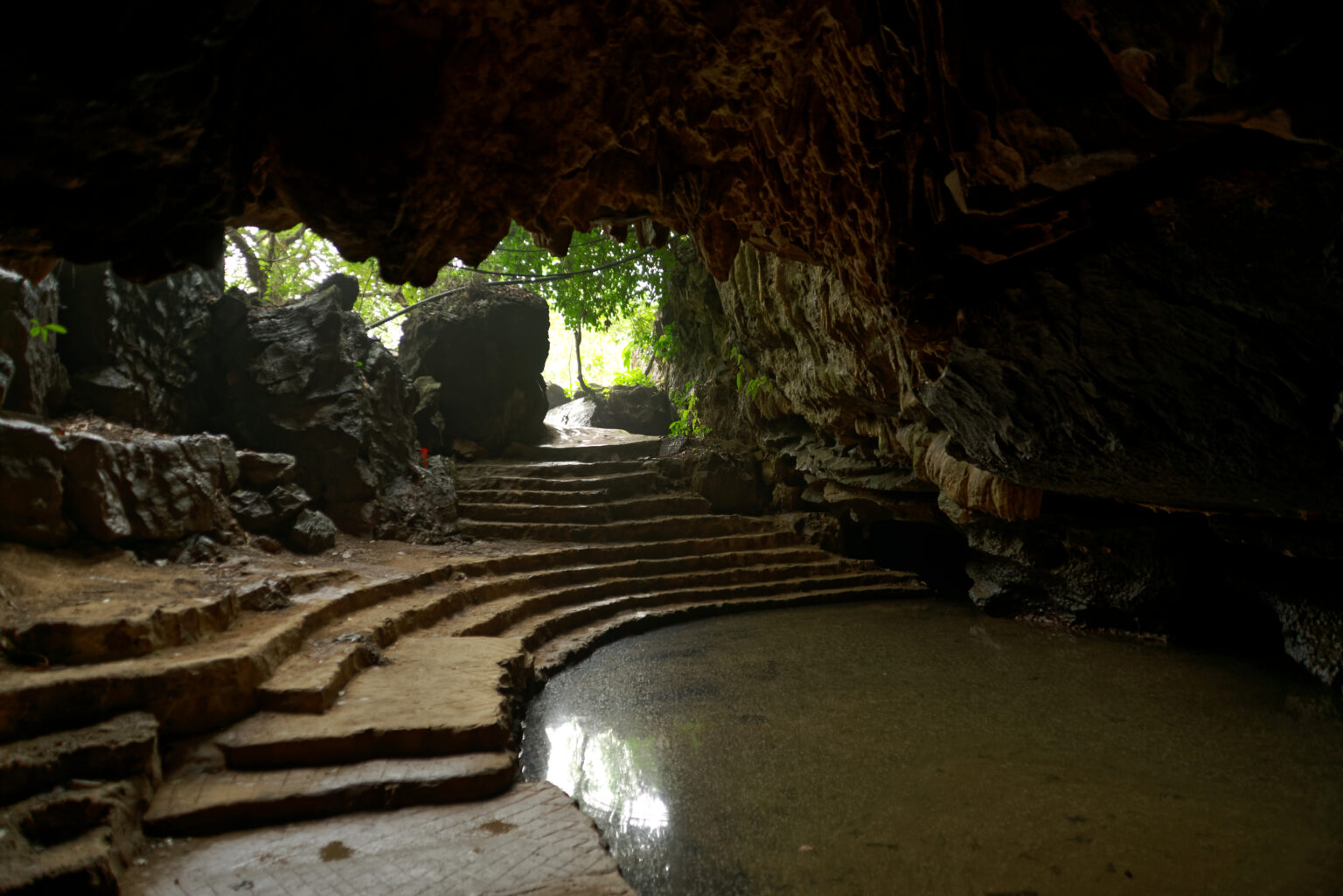
The value lies in how this record meets the geology. UNESCO says the middens, which hold shells, bones, stone tools, hearths and corded-ware pottery, show how early groups adapted to repeated flooding of the landscape by the sea after the last ice age. ICOMOS adds that people shifted their food gathering between sea and inland resources as the sea rose and fell. It also cautions that only a small proportion of the potential cave resource has been examined and the lowest levels have not yet been reached.
Why did both advisory bodies ask for a delay, and what is Hoa Lu’s role?
In 2014 ICOMOS recommended deferring the cultural side of the nomination, and IUCN recommended deferring the nomination as a whole. UNESCO nonetheless inscribed Trang An that year under criteria (v), (vii) and (viii). ICOMOS had judged that criterion (v) rested on the nine excavated caves, and that the remains of Hoa Lu and the many temples and pagodas were not related to any criterion.
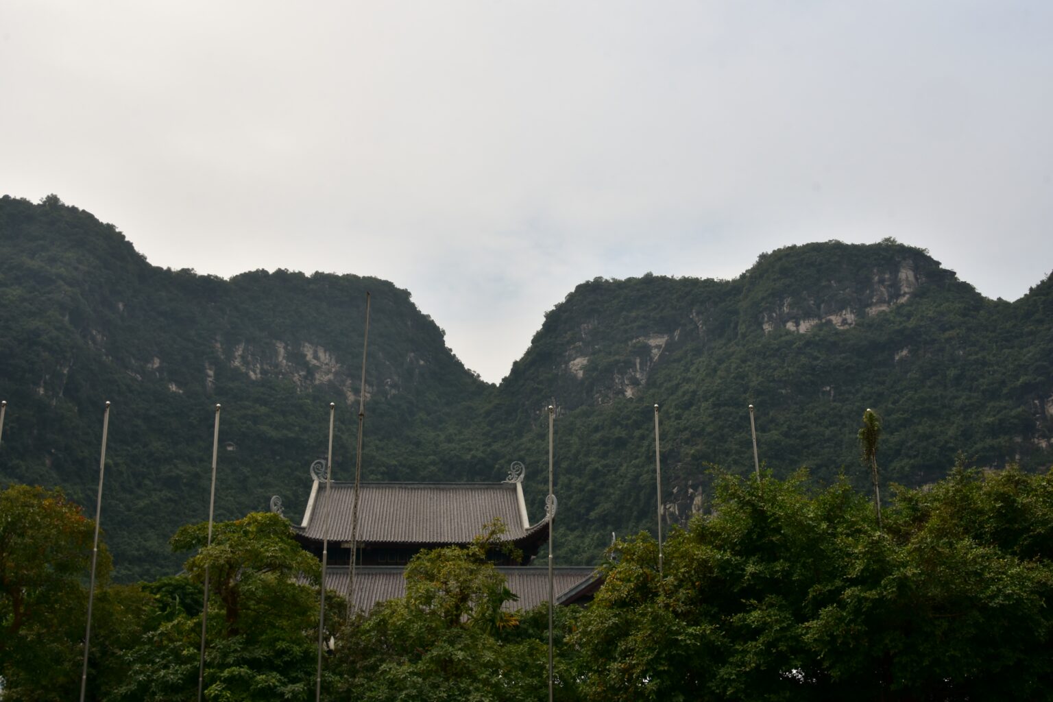
Hoa Lu remains part of the property. ICOMOS records it as the political capital for 42 years, from CE 968 to 1010, under the Dinh dynasty. Its Inner and Outer Citadels cover around 300 ha, but few vestiges of the 10th-century buildings apparently remain, and many temples were rebuilt in the 16th and 17th centuries. Some 14,000 people live in the property, mostly in subsistence farming.
Frequently Asked Questions
Which UNESCO World Heritage sites are near Trang An?
The Citadel of the Ho Dynasty is nearest, 34 km away in a straight line. Then come the Imperial Citadel of Thang Long (87 km), Yen Tu (107 km) and Ha Long Bay (146 km) in Viet Nam, the Plain of Jars in Laos (243 km) and the Zuojiang rock art in China (251 km).
Why is Trang An both a cultural and a natural site?
It was inscribed in 2014 under one cultural criterion, (v), for how early people adapted to changing conditions over 30,000 years, and two natural ones, (vii) and (viii), for its landscape beauty and its tower-karst geology.
How old are the human remains found in the caves of Trang An?
ICOMOS reports occupation evidence from about 33,000 BP at the Mai Da Ong Hay rock-shelter and at least 24,438 BP at Trong cave, down to about 1,200 BP at Moi cave. UNESCO gives the sequence as continuous for more than 30,000 years.
Who manages Trang An?
UNESCO says the property is state-owned and controlled by the Ninh Binh Provincial People’s Committee. It is managed by the Trang An Landscape Complex Management Board, an independent agency working under a government-approved, legally binding management plan.
Sources
- UNESCO World Heritage Centre, Trang An Landscape Complex (inscribed 2014). https://whc.unesco.org/en/list/1438/
- ICOMOS, Advisory Body Evaluation of Trang An (No 1438), March 2014. https://whc.unesco.org/document/152677
- IUCN, World Heritage Nomination Technical Evaluation: Trang An Landscape Complex, April 2014. https://whc.unesco.org/document/152679
- UNESCO World Heritage Centre, Citadel of the Ho Dynasty (2011). https://whc.unesco.org/en/list/1358/
- UNESCO World Heritage Centre, Central Sector of the Imperial Citadel of Thang Long – Hanoi (2010). https://whc.unesco.org/en/list/1328/
- UNESCO World Heritage Centre, Yen Tu-Vinh Nghiem-Con Son, Kiep Bac (2025). https://whc.unesco.org/en/list/1732/
- UNESCO World Heritage Centre, Ha Long Bay – Cat Ba Archipelago (1994). https://whc.unesco.org/en/list/672/
- UNESCO World Heritage Centre, Plain of Jars (2019) and Zuojiang Huashan Rock Art (2016). https://whc.unesco.org/en/list/1587/, https://whc.unesco.org/en/list/1508/
Spotted an error? Write to editorial@culturalheritageonline.com and we correct it the same day.


_(37806488344).jpg)