Lubriano
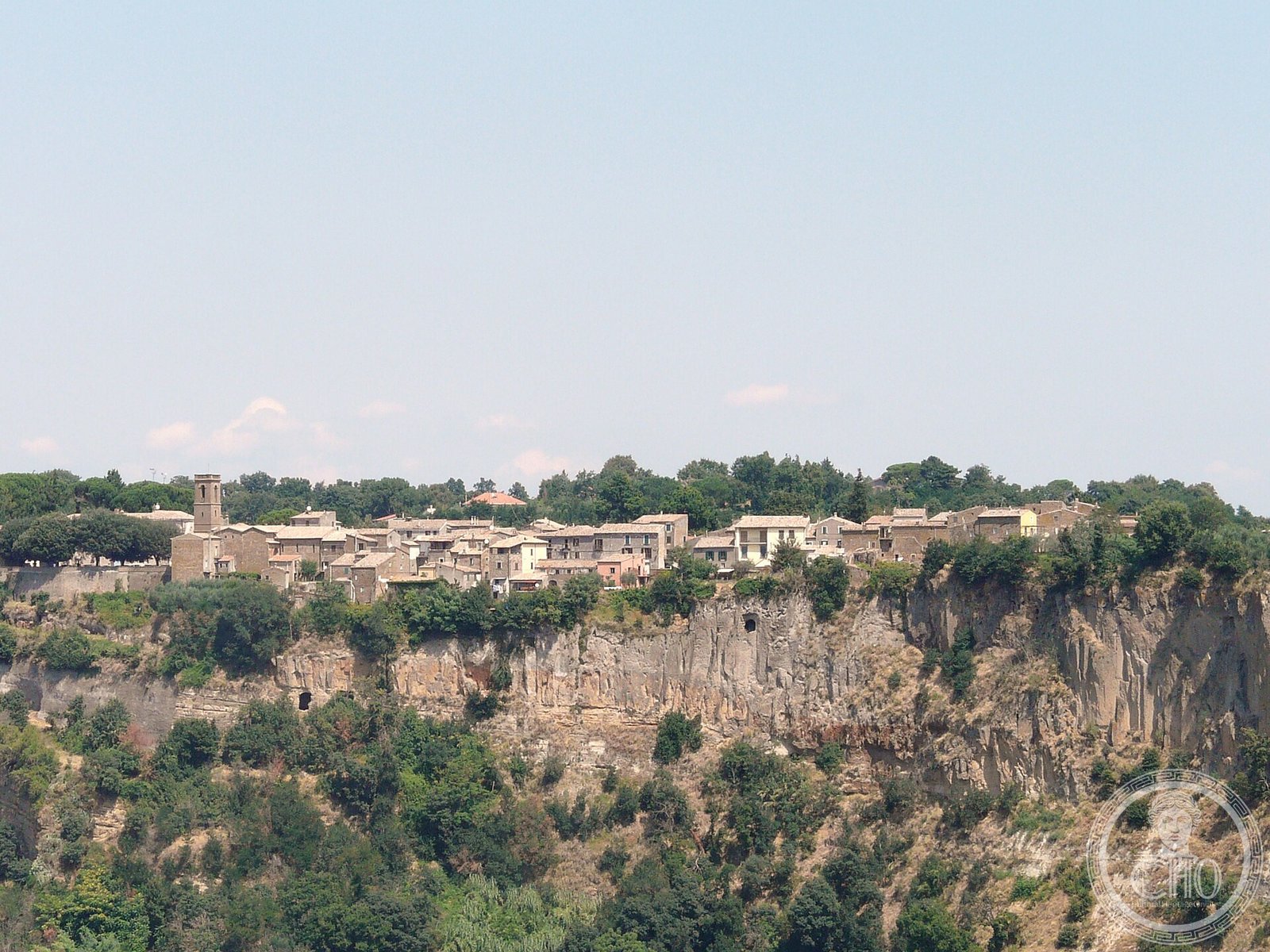
Lubriano is a small medieval hilltop village in the Province of Viterbo, perched on a dramatic tufa spur above the Calanchi di Civita gorge in northern Lazio. Situated at 430 metres above sea level and facing the famous dying village of Civita di Bagnoregio across a deep erosion canyon, Lubriano offers one of the most spectacular viewpoints over the surrounding badlands landscape of the Tuscia region. With fewer than 400 inhabitants, it preserves an intact medieval street plan, a Romanesque parish church, and several noble palaces.
At a glance
- Type
- Medieval hilltop village (borgo)
- Period
- Medieval origins; documented from the 11th century
- Style
- Vernacular tufa-stone architecture; Romanesque ecclesiastical elements
- Location
- Province of Viterbo, Lazio, central Italy
- Coordinates
- 42.6352° N, 12.1046° E
Overview
Lubriano sits within the Calanchi dell’Alta Tuscia landscape, a protected area of eroded clay and tufa formations that gives the surrounding countryside an otherworldly, almost lunar appearance. The village commands sweeping views south over Civita di Bagnoregio — the so-called “dying city” isolated on its eroding tufa pinnacle — making Lubriano’s panoramic terrace a favoured destination for photographers and travellers seeking the quintessential Tuscia vista. Despite its small size, Lubriano retains a living community and a calendar of local festivals tied to agricultural and religious traditions.
History
The tufa plateau on which Lubriano stands was inhabited in Etruscan and Roman times, with the surrounding territory showing evidence of ancient road networks and necropoleis cut into the soft volcanic rock. The medieval village grew around a fortress controlling the Tiber valley approach routes, passing through the hands of various feudal lords before becoming part of the Papal States. Like many villages in the Viterbo hinterland, Lubriano experienced demographic decline in the 20th century as residents moved to urban centres, but it avoided the severe depopulation that emptied nearby Civita.
What you see
The village centre clusters around Piazza Umberto I, where the parish church of Sant’Agostino displays a simple Romanesque facade and houses a modest collection of local devotional art. Tufa-stone houses line narrow, stepped lanes that end abruptly at the cliff edge, where viewing terraces offer vertiginous panoramas over the calanchi gorge and directly across to Civita di Bagnoregio on its isolated rock. Several former noble residences, some with carved stone doorways and coats of arms, testify to the village’s more prosperous medieval past.
Cultural significance
Lubriano is part of the protected landscape zone around Civita di Bagnoregio, which in 2023 was inscribed on the UNESCO World Heritage List as part of the site “Civita di Bagnoregio and its Calanchi Valley.” The village’s position as the principal viewpoint over Civita gives it an irreplaceable role in the understanding and visual experience of that endangered heritage site.
Practical information
- Address
- Lubriano, 01020 VT, Province of Viterbo, Lazio, Italy
- Access
- The village is freely accessible at all times. The panoramic terrace faces Civita di Bagnoregio and requires no ticket.
- Facilities
- Limited; small bar and seasonal restaurant. Check locally for current openings.
Getting there
Lubriano is approximately 100 km north of Rome by road. By car, take the A1 motorway to Orvieto, then follow provincial roads SP12 and SR71 towards Bagnoregio and Lubriano (about 30 km from the motorway exit). There is no direct train service; the nearest station is Orvieto on the Rome–Florence high-speed line. Local Cotral buses connect Viterbo with Bagnoregio, from which Lubriano is reachable by taxi or on foot (about 3 km).
Sources & resources
Find it on the map
See this place and what’s around it →📷 Diventa un fotografo di Cultural Heritage Online
Condividi le tue foto dei luoghi: restano pubblicate con la tua firma come autore. Più vengono viste, più ti fai conoscere — e presto un concorso premierà le foto più apprezzate.
Accedi o registrati gratis per aggiungere una foto