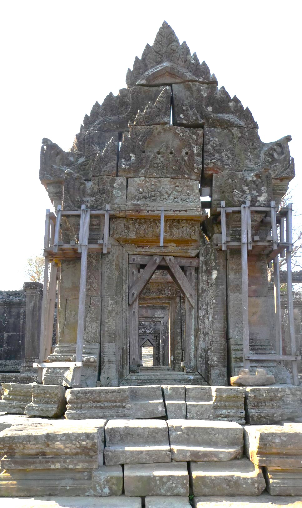
The nearest World Heritage site to the Temple of Preah Vihear is Koh Ker, 69 km away in a straight line, followed by Angkor at 117 km and Vat Phou in Laos at 133 km. Preah Vihear itself is a Hindu sanctuary dedicated to Shiva, built along an 800-metre axis on the edge of a plateau above the plain of Cambodia. UNESCO listed it in 2008.
The World Heritage sites around Preah Vihear
The distances below are straight lines between the reference points UNESCO publishes for each property, measured to the nearest component of a serial site. They show what is close. They do not show how long the road takes.
| Site | Country | Distance | Inscribed | Type |
|---|---|---|---|---|
| Koh Ker: Archaeological Site of Ancient Lingapura or Chok Gargyar | Cambodia | 69 km | 2023 | Cultural |
| Angkor | Cambodia | 117 km | 1992 | Cultural |
| Vat Phou and Associated Ancient Settlements within the Champasak Cultural Landscape | Laos | 133 km | 2001 | Cultural |
| Temple Zone of Sambor Prei Kuk, Archaeological Site of Ancient Ishanapura | Cambodia | 173 km | 2017 | Cultural |
| Dong Phayayen-Khao Yai Forest Complex | Thailand | 194 km | 2005 | Natural |
| Cambodian Memorial Sites | Cambodia | 293 km | 2025 | Cultural |
The three nearest sites all belong to the Khmer world, and they use space in different ways. UNESCO dates the Angkor capitals from the 9th to the 15th century and records Koh Ker as the sole capital from 928 to 944 CE. At Vat Phou, an axis from mountain top to river bank lays out temples, shrines and waterworks over some 10 km, in a landscape developed between the 5th and 15th centuries. Preah Vihear’s axis is far shorter, 800 metres, and runs along the edge of a plateau.
Why does Preah Vihear run along a single axis?
The temple is not built around a centre. UNESCO describes a series of sanctuaries linked by a system of pavements and staircases over an 800 metre long axis, on the edge of a plateau that dominates the plain of Cambodia. The listing dates the temple to the first half of the 11th century AD and traces its history back to the 9th century, when a hermitage was founded.
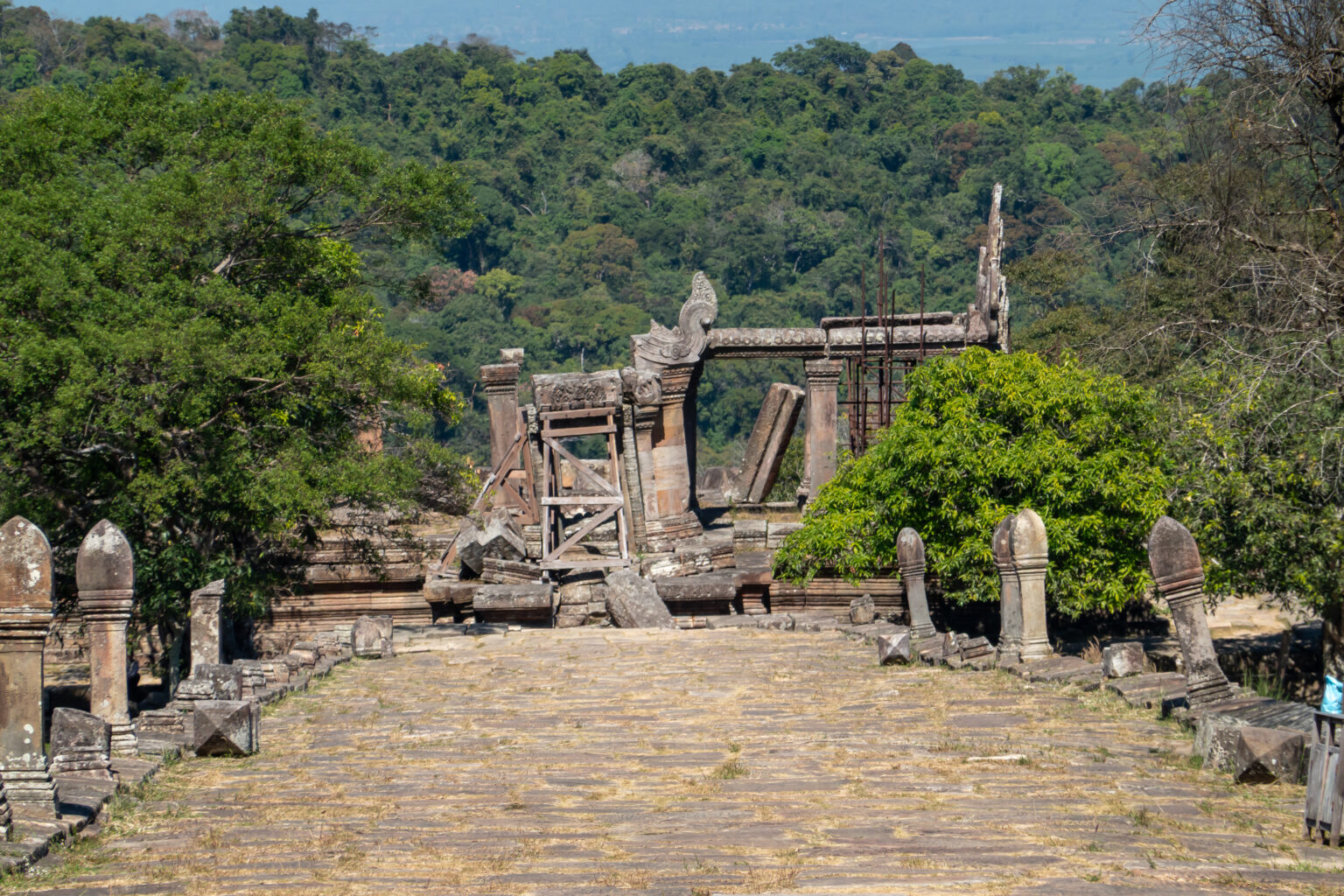
That arrangement is the reason UNESCO calls it a masterpiece. The inscription rests on a single criterion, (i): Preah Vihear is “very ‘pure’ both in plan and in the detail of its decoration”, and its architecture is adapted to the natural environment and to the religious function of the temple. The carved stone ornamentation is singled out for its quality.
Remoteness did the rest. UNESCO states that the site is particularly well preserved, mainly because of where it stands.
What did the International Court of Justice decide in 1962?
Ownership of the temple went before a court. Cambodia filed its application on 6 October 1959. It complained that Thailand had occupied a piece of its territory around the ruins, and asked the Court to declare sovereignty over the temple and to order the withdrawal of the armed detachment stationed there since 1954.
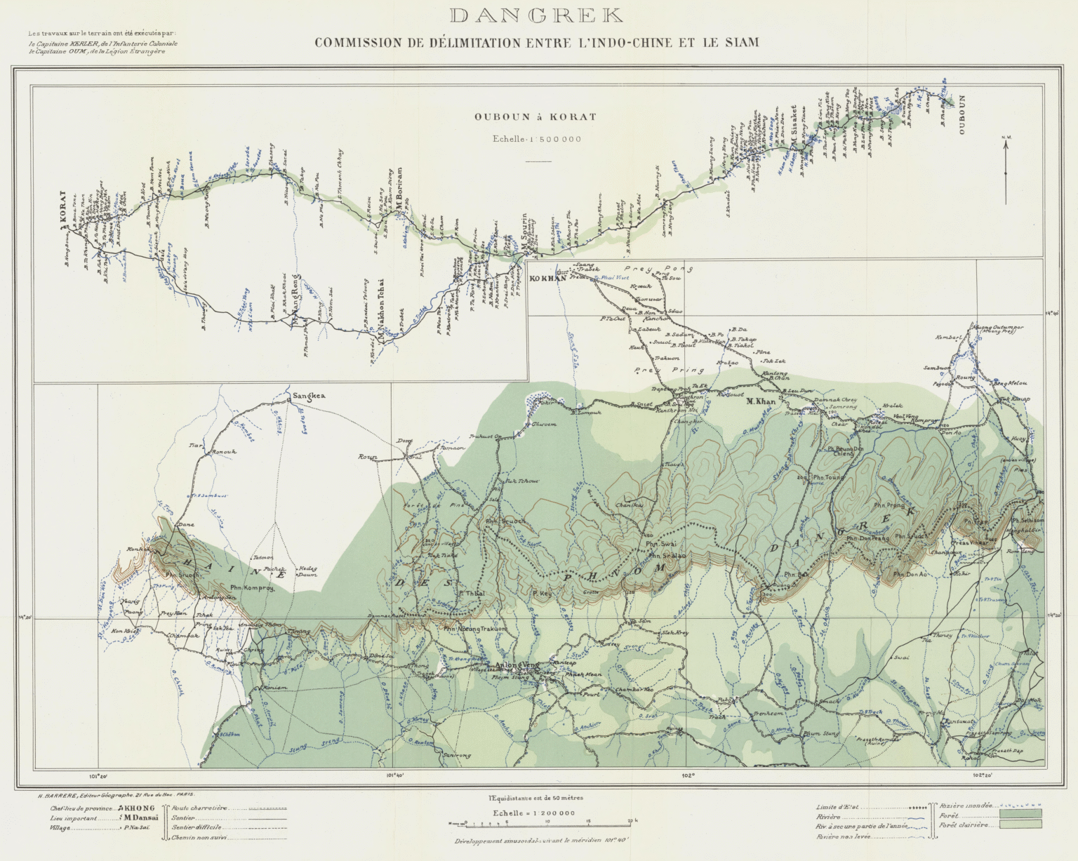
In its judgment of 15 June 1962 the Court noted that a Franco-Siamese Treaty of 1904 provided that the frontier in this area was to follow the watershed line. A map based on the work of a Mixed Delimitation Commission put the temple on the Cambodian side. Thailand argued that the map had no binding character, or that it had accepted it only through a mistaken belief that the line matched the watershed. The Court found that Thailand had accepted the map, and concluded that the temple stood on Cambodian territory. It also required Thailand to withdraw its forces and to restore any objects removed from the ruins since 1954.
Where does the protected area end, and what changed in 2013?
The temple was listed in 2008 on Cambodia’s request, as the Court records. Armed incidents followed in the frontier area near it. On 28 April 2011 Cambodia asked the Court to interpret the 1962 judgment, and on 18 July 2011 an order indicated a provisional demilitarised zone around the temple.
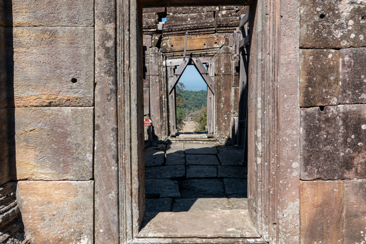
The judgment of 11 November 2013 settled the question of scope. The Court held that the 1962 ruling required Thailand to withdraw from the whole territory of the promontory of Preah Vihear, and that the finding on sovereignty referred to the promontory as well.
UNESCO’s own assessment points to the same ground. Its statement on integrity says the property has to a degree been compromised by the absence of part of the promontory from the perimeter. The listed area is 154.7 hectares. The statement adds that legal protection is adequate, but that the management plan still needs to be consolidated into an approved, full plan.
Frequently Asked Questions
Which UNESCO World Heritage sites are near the Temple of Preah Vihear?
Koh Ker is nearest, 69 km away in a straight line, then Angkor at 117 km. Vat Phou in Laos is 133 km away, Sambor Prei Kuk 173 km, and Dong Phayayen-Khao Yai Forest Complex in Thailand 194 km. These are straight-line distances, not road distances.
How long is the Temple of Preah Vihear and when was it built?
UNESCO gives the temple an axis 800 metres long, with sanctuaries linked by pavements and staircases. It dates to the first half of the 11th century AD, though its history goes back to the 9th century, when a hermitage was founded on the site.
Who owns the Temple of Preah Vihear?
The International Court of Justice ruled in 1962 that the temple stands on Cambodian territory. In 2013 it clarified that the ruling covers the whole promontory of Preah Vihear. Thailand was required to withdraw its forces from the temple and from its vicinity on Cambodian territory.
When was Preah Vihear listed by UNESCO and why?
It was inscribed in 2008 under criterion (i), as a masterpiece of Khmer architecture. UNESCO cites the purity of its plan and decoration, its fit with the spectacular landscape, and the exceptional quality of its carved stone ornamentation.
Sources
- UNESCO World Heritage Centre — Temple of Preah Vihear (inscribed 2008), brief description and statement of Outstanding Universal Value. https://whc.unesco.org/en/list/1224/
- International Court of Justice — Temple of Preah Vihear (Cambodia v. Thailand), overview of the case, judgment of 15 June 1962. https://www.icj-cij.org/case/45
- International Court of Justice — Request for Interpretation of the Judgment of 15 June 1962 (Cambodia v. Thailand), overview of the case, judgment of 11 November 2013. https://www.icj-cij.org/case/151
- UNESCO World Heritage Centre — Koh Ker (inscribed 2023). https://whc.unesco.org/en/list/1667/
- UNESCO World Heritage Centre — Angkor (inscribed 1992). https://whc.unesco.org/en/list/668/
- UNESCO World Heritage Centre — Vat Phou and Associated Ancient Settlements within the Champasak Cultural Landscape (inscribed 2001). https://whc.unesco.org/en/list/481/
Spotted an error? Write to editorial@culturalheritageonline.com and we correct it the same day.