Diy-Gid-Biy (sito naturale): le zone umide saheliane del bacino del Lago Ciad nel Far North del Camerun
Nel cuore arido del Sahel camerunese, dove le pianure del bacino del Lago Ciad si aprono verso il confine con il Ciad e il Niger, il sito di Diy-Gid-Biy è un mosaico di zone umide, pianure inondabili stagionali, laghi temporanei e savana alberata di grande valore ecologico. In una regione dove l’acqua è tutto, queste zone umide attraggono ogni anno milioni di uccelli migratori paleoarctici e sono uno degli ultimi rifugi per l’ippopotamo, il coccodrillo del Nilo e i piccoli nuclei residuali di elefanti del Sahel. Patrimonio UNESCO dal 2023, è uno dei siti naturali africani iscritti più recentemente.
At a glance
Diy-Gid-Biy is a complex of Sahelian wetlands in the Lake Chad basin, in the Far North Region of Cameroon (Logone-et-Chari department). UNESCO inscribed it in 2023 (ref. 1745) as an outstanding example of a Sahelian floodplain ecosystem of exceptional importance for migratory waterbirds on the Central African Flyway. The site consists of seasonal floodplains, temporary lakes and marsh areas that form when the Logone River and its tributaries overflow during the rainy season (July–October). During the dry season (November–May), the floodwaters recede to leave vast mudflats that concentrate millions of birds, hippos and other wildlife around the remaining permanent water bodies.
Key facts
- UNESCO: World Heritage since 2023 (Diy-Gid-Biy, ref. 1745)
- Location: Far North Region, Cameroon; borders Lake Chad area; near Waza National Park
- Migratory birds: millions of Palearctic migrants winter here; species include garganey, pintail, ruff, black-tailed godwit, whiskered tern and many others
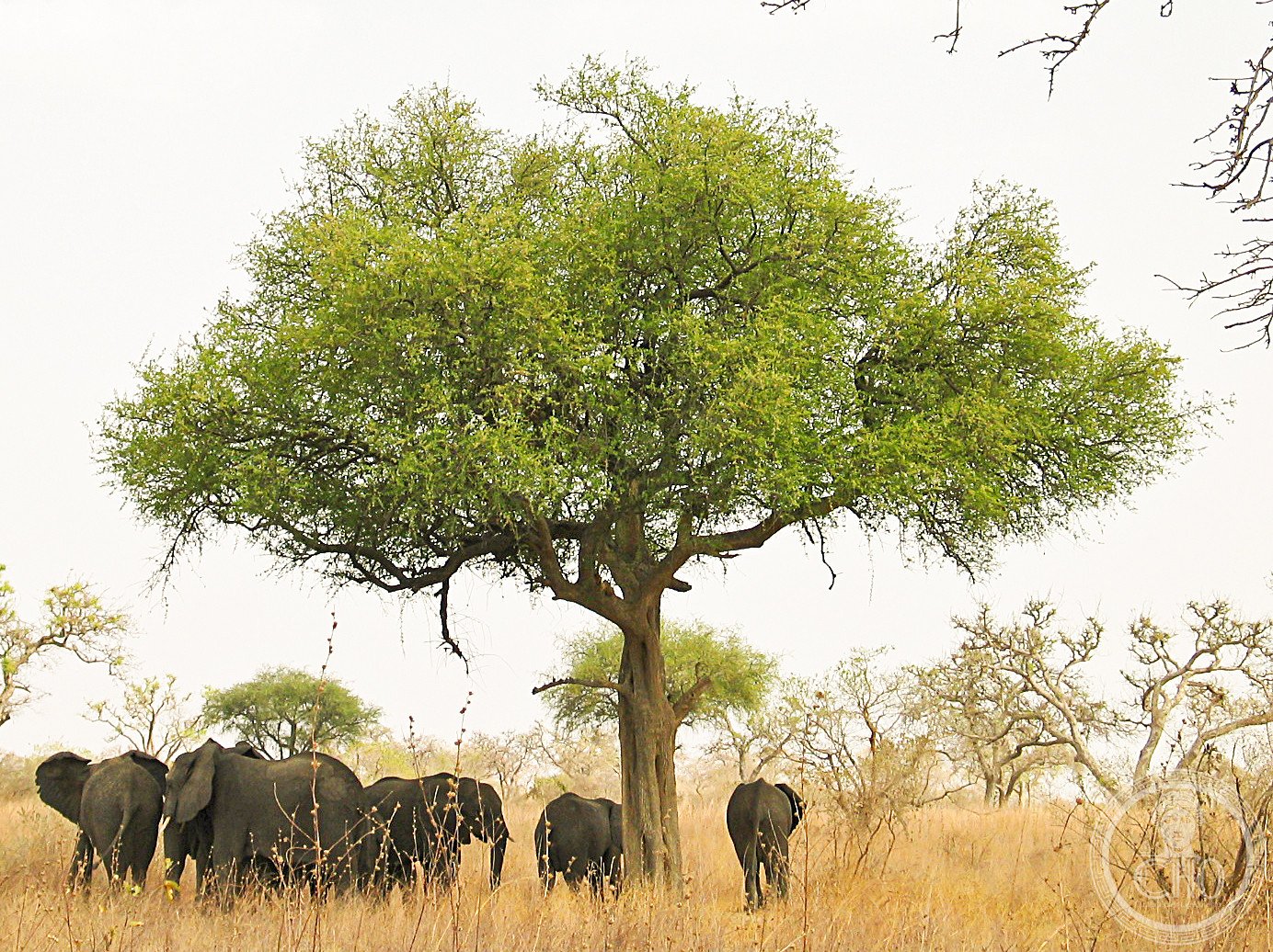
- Mammals: hippopotamus, Nile crocodile, African elephant (residual population), kob, topi, defassa waterbuck
- Climate: Sahelian; very seasonal; rainy season July–October; dry and hot November–June
- Threats: climate change reducing rainfall; encroachment of agriculture; overgrazing; armed conflict in the Lake Chad basin
History
The Lake Chad basin has been inhabited for thousands of years by the Kotoko, Kanuri, Arab Choa and Fulani peoples, all of whom have developed sophisticated systems for living with the seasonal floods — fishing during inundation, farming and grazing on the rich floodplain soils as the waters recede. The region was part of the ancient Kanem-Bornu Empire, one of the longest-lived states in African history (c. 700–1900 AD). French colonial administration established the region’s boundaries and created game reserves in the 1920s–30s; Waza National Park (adjacent to Diy-Gid-Biy) was established in 1968.
Lake Chad itself has shrunk dramatically since the 1960s — from 25,000 km² in 1963 to approximately 2,500 km² today — due to a combination of climate drying and excessive water extraction for irrigation. The Diy-Gid-Biy wetlands represent a critical fragment of the once-vast Chad basin wetland ecosystem. UNESCO inscription in 2023 was partly motivated by the need for international attention to wetland conservation in the deteriorating Lake Chad system.
What you see
In the dry season, the landscape is a vast expanse of cracked grey mud dotted with dying acacia trees — austere, almost lunar. The permanent water bodies concentrate extraordinary densities of birds: pelicans, marabou storks, herons, egrets, spoonbills and thousands of ducks and waders. The sunsets over the Sahelian horizon are dramatic.
In the wet season (July–October), the floods transform everything: the mudflats become shallow lakes, hippos spread widely across the inundated plain, and the air fills with waterbirds. The roads (such as they are) become impassable, and the only access is by pirogue.
Practical information
- Base: Maroua or Kousseri (Far North Region capital), the main regional towns
- Access: road from Maroua north toward Kousseri; the wetlands are accessible by dirt tracks (4WD required) and pirogue in season
- Security: the Far North Region of Cameroon has been affected by the Boko Haram insurgency; check travel advisories carefully before visiting
- Combined visit: pair with Waza National Park (elephant, lion, giraffe), the most visited park in Cameroon, adjacent to the site
Getting there
Fly to Maroua (Salak Airport) from Douala or Yaoundé (1 hr; Camair-Co or charter). Drive north from Maroua toward Kousseri (160 km, 3 hrs). The site is in the Logone-et-Chari department. GPS: 10.92° N, 13.83° E.
Nearby
- Waza National Park (UNESCO tentative) — Cameroon’s flagship Sahelian wildlife park; 50 km from Diy-Gid-Biy; elephants, lions, giraffe
- Lake Chad — the shrinking inland sea, 100 km north; shared by Cameroon, Chad, Niger and Nigeria
- Maroua — the Far North capital; traditional crafts market; gate for northern Cameroon tourism
Sources
- UNESCO World Heritage Centre — “Diy-Gid-Biy” (ref. 1745)
- WWF — Lake Chad Basin Programme
- Encyclopaedia Britannica — Lake Chad; Cameroon
Find it on the map
See this place and what’s around it →📷 Diventa un fotografo di Cultural Heritage Online
Condividi le tue foto dei luoghi: restano pubblicate con la tua firma come autore. Più vengono viste, più ti fai conoscere — e presto un concorso premierà le foto più apprezzate.
Accedi o registrati gratis per aggiungere una foto