
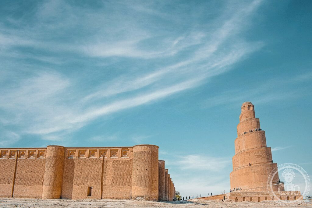
For nearly sixty years, in the ninth century, Samarra was the capital of the Abbasid Islamic empire, an immense city stretching along the Tigris. What remains is the vast archaeological site and, above all, the Great Mosque with its spiral ramp minaret, the Malwiya: one of the most famous images in Islamic art.
At a glance
Samarra, on the river Tigris north of Baghdad, was for nearly sixty years in the 9th century the capital of the Abbasid Caliphate, then the most powerful empire of the Islamic world. The caliphs laid out a vast new city of palaces, mosques and avenues, much of which survives as one of the largest archaeological sites in the world. Its most famous monument is the Great Mosque, once the largest in the world, with its spiralling Malwiya minaret. The Samarra Archaeological City was inscribed by UNESCO in 2007.
Key facts
- UNESCO: World Heritage since 2007 (Samarra Archaeological City)
- Abbasid capital: seat of the caliphate from 836 to 892
- The Malwiya: the Great Mosque’s spiral minaret, with a helical ramp
- Once the largest mosque: the Great Mosque of al-Mutawakkil
- Vast site: one of the largest archaeological cities in the world
- On the Tigris: north of Baghdad in central Iraq
History
In 836 the Abbasid caliph al-Mu’tasim moved his court from Baghdad to a new capital upriver at Samarra, partly to house his Turkish troops. Over the following decades the caliphs built on a colossal scale: palaces strung for kilometres along the Tigris, gardens, racecourses, and great mosques. The Great Mosque of al-Mutawakkil, with its huge enclosure and the spiral Malwiya minaret, crowned the city.
The court returned to Baghdad in 892 and much of Samarra was abandoned, leaving its monuments and street plan in the desert, an unmatched record of Abbasid art and urbanism. The shrines of two imams later made the city a major centre of Shia pilgrimage.
What you see
The Malwiya minaret rises beside the brick outer walls of the Great Mosque, a tapering tower wrapped by an external spiral ramp climbing to the top — an unmistakable silhouette. Around it stretch the foundations and standing fragments of the immense city: the Abu Dulaf mosque with its own spiral minaret, palace walls and the lines of vanished avenues.
The golden-domed shrine of the imams marks the living religious heart of the modern town.
Practical information
- Site: the Great Mosque and Malwiya are the main monuments
- Time needed: half a day for the archaeological sites
- Note: check current travel advice for Iraq before any visit
- Setting: on the Tigris, about 125 km north of Baghdad
Getting there
Samarra is on the river Tigris in Salah ad-Din province, central Iraq, about 125 km north of Baghdad. Access depends on the security situation. GPS: 34.205° N, 43.879° E.
Nearby
- Al-Askari Shrine — the golden-domed shrine of the imams
- Abu Dulaf Mosque — with a second spiral minaret nearby
- Baghdad — the Iraqi capital, downriver
Sources
- UNESCO World Heritage Centre — “Samarra Archaeological City” (ref. 276)
- Iraqi State Board of Antiquities and Heritage — official body
- Encyclopaedia Britannica — Samarra
Find it on the map
See this place and what’s around it →📷 Become a Cultural Heritage Online photographer
Share your photos of places: they stay published under your name as the author. The more they're seen, the more you get noticed — and soon a contest will reward the most appreciated photos.
Log in or sign up free to add a photo