
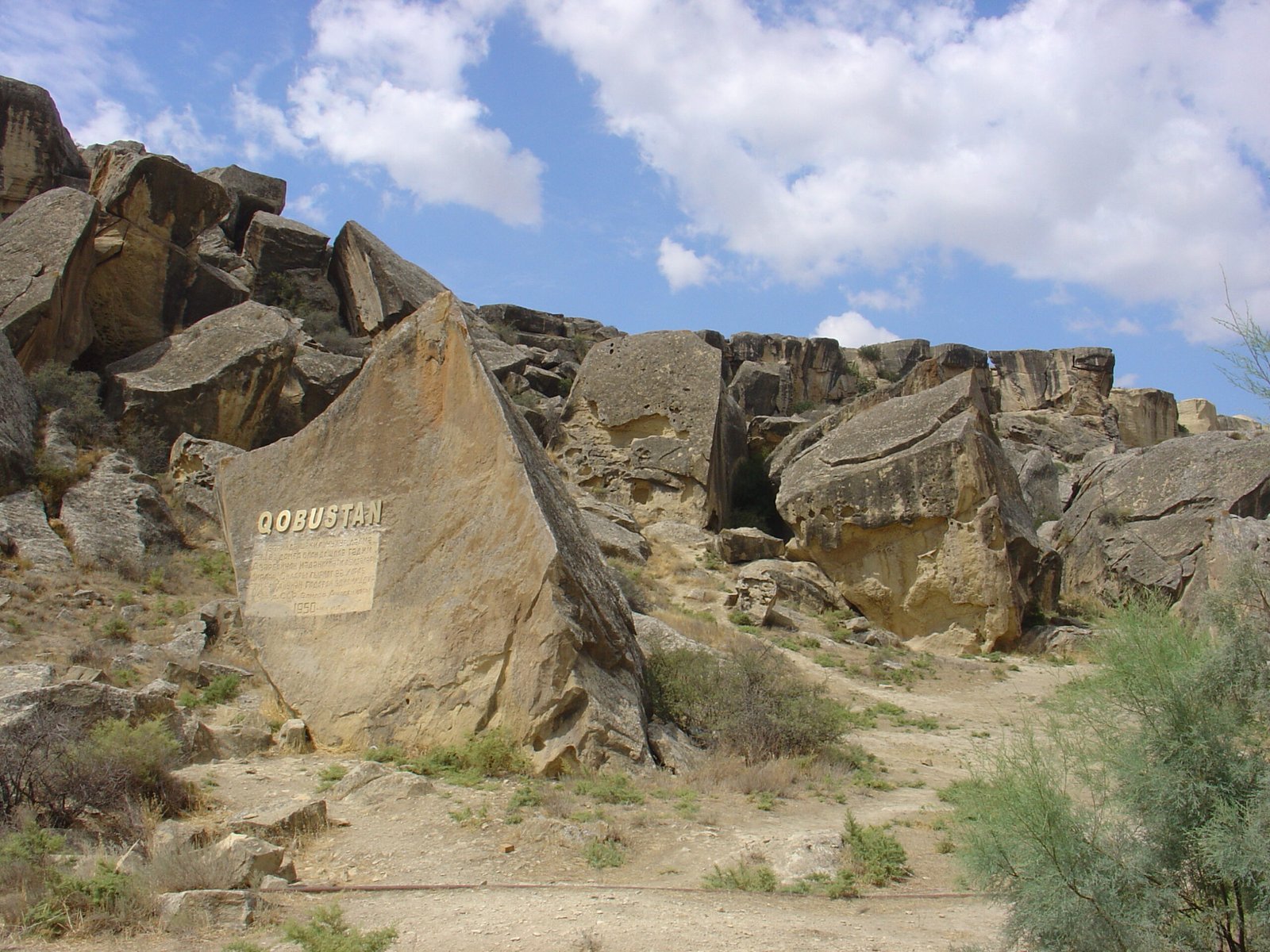
Some 6,000 petroglyphs carved over 40,000 years on rocky promontories overlooking the Caspian Sea – and hidden among them, a Latin inscription proving a Roman legion stood here under Emperor Domitian, 3,000 kilometres from Rome.
At a glance
Qobustan National Park, approximately 60 km southwest of Baku, is a UNESCO World Heritage Site (2007) containing roughly 6,000 rock engravings spread across three main sites on the Boyukdas, Kicikdas, and Cingirdag hills. The petroglyphs span an extraordinary timeline – from Palaeolithic hunting scenes and ritual dancing figures through Bronze Age boats and cattle to medieval inscriptions – constituting one of the world’s great archives of continuous human visual culture. Hidden among them, almost invisible, is the easternmost known Roman military inscription in the world: proof, in three lines of carved Latin, that a centurion of the XII Fulminata Legion stood here during the reign of Emperor Domitian (81-96 AD).
Key facts
- UNESCO WHS: 2007 – “Gobustan Rock Art Cultural Landscape”
- Period: c. 40,000 BC through medieval; core prehistoric corpus c. 12,000-8,000 BC
- Petroglyphs: approximately 6,000 documented engravings across three rocky hills
- Roman inscription: Latin text on Boyukdas hill – centurion of the XII Fulminata Legion, reign of Emperor Domitian (81-96 AD); easternmost Roman military inscription known in the world
- Location: Qobustan National Park, 60 km southwest of Baku, Garadagh District, Azerbaijan
- Museum: Qobustan Museum at the park entrance with contextual exhibition including replica petroglyphs and the Roman inscription
- GPS: 40.0681 N, 49.3700 E
History
The rock engravings of Qobustan document human presence in this landscape from the Upper Palaeolithic – when the Caspian Sea stood higher and the Boyukdas hills formed a promontory overlooking a different coastline – through to the medieval period. The earliest petroglyphs include elongated dancing human silhouettes, which researchers interpret as ritual figures associated with ceremonies whose nature can only be guessed at; hunting scenes depicting aurochs, deer, and boar; and figures of boats with raised prows that constitute some of the earliest representations of watercraft in the Caucasus. By the Bronze Age the imagery shifts: cattle herding scenes, schematic human figures, and the characteristic “ladder” pattern of lines found across the site.
The single most extraordinary object at Qobustan is also the easiest to overlook. A flat-faced rock at the base of the Boyukdas hill bears a Latin inscription in three lines reading: IMP DOMITIANO CAESARE AVG GERMANICO / LVCIVS IVLIVS MAXIMVS / G XII FVL. Translated, this records “Under Emperor Domitian Caesar Augustus Germanicus, Lucius Julius Maximus, centurion of the XII Fulminata Legion.” The XII Fulminata – the “Thunderbolt Legion” – was based at Melitene (modern Malatya in Turkey) during the 1st century AD. This inscription, approximately 3,000 km from Rome as the crow flies, is the easternmost known Roman military inscription in the world, proving that Roman legionary forces operated in what is now Azerbaijan during the late 1st century AD.
Why the XII Fulminata sent a centurion and his detachment to the Caspian shore under Domitian remains one of the unexplained puzzles of Roman imperial history. Possible explanations include a diplomatic mission to the Caucasian kingdoms that Rome was courting, a reconnaissance for the projected conquest of the Caucasus that was never completed, or the aftermath of the Parthian wars. The inscription records their presence but not their purpose.
What you see
The Qobustan Museum at the park entrance is an excellent starting point: a modern, well-designed facility with English-language interpretation, replica petroglyphs, models of the three hill sites, and a display centred on the Roman inscription. From the museum, a raised boardwalk leads up and around the Boyukdas hill through the main concentration of petroglyphs. The engravings are carved directly into the limestone surfaces of the hill – some as small as a hand, others spanning several metres – and the diversity of subjects, periods, and carving techniques within a few dozen square metres is remarkable. The dancing figures are among the most visually striking: elongated, almost abstract human silhouettes with arms raised, some depicted in apparent group formations.
The Roman inscription is on a separate flat rock at the base of the hill, signposted and covered by a protective canopy. It is small and easily missed without guidance. The journey up the hill rewards with views across the semi-desert landscape toward the Caspian, with the spires of Azerbaijan’s offshore oil platforms visible on a clear day – a juxtaposition of 40,000 years of human activity in a single glance. The mud volcanoes of Gobustan, some of the most active in the world, are visible from the road approaching the park and worth a stop.
Practical information
- Location: Qobustan National Park, 60 km southwest of Baku on the Baku-Alyat highway; turn-off clearly signposted
- Opening hours: Museum daily 09:00-18:00; outdoor sites accessible during daylight hours
- Entry fees: Museum and site entrance fee payable at the gate (check current rates; modest)
- Duration: Allow 3-4 hours for museum + Boyukdas petroglyphs + Roman inscription + optional mud volcano stop
- Best season: March-May and September-November; summer heat is intense and shade is minimal on the hilltops
- Guides: English-speaking guides available at the museum; strongly recommended for locating and contextualising the Roman inscription and key petroglyphs
Getting there
From Baku, take the M3 highway south toward Alyat; the Qobustan turn-off is approximately 60 km from central Baku and clearly signposted. By taxi from Baku, allow 1 hour each way; negotiate a round trip with waiting time (Baku taxis are metered or negotiated). There is no reliable public transport to the park; a taxi or guided day-tour from Baku is the standard option. Tour operators in Baku offer day trips combining Qobustan with the Ateshgah Fire Temple and Yanar Dag burning mountain. GPS: 40.0681 N, 49.3700 E.
Nearby
- Gobustan mud volcanoes – one of the world’s densest concentrations of active mud volcanoes, visible from the road to Qobustan; a surreal geological landscape of bubbling grey cones
- Ateshgah Fire Temple, Surakhany – 18th-century Zoroastrian fire temple built over a natural gas vent; 30 km north of Qobustan, en route from Baku
- Yanar Dag – “Burning Mountain,” a natural hillside gas seep that burns continuously; 25 km north of Baku; often combined with Qobustan in a day itinerary
- Old City (Icheri Sheher), Baku – UNESCO-listed historic core of Baku with Maiden Tower and Palace of the Shirvanshahs; the natural base for visiting Qobustan
Sources
- UNESCO World Heritage – Gobustan Rock Art Cultural Landscape (2007)
- Aliyev, I. G. (1960). Gobustan. Azerbaijan Academy of Sciences, Baku.
- Qobustan State Historical-Artistic Reserve – Official site
- Tanner, A. (2013). “The Latin inscription at Gobustan.” Journal of Roman Military Equipment Studies, 14, 21-28.
- Azerbaijan Tourism Board – Gobustan National Park
Find it on the map
See this place and what’s around it →📷 Become a Cultural Heritage Online photographer
Share your photos of places: they stay published under your name as the author. The more they're seen, the more you get noticed — and soon a contest will reward the most appreciated photos.
Log in or sign up free to add a photo