
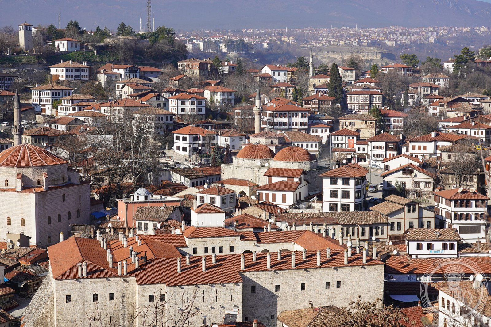
A Black Sea town whose Ottoman-era houses and ravine-set bazaar earned it UNESCO recognition. Safranbolu’s name echoes its historic role as a saffron-trading hub, and its old quarter preserves over a thousand registered historical structures in crystalline form.
At a glance
Safranbolu sits in Karabük Province, 200 kilometres north of Ankara and roughly 100 kilometres south of the Black Sea. The Old Town occupies a deep ravine; the New Town rises on the plateau beyond. This geography shaped centuries of commerce and conflict.
History
The town’s Greek names—Theodoroupolis, Dadybra, later Saphrampolis—mark its ancient origins. Under Ottoman rule, Safranbolu endured a four-month siege by Suleiman II, who destroyed houses and poisoned wells. Residents negotiated surrender during famine and were permitted safe passage.
The 1881–93 Ottoman census recorded 52,523 residents: 49,197 Muslim and 3,326 Greek. Administratively, the town passed from Kastamonu Province (until 1923) to Zonguldak Province (1923–1995) before becoming the seat of Safranbolu District.
What you see
The Old Town preserves 1,008 registered historical artifacts within its ravine setting. These include 25 mosques, 5 Turkish baths, 3 caravanserais, 8 historical fountains, a clock tower, a sundial, and hundreds of mansions and domestic dwellings. Ancient mounds, rock tombs, and historical bridges scatter the landscape. Ottoman-era timber-frame houses with overhanging upper storeys dominate the streetscape.
Cultural significance
Safranbolu was designated a UNESCO World Heritage site in 1994 for its exceptionally well-preserved Ottoman architecture and urban fabric. The town exemplifies how a layered history—Greek, Byzantine, and Ottoman—crystallized into a distinct built environment. Saffron cultivation, which earned the town its name and ancient prosperity, continues at nearby Davutobași village, 22 kilometres east.
Key facts
- Country: Turkey
- City/District seat: Safranbolu, Karabük Province
- Population: 52,999 (2022)
- Elevation: 508 metres
- Coordinates: 41.2494°N, 32.6833°E
- UNESCO World Heritage site: 1994
- Registered historical structures: 1,008
Practical information & getting there
Safranbolu lies approximately 9 kilometres north of Karabük city. The Old Town’s ravine setting and narrow lanes reward unhurried exploration on foot. Contact local tourism authorities for current hours and entrance policies. The New Town and surrounding plateau offer modern services.
Sources & resources
Find it on the map
See this place and what’s around it →Part of a curated route
This site is one of ten stops on the Ottoman Heritage Trail: Istanbul to the Aegean — a curated CHO itinerary connecting major Ottoman monuments from Istanbul to Edirne. The full route includes downloadable GPX and KML files for navigation.
📷 Become a Cultural Heritage Online photographer
Share your photos of places: they stay published under your name as the author. The more they're seen, the more you get noticed — and soon a contest will reward the most appreciated photos.
Log in or sign up free to add a photo