Val d’Orcia
La Val d’Orcia (UNESCO 2004, rif. 1026) è il paesaggio italiano più fotografato al mondo — colline argillose ondulate, cipressi solitari sui crinali e la “città ideale” di Pienza (1458–1462 CE) progettata da Bernardo Rossellino su commissione di papa Pio II Piccolomini: il primo piano urbanistico rinascimentale di una città ex novo in Italia, completato in 4 anni.
At a glance
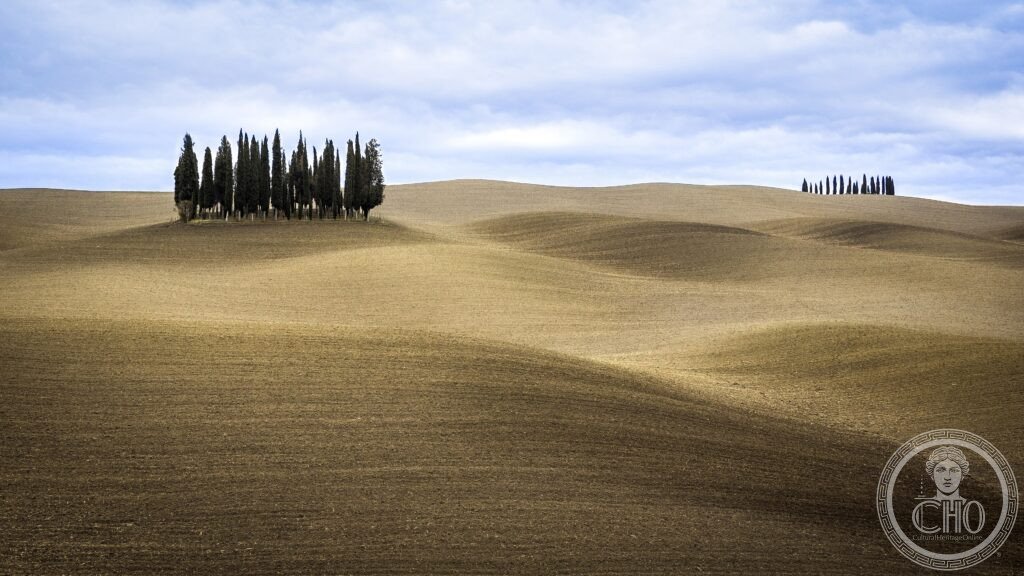
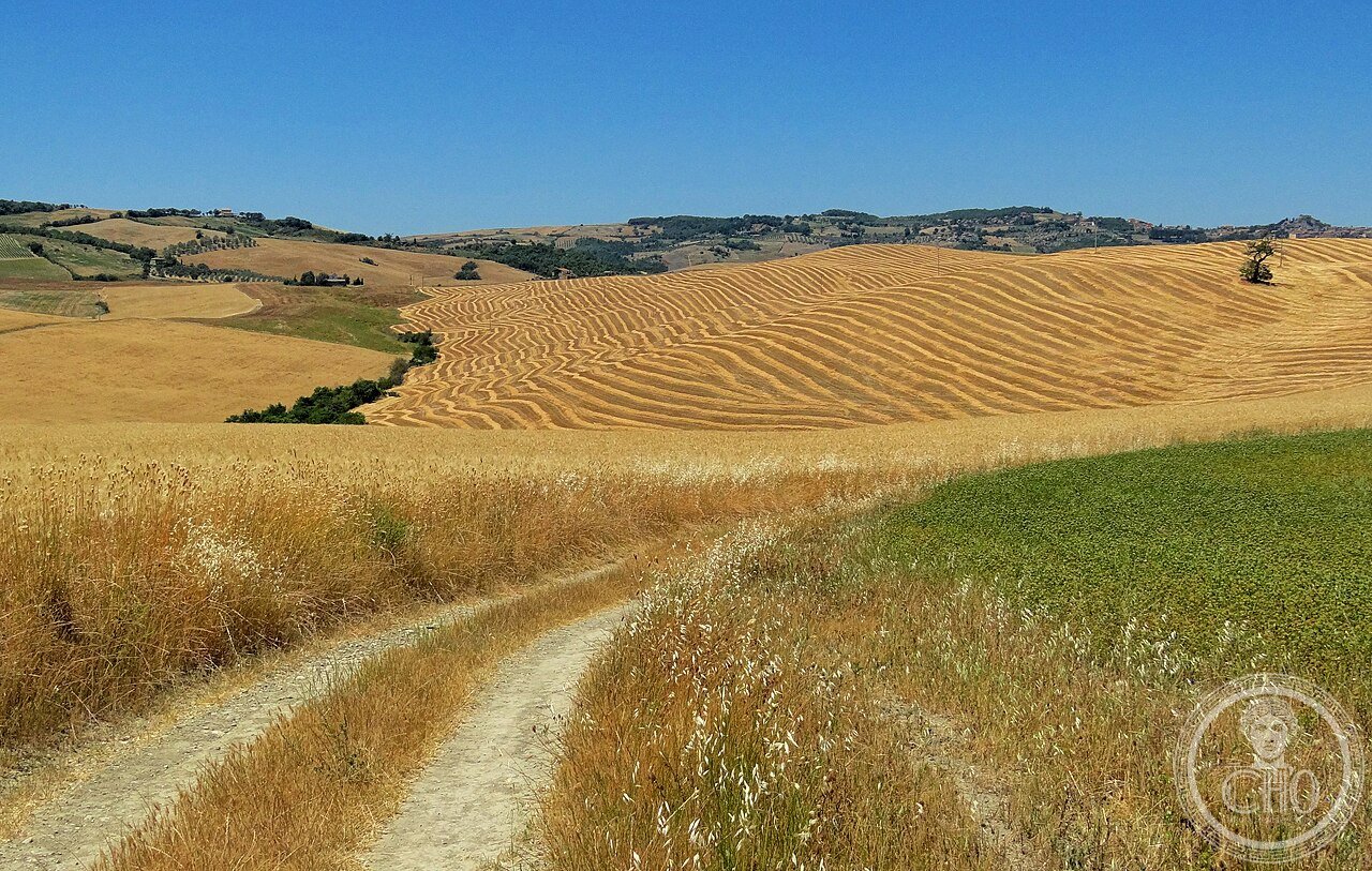
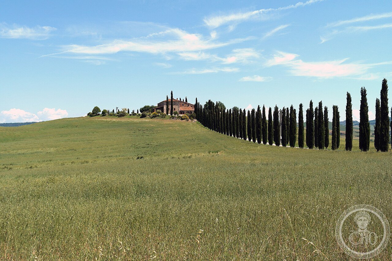
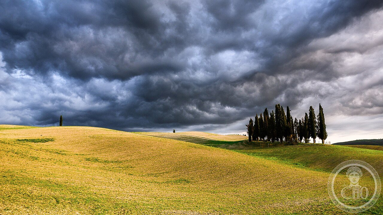
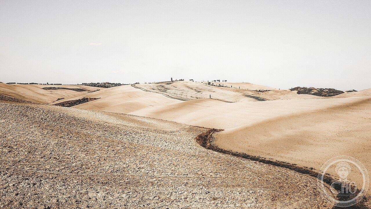
Val d’Orcia Siena Toscana (the most precisely Val d’Orcia zone Pienza Siena Toscana Italy 43.0729 N 11.6791 E UNESCO WHS 2004 reference 1026 Val d’Orcia: the site (the inscribed property: 61,194 ha between Siena (to the north), the Monte Amiata (to the southeast: 1,738 m, the highest peak in Tuscany south of the Arno), the Tiber valley (to the east) and the Maremma (to the southwest); the core zone: the historic municipalities of Castiglione d’Orcia, Pienza, Radicofani, San Quirico d’Orcia, Trequanda); the landscape components (the 4 elements that make the Val d’Orcia landscape: (1) the “crete senesi” (the Sienese clays: the gray-blue Pliocene marine sediment (5–2 million years old) that underlies the rounded erosion hills; the texture (the “biancane”: bleached clay pinnacles 2–6 m high caused by differential erosion; found in the Asciano area northeast of Pienza)); (2) the cypresses (the Tuscan cypress (Cupressus sempervirens var. stricta): planted along roads, on hilltops, and as windbreaks for the “case coloniche” (the sharecroppers’ farmhouses) from the 13th century CE; the iconic single-cypress-on-a-hilltop image: the Cappella della Madonna di Vitaleta (San Quirico d’Orcia): a 4×4 m stone chapel on a hilltop surrounded by 14 cypresses (planted 1957 CE; the most photographed single image in the Val d’Orcia)); (3) the Orcia wine (the Orcia DOC: established 2000 CE (covering the Val d’Orcia municipalities); Sangiovese minimum 60%; the most important wine: Brunello di Montalcino DOCG (the premier wine of the Val d’Orcia: Montalcino is 12 km west of Pienza; the Brunello grape = the Sangiovese Grosso clone; DOCG since 1980 CE; aging: minimum 5 years (Riserva 6); price: €30–500/bottle)); (4) the thermal springs (the Val d’Orcia geothermal field: the subterranean volcanic activity of the Monte Amiata geothermal complex (the 2nd largest in Europe after Iceland); the springs: Bagno Vignoni (51°C; the medieval “piscina” in Piazza delle Sorgenti: a 36×36 m pool fed by the hot spring; bathing prohibited (the pool is the town square); the bathing option: Piscina Val di Sole 1 km from Bagno Vignoni: €20/day); San Casciano dei Bagni (42°C; the most complete Roman thermal facility in Italy: 9 pools excavated 2020–2024 CE with 24 bronze statues (the largest bronze hoard of antiquity found in Italy since the Riace Bronzes 1972 CE))).
Key facts
- Pienza come la prima città ideale rinascimentale: perché Bernardo Rossellino riuscì a costruire l’intera piazza e il palazzo papale in 4 anni (1459-1462 CE) e cosa lo distingue dall’utopia urbanistica di Filarete ad Averlino: the Pienza urbanization (Pienza: the birth name “Corsignano” (the medieval village where Enea Silvio Piccolomini was born on October 18, 1405 CE); the renaming (Enea Silvio Piccolomini was elected Pope as Pius II on August 19, 1458 CE; on March 24, 1459 CE he arrived in his birthplace with Bernardo Rossellino; in May 1459 CE he issued a papal bull renaming the village “Pienza” (from his papal name “Pio” = Pius); the construction (Bernardo Rossellino (1409–1464 CE; a Florentine architect and sculptor, assistant of Alberti on the Palazzo Rucellai (Florence, 1451–1457 CE)): the construction timeline: (1) May 1459: demolition of the existing church and 40 houses in the central area; (2) June 1459: laying of foundations (the Palazzo Piccolomini, the Cathedral, the Palazzo Comunale, the Palazzo del Canonico); (3) August 15, 1462 CE: consecration of the Cathedral: 3 years and 2 months from demolition to consecration; the design principles (the Pienza plan: the 3 innovations vs. contemporary urban projects: (1) actual construction vs. theoretical project (Filarete’s “Sforzinda” (1460 CE) is a utopia on paper; Pienza was built; (2) public space at the center: the trapezoidal Piazza Pio II (the piazza is trapezoidal, not square, because Rossellino had to accommodate the existing road alignments of Corsignano; the Cathedral facade is angled 5° from the perpendicular to the street axis; the visual effect: the piazza appears square because the forced perspective corrects the viewer’s perception); (3) the civic dialogue (the Cathedral, the Palazzo Piccolomini, and the Palazzo Comunale face each other across the piazza: the 3 powers (God, the Sovereign, the People) are co-present but hierarchically ordered (Cathedral = largest; Piccolomini = tallest; Comunale = smallest))))
- GPS (Pienza, centro storico UNESCO, piazza Pio II): 43.0729° N, 11.6791° E; Cappella Vitaleta: 43.0644° N, 11.6386° E
History
Da Lorenzetti 1338 CE al UNESCO 2004 (the most precisely Val d’Orcia zone history: the painted landscape (the Val d’Orcia in Sienese painting: Ambrogio Lorenzetti’s “Allegoria ed Effetti del Buon Governo” (1337–1339 CE; the Sala dei Nove, Palazzo Pubblico, Siena): the right-hand panel “Effetti del Buon Governo in Campagna” shows a landscape with rounded hills, terraced vineyards, isolated farmhouses and winding roads that closely resembles the Val d’Orcia; the specific identifiable features (the Monte Cetona at 1148 m: identifiable in the background of the Lorenzetti fresco); the Simone Martini “Maestà” (1315 CE; same room in the Palazzo Pubblico): a stylized but recognizable Tuscan hill landscape; the Via Francigena (the Val d’Orcia was crossed by the Via Francigena (the pilgrimage road from Canterbury to Rome): the Sigeric of Canterbury route (990 CE): Archbishop Sigeric walked the Via Francigena and documented it in a diary of 79 stages; stages 22–27 cross the Val d’Orcia (S.Quirico d’Orcia → Acquapendente)); the Sienese Republic management (the Val d’Orcia was acquired by the Republic of Siena in 1366 CE from the Salimbeni family; the Sienese reorganized the landscape: replanting the wheat monoculture that gives the landscape its current appearance, building the village hospitals for the Via Francigena pilgrims (the “Ospedali di Siena”: the most famous: Santa Maria della Scala, Siena), incentivizing the sharecropping system (“mezzadria”: the tenant farmed the land and delivered 50% of the harvest to the landlord); the UNESCO inscription (2004 CE: reference 1026).
What you see
Pienza piazza e duomo, Cappella Vitaleta, Bagno Vignoni, Montalcino (the most precisely Val d’Orcia zone visit (1–3 days): Pienza (15 min walk from free parking at Piazzale Rossellino: Piazza Pio II → Cathedral (free; the nave: the German Gothic hall-church plan requested by Pius II (the 3-nave hall plan: equal height for all naves; the Gothic light floods all 3 naves equally; the Italian Gothic had previously always kept the central nave taller)); Palazzo Piccolomini (€7; Tue–Sun 10:00–17:30; the Camera del Papa (the papal bedroom with the original bed of Pius II); the hanging garden (the “Giardino Pensile”: a terrace garden overlooking the Val d’Orcia at 490 m altitude; the most beautiful private garden view in Tuscany)); Cappella della Madonna di Vitaleta (9 km from Pienza on the SP53 toward San Quirico d’Orcia; GPS: 43.0644 N, 11.6386 E; the iconic cypress-lined hilltop chapel; no parking at the chapel: park 500 m south on the SP53 and walk; the best photography time: blue hour 30 minutes before sunrise for the mist in the valleys); Bagno Vignoni (12 km from Pienza: the “piscina” in the central square: the Renaissance bathing pool (the thermal water at 51°C feeds the square pool (36×36 m); bathing not permitted in the historic pool since 1996 CE; the spa (terme) at the edge of the village: Hotel Posta Marcucci spa (open to non-guests: €20/3h; 9:00–19:00)); Montalcino (25 km from Pienza: the “Fortezza di Montalcino” (1361 CE; open daily; the wine enoteca inside the fortress: over 100 Brunello di Montalcino producers represented; tasting from €3/glass; the Brunello di Montalcino DOCG: the most expensive wine produced in Tuscany; vintage chart: 2016, 2015, 2010, 2006 = exceptional).
Practical information
- Come raggiungere la Val d’Orcia senza auto, e la primavera come stagione ideale per il paesaggio fotografico: il trasporto (l’auto è quasi obbligatoria per visitare i siti dispersi della Val d’Orcia; opzioni senza auto: Siena → San Quirico d’Orcia: TIEMME bus n.112 (1h10; 3 corse/giorno; €4.50); Siena → Pienza: TIEMME bus n.112 (1h30; 3 corse/giorno; €6.00); Siena → Montalcino: TIEMME n.112 → n.115 (1h45 con cambio a Buonconvento; €6.50)); il noleggio bici (i colli tra San Quirico d’Orcia e Pienza (12 km; dislivello 250 m: adatto a e-bike); noleggio e-bike: Pienza Bike Rental (€25/mezza giornata)); la stagione migliore (primavera (aprile-maggio): i grano e i fiori di campo trasformano le crete senesi in sfumature di verde-giallo; le più famose fotografie della Val d’Orcia sono quasi tutte di aprile; inverno (gennaio-febbraio): la neve trasforma il paesaggio; 5–7 giorni di neve/anno in media; la nebbia mattutina (ottobre-novembre) riempie le valli con un effetto nebbioso molto ricercato dai fotografi; estate (luglio-agosto): il grano è stato mietuto (luglio 5–15); il paesaggio è paglia bruciata; 38°C)
Getting there
Auto consigliata. Bus TIEMME da Siena: Pienza (1h30, €6) o San Quirico d’Orcia (1h10, €4.50). GPS Pienza: 43.0729/11.6791. Stagione ideale: aprile-maggio per il verde, ottobre per la nebbia.
Nearby
- Siena (centro medievale UNESCO 1995 rif.717 — Piazza del Campo + Torre del Mangia 102m) — 50 km (TIEMME bus 1h30 da Pienza; il Palio di Siena: 2 luglio e 16 agosto; 17 contrade; il Campo; il Museo dell’Opera del Duomo con la Maestà di Duccio (1311 CE))
- Abbazia di Sant’Antimo (Montalcino — abbazia benedettina del XII sec. CE in pietra travertino) — 20 km (nessun trasporto pubblico; la messa gregoriana cantata dai monaci: Lun, Mer, Ven, Dom 11:00 e 18:00; acustica della navata principale (XI sec.); l’edificio più fotografato della Toscana dopo il campanile di Pisa)
Gallery
Sources
- Wikipedia, Val d’Orcia; Pienza; Bernardo Rossellino; Bagno Vignoni; Brunello di Montalcino, accessed June 2026
- UNESCO, Val d’Orcia, WHS reference 1026, inscribed 2004
- Pius II (Enea Silvio Piccolomini). Commentarii. (Book III: the construction of Pienza, 1459–1462 CE)
Find it on the map
See this place and what’s around it →📷 Diventa un fotografo di Cultural Heritage Online
Condividi le tue foto dei luoghi: restano pubblicate con la tua firma come autore. Più vengono viste, più ti fai conoscere — e presto un concorso premierà le foto più apprezzate.
Accedi o registrati gratis per aggiungere una foto