
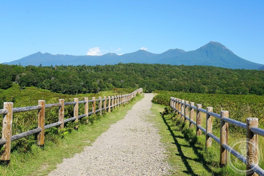
All’estremità nord-orientale dell’Hokkaido, una stretta penisola vulcanica si protende verso il mare di Ochotsk, dove ogni inverno arriva il ghiaccio marino più meridionale del pianeta. Shiretoko — “la fine della Terra” nella lingua Ainu — è uno dei pochi luoghi dove l’ecosistema marino e quello terrestre si nutrono a vicenda.
At a glance
Shiretoko National Park occupies a remote volcanic peninsula at the north-eastern tip of Hokkaido, Japan, reaching into the Sea of Okhotsk. Each winter, the southernmost drifting sea ice in the world reaches its shores, and the nutrients it brings feed an exceptional chain of life linking ocean and land: plankton and fish, the salmon that run up the rivers, and the brown bears, eagles and other animals that feed on them. This rich interaction of marine and terrestrial ecosystems led to its inscription by UNESCO in 2005.
Key facts
- UNESCO: World Heritage since 2005 (Shiretoko)
- Ainu name: Shiretoko means “the end of the Earth”
- Drift ice: the southernmost seasonal sea ice in the world
- Land–sea link: the ice feeds a chain from plankton to bears
- Brown bears: one of the densest populations in the world
- Eagles: Steller’s and white-tailed sea eagles in winter
History
The Shiretoko Peninsula, a chain of volcanoes thrust into the sea, was long the land of the Ainu, the indigenous people of Hokkaido, who gave it its name. Its remoteness and harsh winters kept much of it wild, with only small settlements at its base.
What makes Shiretoko special is ecological: the seasonal drift ice arriving from the north triggers blooms of plankton that feed fish, which feed salmon, which in turn nourish the famous brown bears, foxes and great sea eagles — a vivid example of how marine and land ecosystems sustain each other. Protected as a national park and inscribed by UNESCO in 2005, it remains one of Japan’s last great wildernesses.
What you see
Much of the peninsula is roadless wilderness, but visitors can walk the Shiretoko Five Lakes boardwalks beneath the volcanic peaks, take boat cruises along cliffs and waterfalls to look for bears on the shore and whales offshore, and in winter walk on or cruise among the drift ice. Salmon, eagles and foxes are often seen.
The sense of a true wilderness, where bears roam the coast beneath snowy volcanoes, is the draw of Shiretoko.
Practical information
- Park: boardwalks, boat cruises; the far tip is roadless
- Best time: summer for hiking; February for drift ice
- Time needed: one to two days
- Note: bear country — follow safety guidance
Getting there
Shiretoko is at the north-eastern tip of Hokkaido, Japan, around the town of Utoro and Rausu, reached by road from Memanbetsu airport and the town of Shari. GPS: 44.10° N, 145.20° E.
Nearby
- Utoro — the main gateway town on the Okhotsk side
- Shiretoko Five Lakes — the boardwalk lakes beneath the peaks
- Rausu — the fishing town on the strait toward the Kuril Islands
Sources
- UNESCO World Heritage Centre — “Shiretoko” (ref. 1193)
- Japan Ministry of the Environment — official body
- Encyclopaedia Britannica — Hokkaido
Find it on the map
See this place and what’s around it →📷 Become a Cultural Heritage Online photographer
Share your photos of places: they stay published under your name as the author. The more they're seen, the more you get noticed — and soon a contest will reward the most appreciated photos.
Log in or sign up free to add a photo