
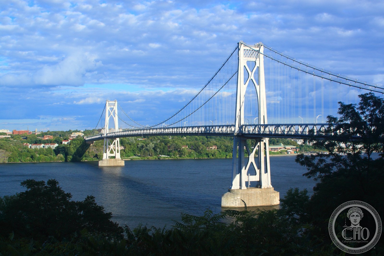
Opened in 1930 and later named for Franklin Roosevelt, this graceful suspension bridge connects Poughkeepsie to Highland across the Hudson — its Art Deco towers a quietly imposing counterpart to the grand bridges going up in New York City at the same moment.
At a glance
The Franklin Delano Roosevelt Mid-Hudson Bridge carries traffic across the Hudson River between Poughkeepsie in Dutchess County and the hamlet of Highland in Ulster County, New York. Completed in 1930 and engineered by Ralph Modjeski, the bridge’s towers are faced in smooth concrete with the restrained geometric ornament characteristic of the Art Deco period — a style deliberately distinct from the wire-cable drama favoured in Manhattan, and better suited to a rural river valley. The bridge is managed by the New York State Bridge Authority and remains a working toll crossing, its profile little changed since it first opened.
Key facts
- Official name: Franklin Delano Roosevelt Mid-Hudson Bridge (renamed for FDR in the 1990s)
- Opened: 25 August 1930
- Type: Suspension bridge
- Engineer: Ralph Modjeski
- Operator: New York State Bridge Authority
- Connects: City of Poughkeepsie (Dutchess County) to Highland (Ulster County)
- Status: National Historic Civil Engineering Landmark; active toll crossing
History
Before the Mid-Hudson Bridge opened, the only way to cross the Hudson at Poughkeepsie was by ferry or, for railway traffic, by the Poughkeepsie Railroad Bridge further north. The population growth of Dutchess and Ulster counties during the 1920s created an evident need for a permanent road crossing, and a bridge commission was formed to finance and oversee construction. Ground was broken in the mid-1920s, with Ralph Modjeski — already celebrated for bridges over the Delaware and Mississippi rivers — engaged as chief engineer.
The bridge opened on 25 August 1930 before a crowd that included Governor Franklin D. Roosevelt, then in his second year as New York’s governor and roughly two and a half years from the presidency. The connection it provided between the Hudson Valley’s agricultural hinterland and the markets of the lower Hudson proved immediate: farm traffic, summer visitors, and commuters all began crossing within weeks of opening day.
The bridge was renamed for Franklin Roosevelt in 1994, decades after his death, in recognition of the role his administration had played in building and maintaining infrastructure throughout the region. It carries US Route 44 and NY Route 55 and remains one of the most-used crossings on the mid-section of the Hudson.
What you see
The two main towers rise from the river in smooth planes of concrete, each face divided by shallow pilasters that draw the eye upward without theatrical excess. At the top, stepped setbacks and a recessed cap give the towers a quietly Art Deco silhouette — nothing as exuberant as the contemporary Hell Gate or Bayonne, but composed with an architect’s sense of proportion. The cables descend from the tower tops in clean parabolic curves to the anchorages on either shore, framing the river view between them like a stage flat.
From the pedestrian walkway — one of the few Hudson River crossings where walkers and cyclists are welcome — the valley opens in both directions: the Catskills to the west, the Shawangunks behind, and to the south the long southward bend of the river toward Newburgh. The Art Deco detailing is understated enough that most drivers experience the bridge primarily as landscape rather than architecture, which is, perhaps, precisely what Modjeski intended.
Practical information
- Access: Toll bridge; pedestrian and bicycle access on the walkway (free)
- Hours: Vehicle traffic 24 hours; pedestrian access varies — check NYS Bridge Authority
- Parking: Small lot on the Poughkeepsie side near the toll plaza
- Rail: Poughkeepsie is served by Metro-North Hudson Line from Grand Central Terminal (approximately 90 minutes); the bridge is walkable from the station
Getting there
By train, take Metro-North’s Hudson Line from Grand Central Terminal to Poughkeepsie. The bridge approach is approximately a 15-minute walk north of the station. By car, the bridge is reached via US-44/NY-55 from either shore; the Poughkeepsie toll plaza is on the east bank. The nearest major airport is Stewart International (SWF) in Newburgh, approximately 20 miles south; JFK and LaGuardia are roughly 85 miles south via the Taconic State Parkway.
Nearby
- Walkway Over the Hudson State Historic Park — converted Poughkeepsie Railroad Bridge just to the north; the world’s longest elevated pedestrian bridge
- FDR Presidential Library and Museum — Hyde Park, 10 miles north
- Vanderbilt Mansion National Historic Site — Beaux Arts estate overlooking the Hudson, Hyde Park
Sources
- New York State Bridge Authority — Mid-Hudson Bridge history, nysba.ny.gov
- American Society of Civil Engineers — National Historic Civil Engineering Landmark designation documentation
- Wikipedia — Mid-Hudson Bridge (cross-checked against NYBA and ASCE sources)
- National Register of Historic Places — nomination file, Mid-Hudson Bridge
Find it on the map
See this place and what’s around it →📷 Become a Cultural Heritage Online photographer
Share your photos of places: they stay published under your name as the author. The more they're seen, the more you get noticed — and soon a contest will reward the most appreciated photos.
Log in or sign up free to add a photoIs this page about you?
This page is read by travellers and heritage enthusiasts who find it on Google. Tell us how you are connected to this place and we will take it from there.