
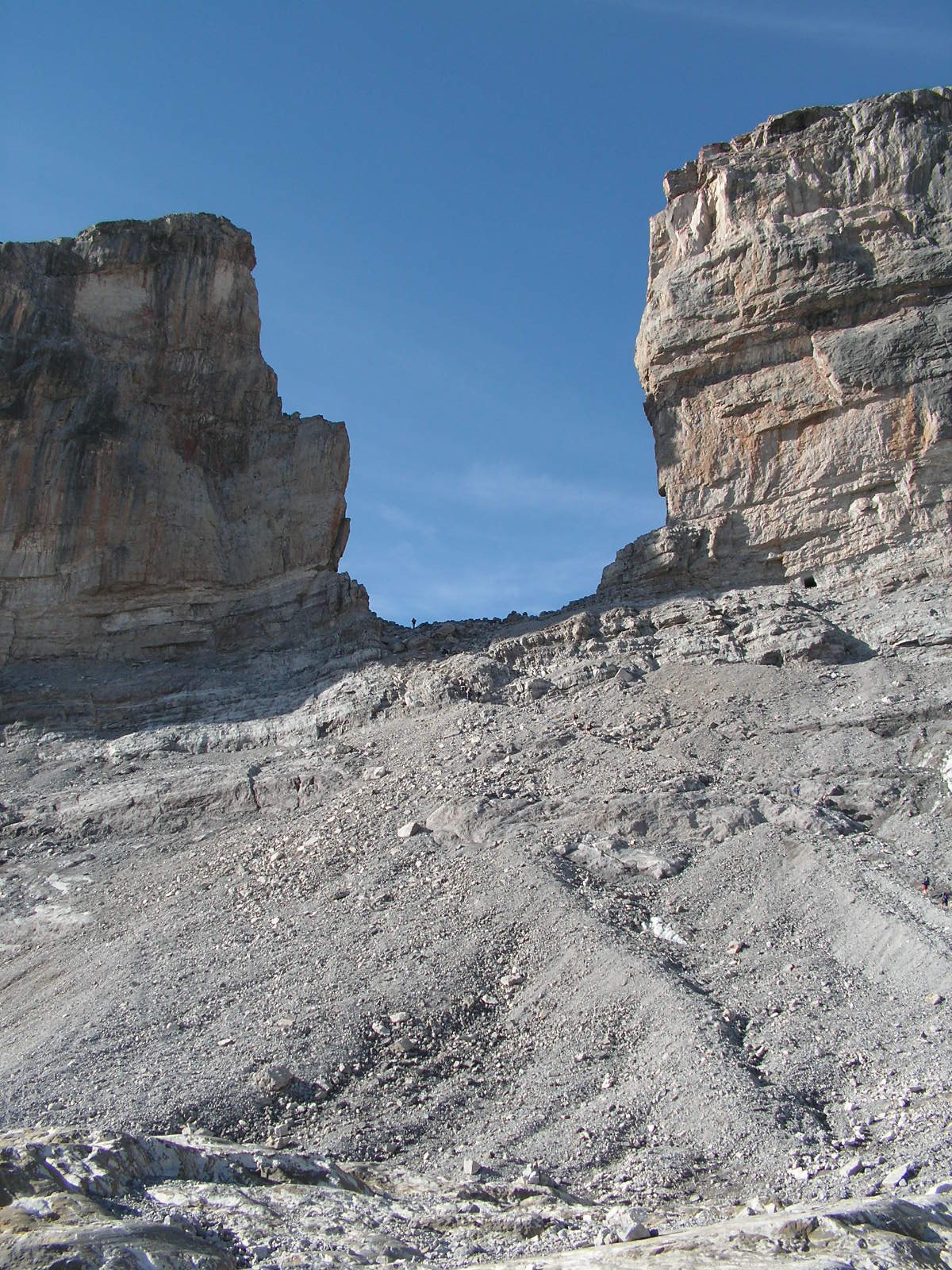
A dramatic natural gap in the Pyrenees, immortalised in medieval legend and steeped in the myth of Charlemagne’s greatest paladin.
At a glance
Roland’s Breach is a striking geological formation high in the Pyrenees—a 40-metre-wide gap rising 100 metres, situated at 2,804 metres elevation. It sits within Ordesa y Monte Perdido National Park, near the ice-carved amphitheatre of the Cirque de Gavarnie. The chasm straddles the Franco-Spanish border, accessible to determined hikers from the nearby Refugio Sarradets in roughly one hour.
History
Legend binds Roland’s Breach to Count Roland, Charlemagne’s foremost paladin, and the Battle of Roncesvalles in 778. According to one account, Roland carved the breach with his sword Durendal in a desperate attempt to destroy the blade after his defeat. A variant narrative tells of Roland fleeing Saracen pursuit northward from Salto de Roldán, some 25 kilometres south. Cornered and mounted, he leapt the chasm on horseback—his horse perished in the crossing. On foot, Roland continued to the Pyrenees and smote the mountains with Durendal to cleave the breach, so that he might glimpse France one final time before death.
The legend’s geographical origins remain uncertain; the Cirque de Gavarnie lies approximately 150 kilometres from Roncesvaux Pass, the historical setting of Roland’s death.
What you see
The breach is a clean vertical fissure in the limestone Pyrenees, dramatic and unadorned. Its scale is evident only from close approach: the 40-metre span compresses visually across distance, while the 100-metre drop commands respect. The surrounding landscape of alpine meadow and steep rock walls frames the gap within the larger Cirque de Gavarnie, one of Europe’s grandest mountain amphitheatres.
Cultural significance
Roland’s Breach represents the marriage of geological fact and medieval romance. For centuries, the Pyrenean chasm has served as the material anchor for the legend of Roland, one of Europe’s most enduring heroic narratives. The breach belongs to the broader Roland legend landscape—including sites across Spain, France and Italy—and reflects how natural wonders can crystallise cultural memory across generations and borders.
Key facts
- Width: 40 metres
- Height: 100 metres
- Elevation: 2,804 metres
- Location: Ordesa y Monte Perdido National Park, Franco-Spanish border
- Approach time from Refugio Sarradets: approximately one hour
- Coordinates: 42.69°N, 0.03°W
Practical information & getting there
You can reach Roland’s Breach from Refugio Sarradets, a mountain shelter in the national park, via a steep climb of about an hour. The site lies within Ordesa y Monte Perdido National Park, so access regulations and seasonal conditions apply. Alpine conditions and exposure demand proper equipment and experience. Check local park information before visiting.
Sources & resources
Find it on the map
See this place and what’s around it →
📷 Become a Cultural Heritage Online photographer
Share your photos of places: they stay published under your name as the author. The more they're seen, the more you get noticed — and soon a contest will reward the most appreciated photos.
Log in or sign up free to add a photo