
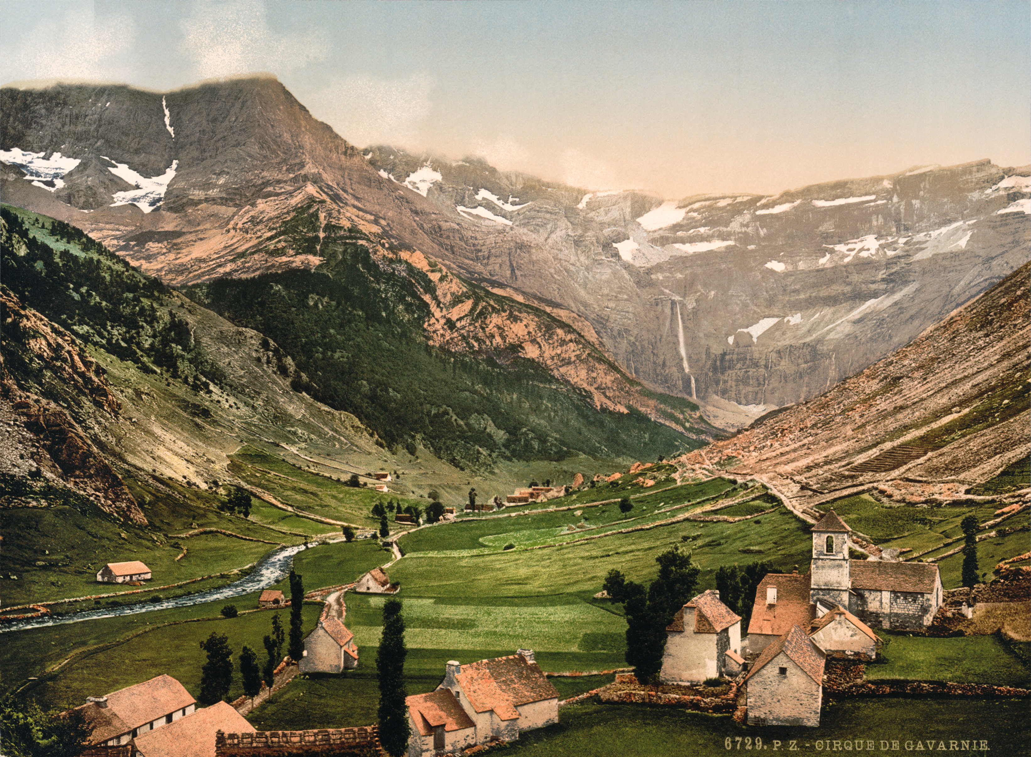
A colossal glacial amphitheatre in the central Pyrenees, where 1,500-metre rock walls embrace plunging waterfalls and legendary mountain passes.
At a glance
The Cirque de Gavarnie is a vast horseshoe-shaped basin carved into the southwestern Pyrenees by glacial erosion over millions of years. Victor Hugo famously called it “the Colosseum of nature” for its immense scale and amphitheatre-like form. Within the Pyrénées National Park and close to the Spanish border, it combines dramatic geology with rare alpine wildlife and legendary landscape features.
History
The cirque was sculpted by repeated cycles of glacial scraping during the Quaternary period, creating its uniquely enormous size. The mountainous rim includes La Brèche de Roland, a 2,800-metre pass. According to legend, its sheer walls were cut by the sword of Roland, the nephew of Charlemagne—a tale rooted in medieval romance rather than geology. The site gained international recognition when it was inscribed on the UNESCO World Heritage List in 1997 as part of the Pyrénées – Mont Perdu World Heritage Site.
What you see
The cirque measures 800 metres wide at its deepest point and approximately 3,000 metres at the rim, with rock walls rising up to 1,500 metres above the basin floor. Gavarnie Falls, the second-highest waterfall in Europe, cascades 422 metres in a series of steps during spring, summer and autumn melt seasons. The rim is studded with passes and clefts; La Brèche de Roland stands at 2,800 metres, its dramatic notch visible from the basin floor.
Cultural significance
The Cirque epitomises the sublime power of glaciated mountain landscape. Its monumental form inspired Romantic-era writers and remains central to understanding the Pyrenees’ geological heritage. The site bridges French and Spanish conservation efforts, protecting rare alpine ecosystems on both sides of the border.
Key facts
- Location: Commune of Gavarnie, Hautes-Pyrénées, France
- Coordinates: 42.697°N, 0.008°W
- Largest feature: Gavarnie Falls, 422 metres high
- Rim height: up to 1,500 metres above basin
- UNESCO World Heritage Site (1997, as part of Pyrénées – Mont Perdu)
- Protected within Pyrénées National Park
Practical information & getting there
The cirque is accessible year-round via the village of Gavarnie, though waterfalls are most dramatic in spring and early summer. The site lies within a national park; visit the official Pyrénées National Park website for current access, guided-tour options and seasonal conditions. Nearby towns include Luz-Saint-Sauveur and Cauterets.
Sources & resources
Find it on the map
See this place and what’s around it →📷 Become a Cultural Heritage Online photographer
Share your photos of places: they stay published under your name as the author. The more they're seen, the more you get noticed — and soon a contest will reward the most appreciated photos.
Log in or sign up free to add a photo