
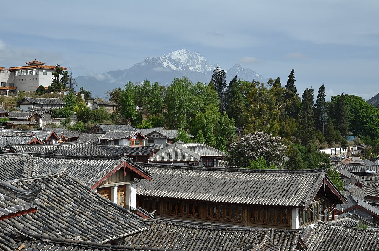
The nearest World Heritage site to the Old Town of Lijiang is Three Parallel Rivers of Yunnan, 207 km away in a straight line, followed by the Chengjiang Fossil Site (368 km) and South China Karst (381 km), all in China. Lijiang itself is a trading town on a plateau at 2,400 metres in Yunnan, inscribed in 1997 under criteria (ii), (iv) and (v).
The World Heritage sites within reach of Lijiang
The distances below are straight lines between the reference points that UNESCO publishes for each property, measured to the nearest component of a serial site. They show what is close, not how long the road takes, which in the mountains of Yunnan and Sichuan can be very different.
| Site | Country | Distance | Inscribed | Type |
|---|---|---|---|---|
| Three Parallel Rivers of Yunnan Protected Areas | China | 207 km | 2003 | Natural |
| Chengjiang Fossil Site | China | 368 km | 2012 | Natural |
| South China Karst | China | 381 km | 2007 | Natural |
| Mount Emei Scenic Area, including Leshan Giant Buddha Scenic Area | China | 421 km | 1996 | Mixed |
| Cultural Landscape of Honghe Hani Rice Terraces | China | 492 km | 2013 | Cultural |
| Sichuan Giant Panda Sanctuaries | China | 509 km | 2006 | Natural |
Lijiang is the only property in the table inscribed purely as a town. Its neighbours are mostly mountains and rivers, and that is the link: UNESCO says the rivers and springs that water the Lijiang plain rise on Yulong Snow Mountain to the north-west, while Three Parallel Rivers protects the upper Yangtze, Mekong and Salween, running through gorges up to 3,000 metres deep. The one cultural landscape among the neighbours is Honghe, where, UNESCO says, the Hani have spent 1,300 years building channels that bring water from forested mountaintops to their terraces: another Yunnan community shaped by water.
What are the three parts of the Old Town, and who ruled them?
The property has three component parts. Dayan Old Town, with the Black Dragon Pond, was established in the Ming dynasty as a commercial centre. Baisha, 8 km to the north, is older, from the Song and Yuan dynasties, and its religious complex holds over 40 paintings dating from the early 13th century that show Buddhist and Taoist subjects and the life of the Naxi people. Shuhe lies 4 km north-west of Dayan.
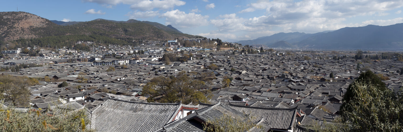
Trade made the town. UNESCO writes that from the 12th century Lijiang was a goods distribution centre between Sichuan, Yunnan and Tibet, where the southern Silk Road meets the Ancient Chama (Tea and Horse) Roads. Political power sat with the Mu family. According to the ICOMOS evaluation of 1997, their ancestors moved their main centre from Baisha to the foot of the Shizi Mountains in the 13th century, the prefecture was established under Ming rule in 1382, and the Mu were made hereditary prefects, a title the Qing confirmed in 1660. In 1723 the court replaced the native prefect with an imperial appointee.
How does water reach every street in Lijiang?
ICOMOS describes the system as starting at the Black Dragon Pool, which is fed by springs on the mountainside. Water flows to a bridge where it branches into three tributaries, the Eastern, Central and Western Rivers, which divide into channels and culverts to supply every house. The evaluation counts 354 bridges, of several kinds, and says the town takes its name “City of Bridges” from them. Beside the Kegong archway on Sifang street, a sluice uses the difference in level between two waterways to wash the streets, which ICOMOS calls a unique form of municipal sanitation.
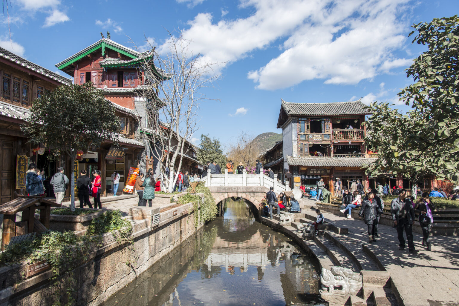
UNESCO notes that the pool, wells and springs together meet the needs of fire prevention, daily life and production, and that the time-honoured water-supply system still works today. UNESCO adds that the main street and small alleys front onto the canals, with numerous bridges built across them, so water plays an important role in the town’s architecture, layout and landscape.
Why do Lijiang’s timber houses suit an earthquake region?
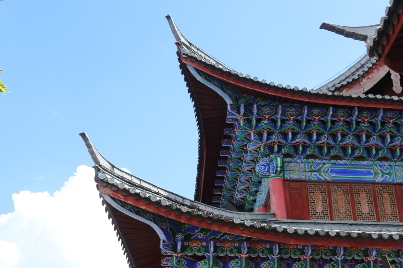
ICOMOS records earthquakes at Lijiang in 1481, 1515, 1624, 1751, 1895, 1933, 1951, 1961, 1977 and, most recently, on 3 February 1996. The traditional answer is in the carpentry: the evaluation says the wooden frames are built to be flexible and that the upright timbers lean slightly inwards for stability. UNESCO’s text on authenticity states that the town kept the overall layout, urban form and architectural style of the Ming and Qing dynasties in spite of numerous earthquakes, including the 1996 one. ICOMOS adds that the historic townscape was preserved through a policy of rebuilding in traditional style with traditional materials.
One historical point is worth holding up against the popular story. The nomination dossier says Lijiang has neither a regular street pattern nor city walls. Yet the ICOMOS history says the Mu, on moving to Dayan in the 13th century, began building houses surrounded by a city wall and moat. The absence of walls describes the Old Town as inscribed, not every century of its past. ICOMOS has also noted that the three components are vulnerable to severe development pressures.
What the Naxi wrote, and where it is kept
The town is the centre of Naxi culture, and the writing that culture produced has a listing of its own. UNESCO entered the Ancient Naxi Dongba Literature Manuscripts in its Memory of the World register in 2003, on a submission from China; the collection is held by the Lijiang Prefecture Administration in Yunnan. The name comes from the priests of the Dongba religion, and the pictographic characters are what make the collection unusual. The register entry calls it a heritage rare and hard to reproduce.
Frequently Asked Questions
Which UNESCO World Heritage sites are near Lijiang?
Three Parallel Rivers of Yunnan is the nearest, 207 km away in a straight line, then the Chengjiang Fossil Site (368 km), South China Karst (381 km), Mount Emei and Leshan Giant Buddha (421 km), the Honghe Hani Rice Terraces (492 km) and the Sichuan Giant Panda Sanctuaries (509 km).
Does the Old Town of Lijiang have city walls?
The nomination dossier describes a town with neither a regular street pattern nor city walls. The ICOMOS history, however, says the Mu family began building houses surrounded by a city wall and moat when they moved to Dayan in the 13th century. The walls are not a feature of the town UNESCO inscribed.
What are the three parts of the Old Town of Lijiang?
Dayan Old Town with the Black Dragon Pond, the Baisha housing cluster 8 km to the north, and the Shuhe housing cluster 4 km north-west of Dayan. Dayan was founded in the Ming dynasty as a commercial centre, while Baisha dates from the earlier Song and Yuan periods, according to UNESCO.
When was the Old Town of Lijiang inscribed, and why?
In 1997, under criteria (ii), (iv) and (v). UNESCO cites trade between Sichuan, Yunnan and Tibet, a settlement combining Naxi, Han, Bai and Tibetan traditions, and a human habitat in which mountains, water and buildings form a unity.
Sources
- UNESCO Memory of the World — Ancient Naxi Dongba Literature Manuscripts (registered 2003). https://www.unesco.org/en/memory-world/ancient-naxi-dongba-literature-manuscripts
- UNESCO World Heritage Centre, Old Town of Lijiang (inscribed 1997). https://whc.unesco.org/en/list/811/
- ICOMOS, Advisory Body Evaluation of the nomination of Lijiang (No 811), September 1997. https://whc.unesco.org/document/154336
- ICOMOS, evaluation of the boundary modification for the Old Town of Lijiang, 2012. https://whc.unesco.org/document/154340
- UNESCO World Heritage Centre, Three Parallel Rivers of Yunnan Protected Areas (2003). https://whc.unesco.org/en/list/1083/
- UNESCO World Heritage Centre, Cultural Landscape of Honghe Hani Rice Terraces (2013). https://whc.unesco.org/en/list/1111/
- UNESCO World Heritage Centre, Chengjiang Fossil Site, South China Karst, Mount Emei and Sichuan Giant Panda Sanctuaries. https://whc.unesco.org/en/list/
Spotted an error? Write to [email protected] and we correct it the same day.