
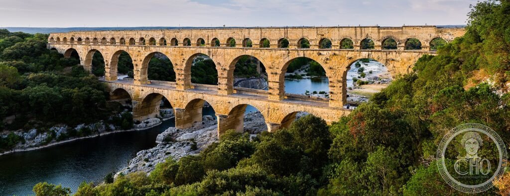
Tre file di arcate, una sopra l’altra, scavalcano la gola del Gardon: il Pont du Gard portava l’acqua a Nîmes lungo un acquedotto di cinquanta chilometri. Costruito senza malta, con blocchi che pesano fino a sei tonnellate, è il ponte-acquedotto romano più alto rimasto al mondo.
At a glance
The Pont du Gard is the most spectacular surviving section of a Roman aqueduct, built in the 1st century AD to carry water some 50 km from a spring near Uzès to the Roman city of Nîmes (Nemausus). Spanning the gorge of the Gardon in three tiers of arches, it rises about 49 m, the highest of all Roman aqueduct bridges. Its great blocks of golden limestone were laid largely without mortar. A masterpiece of engineering and proportion, it was inscribed by UNESCO in 1985.
Key facts
- UNESCO: World Heritage since 1985
- Built: 1st century AD, under Roman rule
- Purpose: part of a roughly 50 km aqueduct supplying Nîmes (Nemausus)
- Height: about 49 m — the tallest surviving Roman aqueduct bridge
- Three tiers: arches in three superimposed rows; the top carried the water channel
- Construction: golden limestone blocks, some up to 6 tonnes, set largely without mortar
History
The aqueduct was built to bring fresh water to Nîmes, one of the most prosperous cities of Roman Gaul. Over its 50 km course the channel fell only a few metres in total, a remarkable feat of surveying; where it had to cross the Gardon valley, Roman engineers raised the three-tiered bridge that is the Pont du Gard. It carried water for several centuries before silting and the decline of Rome put it out of use.
In the Middle Ages the lowest tier was adapted as a road bridge, which helped preserve the structure. Admired by travellers and engineers from the Renaissance on, it was consolidated in the 19th century and is today set within a protected natural site.
What you see
The three rows of arches step up the valley sides, the largest spanning the river itself. Close up, the precision of the dry-laid masonry is striking, with projecting stones once used to support the timber scaffolding. The water channel along the top can be glimpsed, lined to keep it watertight.
The surrounding garrigue landscape of scrub and stone, with the Gardon flowing below, completes the Roman engineer’s setting.
Practical information
- Entry: the site and museum charge a combined admission, mostly for parking and exhibits
- Museum: explains the aqueduct’s construction and the water supply of Nîmes
- Time needed: 1.5–2 hours; longer to walk the trails or swim in the river
- Note: the lower bridge deck is walkable; upper levels by guided tour only
Getting there
The Pont du Gard stands near Vers-Pont-du-Gard in the Gard department, between Nîmes and Avignon. It is most easily reached by car or by seasonal bus from Nîmes or Avignon. GPS: 43.9476° N, 4.5350° E.
Nearby
- Nîmes — Roman amphitheatre and the Maison Carrée temple, about 25 km south
- Uzès — a fine old town near the aqueduct’s spring source
- Avignon — the papal city, about 25 km east
Sources
- UNESCO World Heritage Centre — “Pont du Gard (Roman Aqueduct)” (ref. 344)
- Site du Pont du Gard — official Établissement public de coopération culturelle
- Encyclopaedia Britannica — Pont du Gard
Find it on the map
See this place and what’s around it →📷 Become a Cultural Heritage Online photographer
Share your photos of places: they stay published under your name as the author. The more they're seen, the more you get noticed — and soon a contest will reward the most appreciated photos.
Log in or sign up free to add a photoIs this page about you?
This page is read by travellers and heritage enthusiasts who find it on Google. Tell us how you are connected to this place and we will take it from there.