
Costiera Amalfitana — Amalfi, Positano, Ravello
A 50 km limestone coast between Sorrento and Salerno where cliff villages, terraced lemon groves, paper mills, and the ruins of the medieval Republic of Amalfi coexist on one of the most vertical landscapes in the Mediterranean.
At a glance
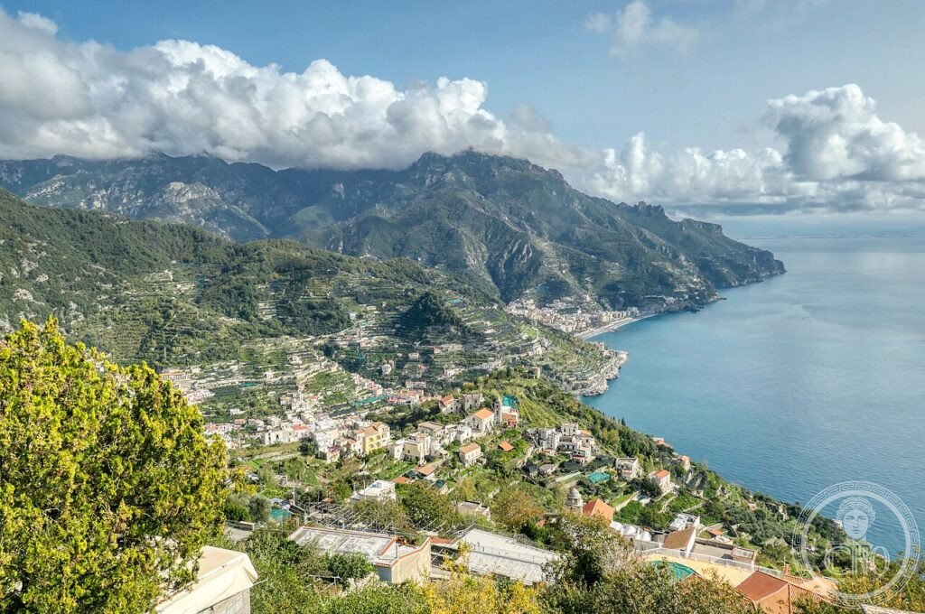
The Costiera Amalfitana runs along the southern edge of the Sorrentine Peninsula, its coastal road (SS163, completed 1852) cut into cliffs that rise 1,000 metres in 2 km from the sea. The UNESCO inscription of 1997 under criterion v recognised the landscape as an “outstanding example of a Mediterranean landscape” where human settlement, agriculture (terrace cultivation of lemons, vines, and olives), and maritime culture have shaped the terrain over 1,500 years. The Republic of Amalfi was the first maritime republic to rise in medieval Italy (839 CE); the Amalfi Tables (Tavole Amalfitane), the oldest maritime law code in Europe, were written here in the 11th century. The coast includes four main towns — Amalfi, Positano, Ravello, and Praiano — plus a dozen smaller settlements.
Key facts
- Amalfi: seat of the medieval maritime republic (839–1073 CE); Duomo di Sant'Andrea (9th century, façade 1891), Chiostro del Paradiso (1266)
- Positano: multi-coloured houses stacked on a vertical cliff above the beach; Church of Santa Maria Assunta with Byzantine icon
- Ravello: 350 m above the coast; Villa Rufolo (1270, Arab-Norman palace) and Villa Cimbrone (1904 terraced garden, “Belvedere dell'Infinito”)
- Carta di Amalfi: artisanal paper made since the 13th century from cotton rags, still produced in the Valle dei Mulini
- Landscape: 50 km coast; 4 towns; terraced lemon groves (Sfusato Amalfitano IGP); cliffs 300–1,443 m
- UNESCO inscription: 1997, criterion v
- Coordinates: 40.6340° N, 14.6027° E — Google Maps
History
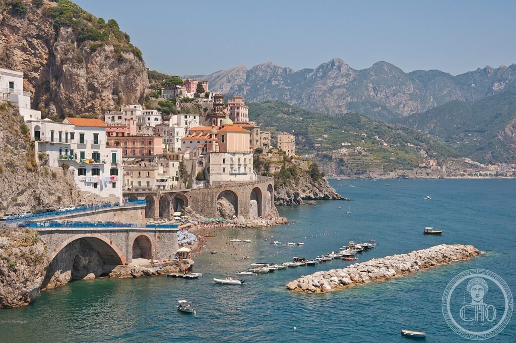
Amalfi's maritime republic emerged in 839 CE when the town declared independence from the Duchy of Naples. By the 10th century it controlled trade routes between Constantinople, the Levant, and North Africa, introducing the compass to European navigation and the first public currency in southern Italy. The Tavole Amalfitane, a comprehensive maritime code assembled between the 11th and 13th centuries, regulated merchant shipping across the Mediterranean for five centuries. The Normans sacked Amalfi in 1131 and 1137, ending its independence; the town was absorbed into the Norman Kingdom of Sicily. The coast's relative inaccessibility — the coastal road didn't exist until 1852 — preserved its medieval settlement pattern intact through the early modern period.
Ravello became a cultural centre in the 11th and 12th centuries under the wealthy Rufolo and Frumentario merchant families. Villa Rufolo, built c. 1270 for Nicola Rufolo, combined Arab, Norman, and Byzantine architectural elements in a series of terraced courts above the sea; Richard Wagner visited in 1880 and declared the garden the setting for the Klingsor's Garden scene in Parsifal. The annual Ravello Festival (established 1953) stages concerts in the Villa Rufolo garden. Villa Cimbrone (1904, Lord Ernest William Beckett) added a formal Italian garden culminating in the “Belvedere dell'Infinito,” a terrace lined with busts overlooking the full curve of the Gulf of Salerno.
What you see
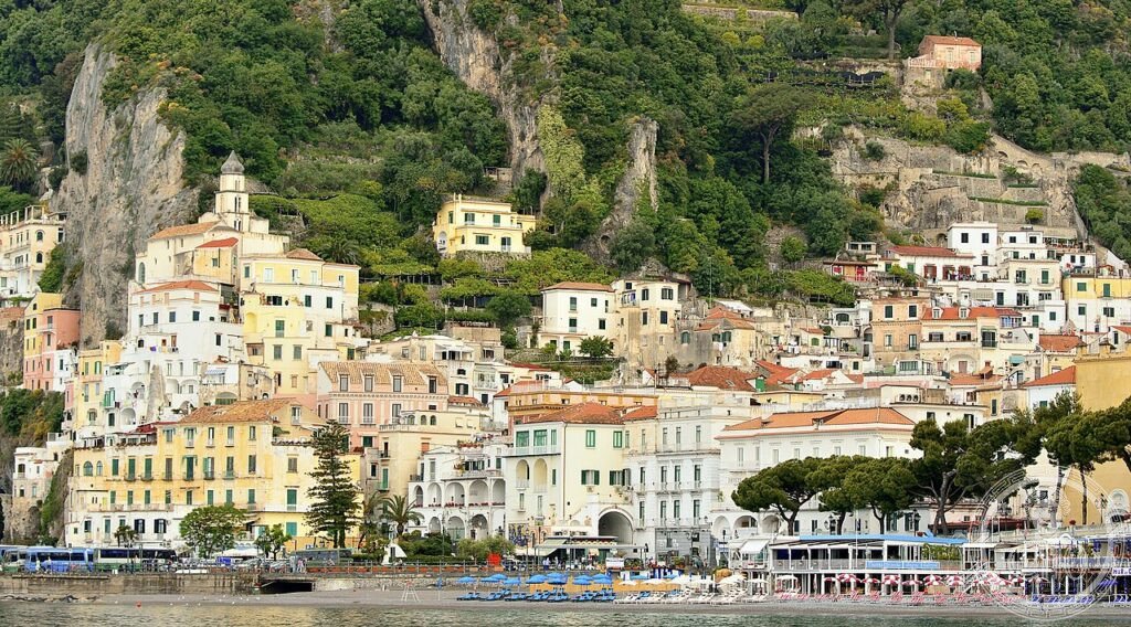
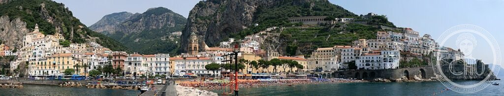
The Duomo of Amalfi (Cathedral of Sant'Andrea, begun 9th century, façade reconstructed 1891) opens onto a broad staircase that descends into Piazza del Duomo, the civic heart of the former republic. The Chiostro del Paradiso (1266), an Arab-Norman cloister attached to the south side of the cathedral, presents interlacing pointed arches in white marble against a garden that holds Roman sarcophagi; the effect is of a space that belongs simultaneously to Islamic and Christian architectural traditions. Under the cathedral crypt, the relics of Saint Andrew (acquired from Constantinople in 1206) are kept in a silver-and-gold reliquary of the 14th century.
Positano's settlement pattern is the most extreme on the coast: houses are stacked in direct vertical succession on a cliff face, each building's roof serving as the terrace of the house above it. There are no streets wide enough for cars in the upper town; the only connection between levels is a succession of stairways that descend to the beach through lemon trees and bougainvillea. The Church of Santa Maria Assunta (baroque façade, 1700; mosaic dome) holds a 13th-century Byzantine icon brought from Constantinople, the dark-faced Madonna that gave the town its medieval significance as a pilgrimage destination.
Practical information
- Getting around: Ferry between coastal towns is faster and more pleasant than the SS163 road (frequent daily service April–October)
- Driving: SS163 is single-lane with passing bays; avoid July–August when traffic backs up for hours; park at Amalfi bus terminal and walk or take ferries
- Best months: April–June and September–October for fewer crowds and cooler temperatures
- Ravello: 45 min by bus from Amalfi; Ravello Festival June–September, book far in advance
- Paths: Sentiero degli Dei (“Path of the Gods”): 7 km ridge walk from Agerola to Nocelle above Positano; 2–3 hours, moderate difficulty
Getting there
No railway serves the Amalfi Coast directly. From Naples: SITA buses from Piazza Garibaldi to Amalfi (2 hours), or ferry from Molo Beverello (summer only, 1h 30m). From Salerno: SITA bus to Amalfi (1h 15m), or ferry (45 min). Naples Airport (NAP) is the nearest international hub (80 km). Circumvesuviana train from Naples to Sorrento, then bus or ferry along the coast.
Nearby
- Eremo di Santa Rosa, Conca dei Marini: 11th-century clifftop monastery, birthplace of the sfogliatella pastry
- Grotta dello Smeraldo: 4 km from Amalfi — sea cave with emerald-green water reachable by boat
- Paestum: 60 km southeast — three Doric Greek temples (6th–5th century BCE), the best-preserved in Europe
- Pompei: 30 km northeast — Roman city buried by Vesuvius in 79 CE; UNESCO 1997
Gallery
Sources
- UNESCO World Heritage List — Costiera Amalfitana, rif. 830, inscribed 1997
- Comune di Amalfi — amalfi.it
- Ravello Festival — ravellofestival.com
- Wikimedia Commons — CC BY-SA images of Amalfi Coast
Find it on the map
See this place and what’s around it →📷 Diventa un fotografo di Cultural Heritage Online
Condividi le tue foto dei luoghi: restano pubblicate con la tua firma come autore. Più vengono viste, più ti fai conoscere — e presto un concorso premierà le foto più apprezzate.
Accedi o registrati gratis per aggiungere una foto