Val d’Orcia
The Val d’Orcia (UNESCO 2004) is the most reproduced landscape in Tuscan art history — the pale clay hills with cypress windbreaks and medieval hilltop farmhouses that the Sienese painters of the 14th century (Simone Martini, Ambrogio Lorenzetti, Duccio) depicted as the ideal background landscape in their altarpieces, and whose deliberate agricultural transformation by the Piccolomini and other Sienese families from the 15th century onward produced the specific visual pattern of terraced fields, cypress lines, and isolated hilltop towers that the world now recognizes as “Tuscany.”
At a glance
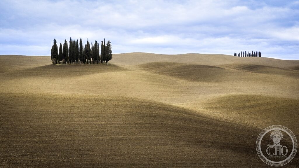
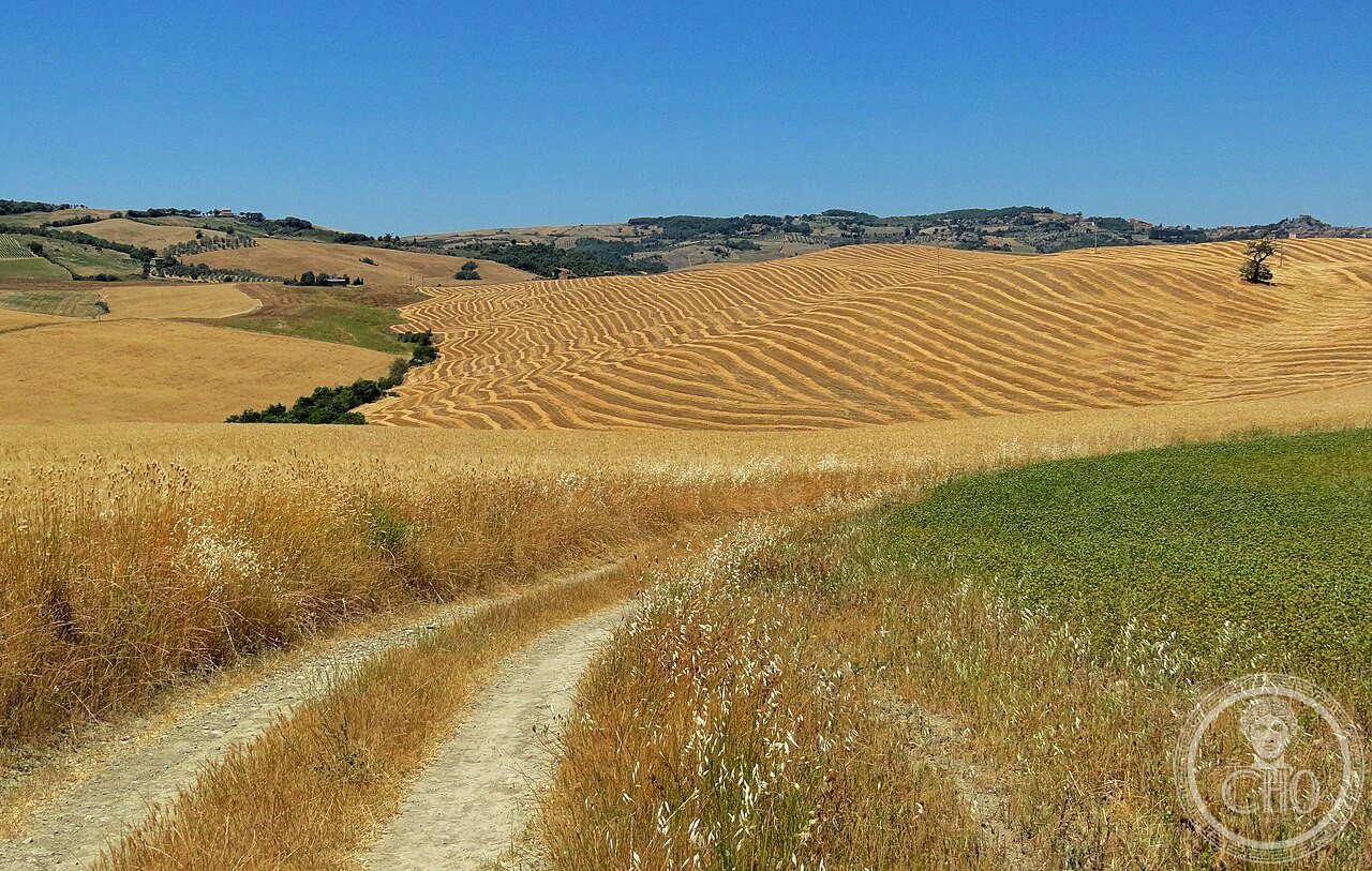
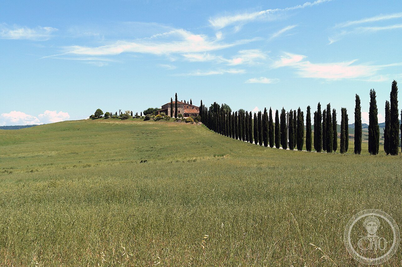
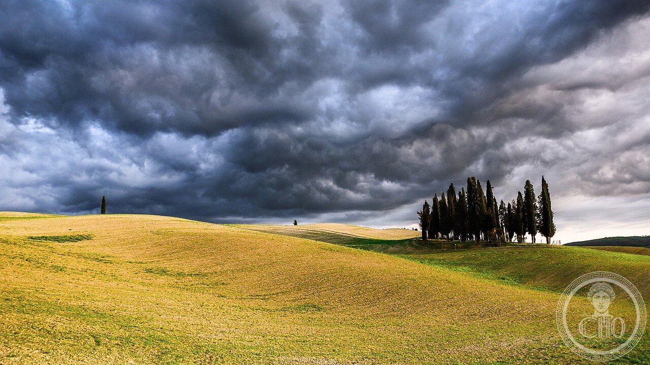
Val d’Orcia (the most precisely ValDOrcia zone Siena Toscana Italy 42.9500 N 11.6500 E UNESCO WHS 2004 reference 1026: the valley context: the Orcia river rises in the Monte Amiata (1738m; the largest extinct volcano in central Italy) and flows northeast for 60 km to join the Ombrone river near Buonconvento; the valley bottom is the least settled part (the river floodplain is seasonally flooded and was historically malaria-prone); the settlement pattern is on the hilltops (altitudes 400–600m above sea level; the towns of Pienza (490m), Montalcino (567m), San Quirico d’Orcia (424m), Castiglione d’Orcia (540m)); the geological formation (the crete senesi: the Pliocene marine sediments (grey clay and sand deposited 5–2 million years ago when the Orcia valley was a shallow sea arm of the Tyrrhenian) create the characteristic light-colored rolling terrain without vegetation (the clay is too alkaline for most spontaneous vegetation other than grass); the human imprint on the landscape (the specific elements that make the Val d’Orcia UNESCO landscape: (1) the cypress windbreak lines (Italian cypress; Cupressus sempervirens; planted 15th–17th century CE; the typical pattern is 10–20 trees in a straight line following a farm track or field boundary; the trees were planted as windbreaks but their visual dominance in the landscape is the primary UNESCO criterion); (2) the poderi (individual farmhouses on hilltops; typical plan: central farmhouse + attached barn + stone-walled garden + 15–30 ha agricultural land; the mezzadria (sharecropping) system that organized this landscape from the 14th century CE); (3) the medieval towns on the ridges (Pienza, Montalcino, San Quirico, Castiglione, Radicofani); (4) the via Francigena (the medieval pilgrimage road from Canterbury to Rome (Sigeric the Serious’s 990 CE route; still walkable; the Val d’Orcia section from San Quirico d’Orcia to Radicofani is the most dramatically scenic day’s walk in central Italy))).
Key facts
- Pienza (built 1459–1464 CE) and why Enea Silvio Piccolomini (Pope Pius II) rebuilt his birthplace as the ideal Renaissance city in a single building campaign: Pienza (the original village Corsignano; renamed Pienza (the city of Pius) in 1462 CE by papal decree); Enea Silvio Piccolomini (1405–1464 CE; born in Corsignano; cardinal and humanist scholar (the author of “Historia de duabus amantibus” (1444 CE) — the most widely read Latin prose romance of the 15th century, a genre hybrid between Boccaccio and Petrarch); Pope from 1458 CE as Pius II); the building campaign: in 1459 CE Pius II commissioned the Florentine architect Bernardo Rossellino (1409–1464 CE; the architect of the facade of Santa Croce in Florence) to transform Corsignano into a model Renaissance city; Rossellino had worked for Pope Nicholas V in Rome (1452–1455 CE) and had designed a master plan for the Vatican area for Nicholas V that was never built; the Pienza commission was the opportunity to realize a Renaissance ideal city in miniature; the specific design (the Piazza Pio II: the central piazza designed with 4 different buildings on 4 sides (the Cathedral (south), the Palazzo Piccolomini (west), the Palazzo Vescovile (north), the Palazzo Comunale (east)) — a deliberate architectural composition where no 2 facades are identical but all 4 are aligned to produce a unified civic space; the Cathedral facade is the most sophisticated element: it is deliberately perspective-skewed (the columns are wider at the front than at the back) to increase the visual depth from the piazza); the specific problem with the Cathedral (the Cathedral began to crack almost immediately after completion (1462 CE) because the choir end was built on a steep hillside with insufficient foundation; the cracks have been repaired repeatedly but the structural instability (visible as diagonal cracks in the south transept) is the result of the original foundation failure — a technical error by Rossellino that Pius II specifically complained about in his memoirs (“Commentarii”))
- GPS (Pienza): 43.0740° N, 11.6780° E | Val d’Orcia center: 42.9500° N, 11.6500° E
History
From the Sienese Republic to the Piccolomini to Brunello di Montalcino to 2004 UNESCO (the most precisely ValDOrcia zone medieval and early modern history: the Sienese Republic (the Val d’Orcia was the southern territory of the Sienese Republic from the 12th to 16th century CE; the specific infrastructure of the Sienese in the Val d’Orcia: the ospitali (wayfarers’ hospitals on the via Francigena); the bridges (the Ponte d’Arbia at Buonconvento; the Ponte Rotto near San Quirico); the tower-farms (the Sienese noble families built fortified farms (case-forti) in the landscape — the most important surviving is the Bagno Vignoni thermal complex (the hamlet of Bagno Vignoni (population 50); the central piazza is a travertine-lined thermal pool (36°C; fed by the same geological system as the Terme di San Filippo; the pool was used in the medieval period as a wayfarers’ bath on the via Francigena; the pool was restored and made accessible to the public in 2002 CE))); the Piccolomini family (the most important local noble family; the Piccolomini gave the church Pope Pius II (Enea Silvio Piccolomini, see above) and Pope Pius III (his nephew; reigned 26 days in 1503 CE — the shortest pontificate in 15th-century history)); Montalcino (the wine capital of the Val d’Orcia; the Brunello di Montalcino DOCG (the most expensive Italian wine by denomination average; the Sangiovese Grosso grape (locally called Brunello) produces a wine that requires 5 years’ minimum ageing (at least 2 years in oak) before release; the specific pioneer: Ferruccio Biondi Santi (1848–1917 CE) who selected the Brunello clone from the Montalcino Sangiovese population and made the first Brunello Riserva in 1888 CE (the bottle is in the Biondi Santi estate museum; il Greppo, Montalcino)); 2004 CE UNESCO inscription reference 1026.
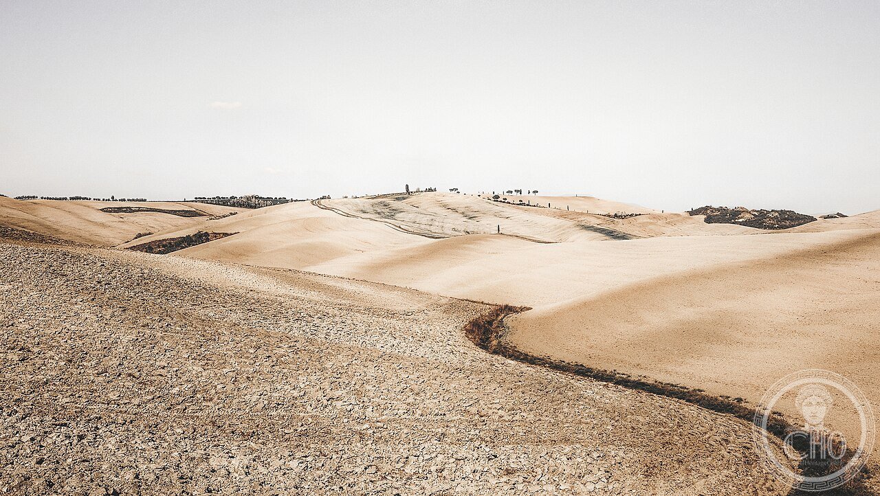
What you see
Pienza cathedral, Montalcino fortress, Bagno Vignoni thermal pool, and the via Francigena (the most precisely ValDOrcia zone visit (2 days minimum; ideally 3–4 days with agriturismo base)): the viewing points for the landscape (the specific locations for the classic “Val d’Orcia” landscape photographs): (1) the road from San Quirico d’Orcia to Pienza (the SP146; the specific stretch between km 7 and km 9 from San Quirico; the row of cypress trees on the left side of the road with the rolling white clay hills behind; this is the most reproduced single landscape composition in Tuscany (it is the view reproduced on 80% of all “Tuscany” stock photography and countless computer desktop images)); (2) the Montalcino panoramic viewpoint (the Fortezza di Montalcino terrace; the 360° panorama from the fortress includes Monte Amiata (south), Siena (north), and the entire Val d’Orcia (east); admission €5 for the fortress + wine tasting in the enoteca inside the fortress walls)); (3) the Bagno Vignoni pool (the medieval thermal pool in the hamlet center (45m × 29m; 1.2m deep; 36°C; free to view but not to bathe (bathing in the historic pool has been prohibited since 1975 CE; the bathing pools are 200m south at the Posta Marcucci hotel)); the town circuit: Pienza (45 min to 1.5 hours; the Piazza Pio II + Cathedral + Palazzo Piccolomini (€7; the only Piccolomini palace interior open to the public; the loggia with the Val d’Orcia view is the primary attraction; the specific view Pius II had from his study: the geometric garden in the foreground and the Orcia valley below)); Montalcino (2 hours; the Fortezza + the enoteca + the Brunello wine producers (the Consorzio del Brunello on Piazza Cavour can direct visitors to the smallest estates that receive visitors without appointment)).
Practical information
- Getting to and around the Val d’Orcia without a car and staying at an agriturismo: without a car (the challenge: the Val d’Orcia is designed for agricultural use, not tourist access — the iconic landscape viewpoints are on secondary roads with no bus service; the only public transport is: the Siena–Pienza–Montepulciano bus (TiemmeSpa line 112; 3 times/day; Siena bus station to Pienza 55 min; €4.50); the Siena–Montalcino bus (TiemmeSpa line 115; 4 times/day; 1h10min; €5.50); the bike option (Pienza to Montalcino via the via Francigena (17 km by road, 22 km by the via Francigena path; gradient: mostly rolling terrain with 3 significant climbs; suitable for moderate cyclists on a touring bike; the specific route: Pienza → Bagno Vignoni (8 km) → Castiglione d’Orcia (3 km) → Montalcino (11 km up a significant hill — 300m climb in 4 km; the ascent to Montalcino is the hardest section)); the agriturismo option (the most practical way to experience the Val d’Orcia is to stay at an agriturismo in the landscape itself; price range €80–250 per night for 2 persons; most agriturismo include breakfast and some offer dinner (half-board); the specific season: spring (April–June) for wildflowers and green fields; September–October for harvest (vendemmia and olive harvest); the summer (July–August) is visually less interesting (the fields are golden from the harvest))
Getting there
Best by car from Siena (50 km, 45 min) or Florence (150 km, 1h45). By bus: Siena→Pienza (TiemmeSpa line 112, 3x/day, 55 min, €4.50) or Siena→Montalcino (line 115, 4x/day, 1h10, €5.50). GPS center: 42.9500, 11.6500.
Nearby
- Siena — 50 km north (UNESCO WHS 1995 (ref 717); the Piazza del Campo + Palazzo Pubblico (Ambrogio Lorenzetti’s Allegory of Good and Bad Government (1338 CE) + the Torre del Mangia (the tallest medieval tower in Italy open to the public); the Palio (July 2 and August 16; the most intense horse race in Europe)
- Montepulciano — 30 km east (outside the UNESCO boundary; the Vino Nobile di Montepulciano DOCG; the most complete late-Renaissance hill town in Tuscany; Sangallo the Elder and Antonio da Sangallo the Younger buildings on the Corso)
Gallery
Sources
- Wikipedia, Val d’Orcia; Pienza; Brunello di Montalcino; Bagno Vignoni; Via Francigena, accessed June 2026
- UNESCO, Val d’Orcia, WHS reference 1026, inscribed 2004
- Piccolomini, Enea Silvio (Pius II). Commentarii (c.1462 CE; modern edition: Washington DC, Dumbarton Oaks, 2003)
Find it on the map
See this place and what’s around it →📷 Diventa un fotografo di Cultural Heritage Online
Condividi le tue foto dei luoghi: restano pubblicate con la tua firma come autore. Più vengono viste, più ti fai conoscere — e presto un concorso premierà le foto più apprezzate.
Accedi o registrati gratis per aggiungere una foto