
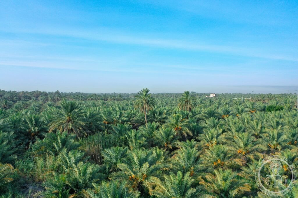
The largest natural oasis on Earth spreads across the al-Hasa plain, its three million date palms fed by natural springs and a network of underground channels that has irrigated the land continuously for thousands of years, sustaining a farming landscape unlike any other in the Gulf.
At a glance
Al-Ahsa Oasis covers a vast stretch of cultivated land around Al-Hofuf in Saudi Arabia’s Eastern Province, watered by some 270 natural artesian springs drawing on an aquifer recharged far away in the central Arabian highlands. The oasis has been farmed since the Neolithic period, and its palm gardens, walled estates and irrigation channels, known locally as falaj, still function much as they always have.
The oasis sits directly above the Ghawar oil field, among the most productive in history, so the world’s largest natural oasis and one of the world’s largest petroleum reserves occupy the same patch of ground, one below the other.
Key facts
- Scale: around 85,000 hectares of cultivated oasis, supported by roughly 270 natural springs and some three million date palms across 400 named local cultivars.
- Qasr Ibrahim: an Ottoman governor’s fortress and palace built in the mid-16th century, with a mosque added shortly after; it later served the Al-Rashid dynasty and then the Al-Saud from 1913, and is now open as a museum.
- Al-Qaisariya market: a 19th-century covered market in Al-Hofuf, the largest traditional covered market still trading on the Arabian Peninsula, with dedicated sections for gold, textiles, pottery and dates.
- UNESCO status: inscribed as a World Heritage Site in 2018 under the title Al-Ahsa Oasis, an Evolving Cultural Landscape.
- Location: 25.3500° N, 49.5800° E.
History
Al-Ahsa was known in antiquity as Hajar, recorded in Assyrian texts as Hagar or Hagara, the principal inland city of the eastern Arabian coast. The region formed part of the Dilmun trade network, with Bahrain serving as the seaport and Al-Ahsa as the inland provisioning base. Some historians identify the site with Gerrha, the Hellenistic-era caravan city described by Strabo and Pliny as the wealthiest in Arabia for its incense and spice trade.
The Ottomans built the Qasr Ibrahim fortress in the mid-16th century as a regional administrative centre. Control later passed to the Al-Rashid dynasty of Hail and then to the Al-Saud in 1913, and the fortress remains the most significant surviving Ottoman-era building on the Arabian Peninsula.
What you see
A typical circuit begins at the Qasr Ibrahim fortress, where visitors can see the Ottoman gateway, the small inner mosque and a rooftop view over Al-Hofuf. A short walk leads to the Al-Qaisariya market, with its covered stone arcades, gold souq and dates section, where the Khalas is the best known commercially and the al-Hilali the most prized by traditional connoisseurs.
Beyond the market, the date palm gardens on the eastern edge of Al-Hofuf give a sense of the oasis at scale: the falaj channels are visible throughout the plots, and although the gardens themselves are privately owned, the perimeter paths are open to walkers. The Al-Arus Palace, a late Ottoman-era compound, is also open as a heritage site nearby.
Practical information
- Visa: most visitors need a Saudi tourist eVisa, obtainable online in advance; check the official Saudi eVisa portal for current eligibility and fees.
- Dress and conduct: alcohol is prohibited throughout Saudi Arabia, and modest dress covering shoulders and knees is expected of all visitors.
- Best time to visit: the cooler months from October to March are more comfortable for walking the oasis; the date harvest in August and September is visually striking but considerably hotter.
- Opening hours: the Qasr Ibrahim museum and the Al-Qaisariya market keep set opening days and hours that change periodically; check with the local tourism authority or the site directly before visiting.
Getting there
Al-Hofuf is served by King Abdullah bin Abdulaziz Airport (HOF), with connections to Riyadh, or can be reached by road from Riyadh via the Riyadh-Dammam Highway. Dammam’s King Fahd International Airport (DMM) offers an alternative approach by car. Local transport and current schedules are best confirmed through official airline and highway authority channels.
Nearby
- Abqaiq (Buqayq) — around 50 km east; site of one of the world’s largest oil processing facilities, not open to the public but visible from the highway, sitting on the same geological formation as the oasis.
- Half Moon Bay — around 85 km north; a crescent-shaped beach on the Arabian Gulf coast with resort hotels and seafront restaurants, popular with weekend visitors from Riyadh.
Sources
- Wikipedia, Al-Ahsa Oasis
- Wikipedia, Gerrha
- Wikipedia, Qasr Ibrahim
- UNESCO, Al-Ahsa Oasis, an Evolving Cultural Landscape, WHS reference 1563
Find it on the map
See this place and what’s around it →📷 Become a Cultural Heritage Online photographer
Share your photos of places: they stay published under your name as the author. The more they're seen, the more you get noticed — and soon a contest will reward the most appreciated photos.
Log in or sign up free to add a photo