
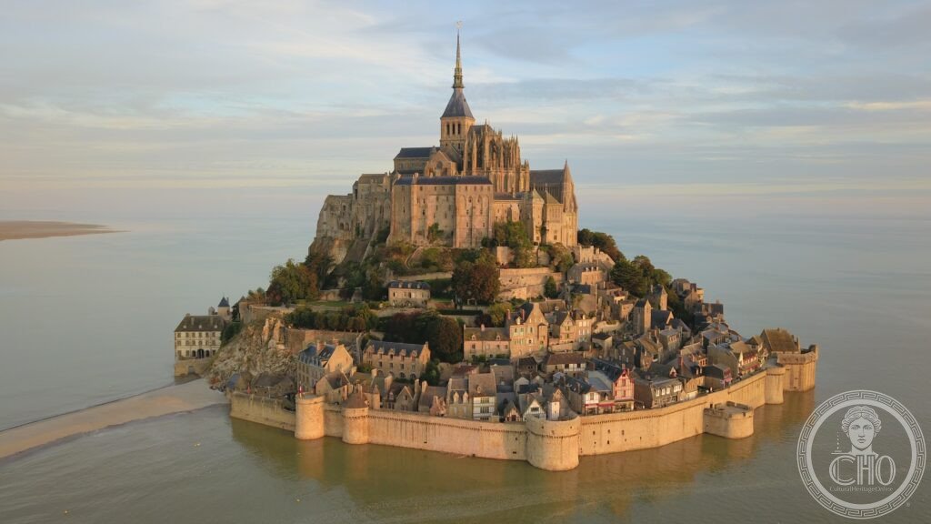
Rising 92 metres from the tidal flats of Normandy, Mont-Saint-Michel has drawn pilgrims since the eighth century and remains crowned by a Benedictine abbey rebuilt across the Romanesque and Gothic centuries. The bay around it holds the highest tidal range in mainland France, and a 2015 footbridge restored the tides that once cut the rock off from the mainland.
At a glance
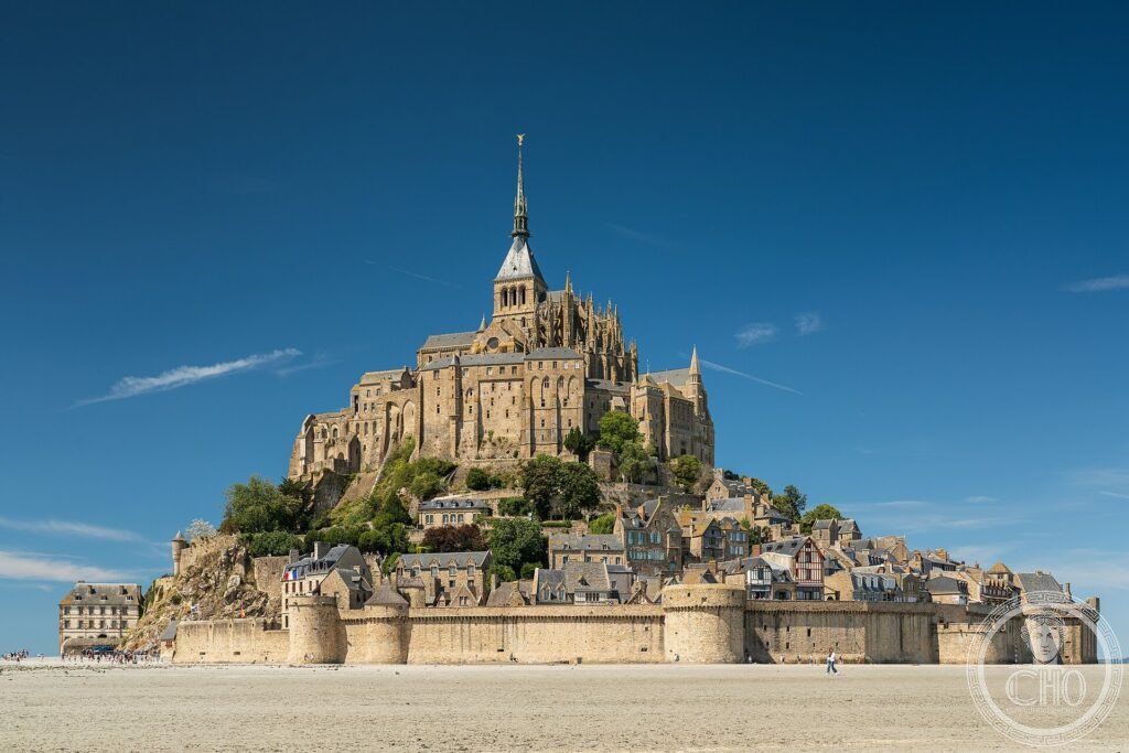
Mont-Saint-Michel is a granite rock rising 92 metres from the tidal flats of the Bay of Mont-Saint-Michel, with a base measuring roughly 960 metres in circumference at low tide. On its summit stands a Romanesque and Gothic abbey, whose spire and gilded statue of St Michael bring the total height above the bay to 157 metres.
The bay itself has the highest tidal range in mainland France, reaching up to 15 metres, a figure comparable to the Bay of Fundy in Canada or the Severn Estuary in Britain. At spring tides the sea advances across the flats at walking pace, isolating the Mont from the mainland. In 2015 the nineteenth-century causeway was replaced with a slender footbridge on piles, allowing the tide to circulate freely beneath it and restoring the site’s character as a true tidal island.
Key facts
- Height: the rock rises 92 metres from the tidal flats; the abbey and spire reach 157 metres above the bay.
- Base: approximately 960 metres in circumference at low tide.
- Tidal range: up to 15 metres, the highest in mainland France.
- World Heritage status: Mont-Saint-Michel and its Bay were inscribed in 1979; the listed area covers the Mont and roughly 250 square kilometres of surrounding bay.
- Founding: a sanctuary was established in 708 CE by Bishop Aubert of Avranches; a Benedictine monastery followed in 966 CE under Duke Richard I of Normandy.
History
According to the founding legend, the Archangel Michael appeared to Bishop Aubert of Avranches three times in 708 CE, instructing him to build a sanctuary on the rock. Aubert hesitated, and only acted after the third vision. The Benedictine monastery followed in 966 CE, and the main Romanesque church was begun in 1017 under Abbot Hildebert II. Its choir collapsed in 1421 and was rebuilt in Gothic style between 1450 and 1521.
The most significant medieval addition, the Merveille, was built between 1211 and 1228 under Abbot Jourdain during the reign of Philip Augustus: a three-storey Gothic complex set against the rock’s north face.
During the Hundred Years’ War, Mont-Saint-Michel was the only fortress in Normandy never taken by the English, withstanding a siege from 1423 to 1434 with a garrison of around 119 knights. In 1469 Louis XI founded the Order of Saint Michael, whose knights wore a collar incorporating the Mont’s emblematic shells until the order was superseded by the Order of the Holy Spirit in 1578.
What you see
The Merveille contains six principal rooms across its levels: the Aumônerie, once used to house and feed poor pilgrims; the Cellar, the monks’ storehouse; the Guests’ Hall, where royal visitors were received; the Knights’ Hall, which served as the monastery’s scriptorium and was the only heated room in the medieval complex, its fire kept to stop ink freezing rather than to warm the monks; the Refectory, lit by narrow windows set deep in the side walls and invisible from the entrance, giving the hall a distinctive acoustic quality; and the Cloister, with its double row of slender columns set in alternating diagonal patterns.
At the top of the abbey spire stands a gilded statue of St Michael, regilded in 1897. Medieval pilgrims who reached the Mont bought lead badges known as the ampullae de Saint-Michel, examples of which have been found on archaeological sites from Scotland to Sicily.
Beyond the abbey walls, the bay itself is part of the experience: vast tidal flats that can turn from exposed sand to open sea within a short span of time.
Practical information
- Crossing the bay: the sand and silt flats contain genuine quicksand hazards; crossing on foot is only considered safe with an official guide from the Guides Nature Baie du Mont-Saint-Michel.
- Access to the Mont: pedestrian access is via the footbridge installed in 2015, which allows the tide to flow beneath it; check tide times before visiting.
- Opening times and charges: these vary and should be checked directly through the abbey’s official visitor channels rather than relied upon from secondary sources.
Getting there
Mont-Saint-Michel has long been a pilgrimage destination, lying near the route of the via Turonensis leading to Santiago de Compostela. For current transport options and road access, visitors should consult the site’s official information channels rather than fixed schedules, given how much this can change.
Nearby
- Avranches — the town associated with Bishop Aubert, whose vision led to the founding of the sanctuary.
- The Bay of Mont-Saint-Michel — the tidal flats surrounding the rock, crossed only with official guides because of quicksand.
More photographs
Sources
- UNESCO
- Guides Nature Baie du Mont-Saint-Michel
Find it on the map
See this place and what’s around it →📷 Become a Cultural Heritage Online photographer
Share your photos of places: they stay published under your name as the author. The more they're seen, the more you get noticed — and soon a contest will reward the most appreciated photos.
Log in or sign up free to add a photoDo you manage this place?
This page is read by travellers and heritage enthusiasts who find it on Google. Keep it accurate — and make it work for you. Free for non-profit heritage institutions.