
A tiny walled peninsula on the Río de la Plata estuary where Portuguese and Spanish empires clashed for a century — leaving behind the most layered colonial streetscape in the Southern Hemisphere.
At a glance
Colonia del Sacramento sits directly across the river from Buenos Aires, occupying a small peninsula in southwestern Uruguay. Its historic quarter — the Barrio Histórico — is one of South America’s best-preserved colonial urban ensembles, inscribed as a UNESCO World Heritage Site in 1995. What makes it extraordinary is its layered Portuguese and Spanish colonial architecture: wide cobblestone streets, pastel-coloured low-rise buildings from the 17th and 18th centuries, a ruined convent, a city gate, and a lighthouse built atop the rubble of an earlier religious structure. The entire quarter is walkable in under two hours.
Key facts
- Founded: 1680 CE by Manuel Lobo, Portuguese Governor of Brazil.
- UNESCO inscription: 1995, as an outstanding example of Ibero-American colonial urban planning.
- Location: Colonia del Sacramento, southwestern Uruguay, on the Río de la Plata estuary.
- Distance from Buenos Aires: approximately 50 km across the river; 1-hour ferry crossing.
- Area of historic quarter: approximately 6 × 6 blocks on a peninsula.
- Changes of hands: at least 7 times between Portugal and Spain, 1680–1777 CE.
- Heritage significance: rare surviving example of Portuguese colonial urban planning outside Brazil; exceptional Portuguese-Spanish architectural fusion.
History
Colonia del Sacramento was founded on 20 January 1680 by Manuel Lobo, Governor of Rio de Janeiro, acting on orders from the Portuguese Crown to establish a strategic foothold on the eastern bank of the Río de la Plata. The location was chosen deliberately: directly opposite Buenos Aires, it threatened Spanish control of the estuary and the trade routes to the silver-rich interior.
The city’s history over the next century was one of almost continuous conflict. Spain attacked and seized it within months of its founding in 1680. A treaty in 1681 returned it to Portugal. Spain captured it again in 1705, returned it in 1715, seized it once more in 1762, restored it in 1763 under the Treaty of Paris, and finally incorporated it permanently into Spanish territory in 1777 under the Treaty of San Ildefonso. This extraordinary sequence — at least seven changes of sovereignty — left physical traces in the built environment: Portuguese urban planning and building techniques overlaid with Spanish administrative structures, all within a few hectares.
During periods of Portuguese control, Colonia thrived as a smuggling hub, channelling British and Portuguese goods into Spanish South America in defiance of Spanish trade monopolies. This economic vitality funded the buildings that still stand today. After 1777, the city’s strategic importance faded under unified Spanish administration, and it entered a long period of quiet that inadvertently preserved its colonial fabric.
Uruguay’s independence (1828) brought the city into the new republic, where its remoteness and small size continued to protect the historic quarter from the redevelopment that transformed larger South American cities in the 19th and 20th centuries.
What you see
The Barrio Histórico is remarkable for its physical density of historic fabric within a tiny area. The cobblestone streets — some of the oldest surviving in South America — are characteristically wide by colonial standards, lined with single-storey houses in ochre, terracotta, yellow, and pale blue. Portuguese colonial buildings are distinguished by their azulejo tile panels, wrought-iron balconies, and steeply pitched roofs; Spanish structures favour whitewashed walls and enclosed courtyards.
Portón de Campo (city gate, 1745): the best-preserved entrance gate in the fortification walls, flanked by restored bastions. The surrounding earthwork fortifications are partly visible and trace the outline of the original Portuguese defences.
Convento de San Francisco ruins (1693): the shell of a Franciscan convent destroyed by Spanish bombardment, now preserved as an open-air ruin beside a functioning lighthouse. The lighthouse itself was constructed in 1857 on the rubble of the convent’s bell tower — one of the more striking architectural palimpsests in South America.
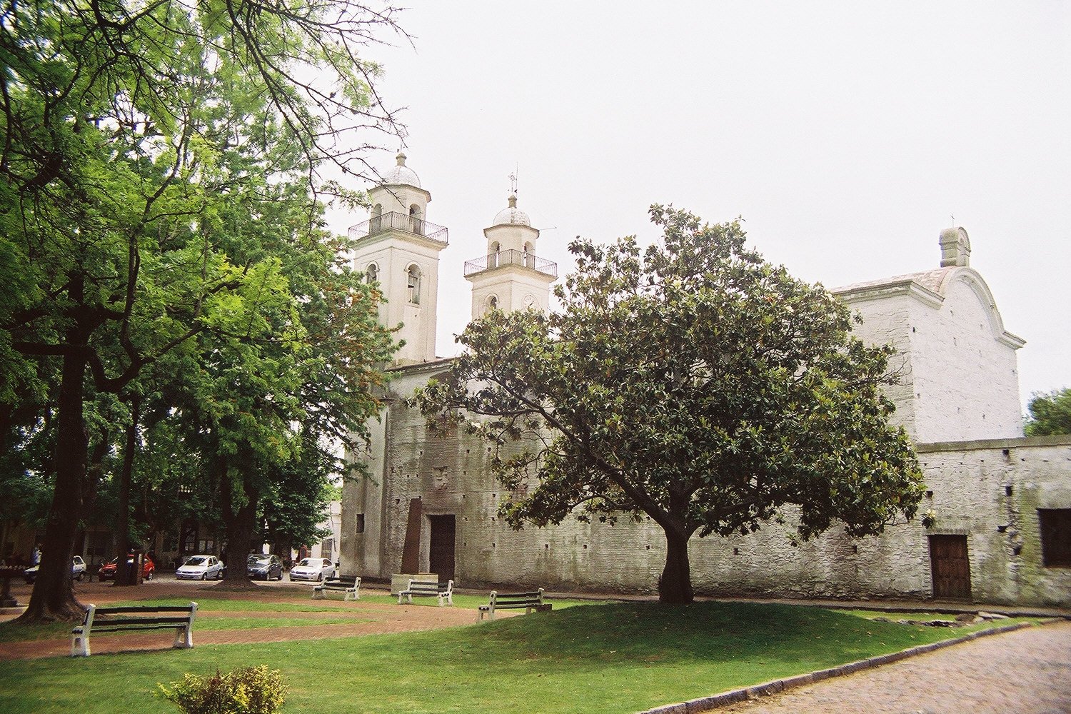
Plaza Mayor: the central square, surrounded by the Portuguese colonial municipal house (Casa del Gobernador), several small museums including the Municipal Museum (Museo Municipal) with colonial-era artefacts, and the Basílica del Santísimo Sacramento, originally built in 1680 and repeatedly damaged and rebuilt through the colonial wars.
Calle de los Suspiros (Street of Sighs): a photogenic cobblestone lane with original colonial paving stones and low houses, frequently cited as among the most atmospheric colonial streetscapes in South America.
Practical information
- Opening hours: The historic quarter is an open urban area — streets and plazas accessible at all times. Individual museums have varying hours; most open Tuesday–Sunday 10:00–17:00.
- Admission: No entrance fee for the historic quarter. Individual museums charge a small fee (typically 2–5 USD equivalent).
- Best time to visit: Year-round. Spring (September–November) and autumn (March–May) offer mild temperatures and smaller crowds. Summer (December–February) brings day-trippers from Buenos Aires.
- Duration: The historic quarter can be covered in 2–3 hours on foot. A full day allows for museums, waterfront, and surrounding areas.
- Language: Spanish throughout. Some tourist infrastructure in English and Portuguese.
- Currency: Uruguayan peso (UYU). Buenos Aires visitors may use Argentine pesos informally but should carry UYU for official transactions.
Getting there
The most popular approach is by ferry from Buenos Aires. Buquebus and Colonia Express operate daily services from the Buenos Aires port terminal (Puerto Madero area) to Colonia del Sacramento; the crossing takes approximately 1 hour by fast ferry or 3 hours by slower vessel. Tickets should be booked in advance during peak season.
By land from Montevideo: Colonia del Sacramento is approximately 180 km west of the Uruguayan capital via Ruta 1. Bus services connect the two cities (around 2.5–3 hours). From the bus terminal, the historic quarter is a 15-minute walk or short taxi ride.
The Barrio Histórico is compact and pedestrian-only in its central streets — no car access is needed or recommended within the quarter itself.
Nearby
- Carmelo (75 km northwest): a wine-producing town in the Colonia department, known for tannin-rich Tannat wines; small boutique bodegas offer visits and tastings.
- Conchillas (45 km northeast): a remarkably intact 19th-century British mining company town, built for workers of the English-owned port construction; an unusual piece of Victorian industrial heritage in Uruguay.
- Montevideo (180 km east): Uruguay’s capital, with the Ciudad Vieja (Old City) containing its own colonial and Art Deco heritage, the Mercado del Puerto, and several significant museums.
- Buenos Aires (across the Río de la Plata, Argentina): the Argentine capital is the natural paired destination for Colonia visitors, with the San Telmo colonial neighbourhood, La Boca, and the MALBA contemporary art museum among major cultural draws.
Sources
- UNESCO World Heritage Centre — Historic Quarter of the City of Colonia del Sacramento (1995): whc.unesco.org/en/list/747.
- Wikipedia — Colonia del Sacramento: en.wikipedia.org/wiki/Colonia_del_Sacramento.
- Ministerio de Educación y Cultura, Uruguay — Patrimonio Cultural del Uruguay.
Find it on the map
See this place and what’s around it →📷 Become a Cultural Heritage Online photographer
Share your photos of places: they stay published under your name as the author. The more they're seen, the more you get noticed — and soon a contest will reward the most appreciated photos.
Log in or sign up free to add a photo