
The legendary Arabian city dismissed for centuries as myth — until NASA Shuttle Imaging Radar located it in 1992 beneath the sands of the Empty Quarter, and excavation revealed a real frankincense-trading metropolis that collapsed catastrophically into a sinkhole.
At a glance
In the Dhofar Province of southern Oman, at the desert oasis of Shisr on the edge of the Rub al Khali, the ruins of Ubar represent one of the most extraordinary archaeological rediscoveries of the twentieth century. Known to the ancient Arabs as a city of fabulous wealth and to the Quran as “Iram of the Pillars” — destroyed by divine punishment for the pride of its rulers — the city was called “the Atlantis of the Sands” by Lawrence of Arabia. In 1992, a team using satellite radar data from NASA identified converging caravan tracks beneath the desert surface that pointed to Shisr, where excavation confirmed a real octagonal fortress city that served as a major waystation on the ancient frankincense trade route before collapsing into a massive limestone sinkhole around 300 AD.
Key facts
- Period: c. 300 BC to 300 AD; peak activity c. 1st century AD
- Location: Shisr oasis, Dhofar Province, southern Oman
- Discovery: Located 1992 by Nicholas Clapp using NASA SIR-C Shuttle Imaging Radar
- Excavator: Juris Zarins, Southwest Missouri State University, 1992 to 1995
- Structure: Octagonal fortress of approximately 0.6 hectares with at least eight defensive towers
- Destruction: Catastrophic collapse into a limestone cave sinkhole, c. 300 AD
- Quranic name: Iram Dhat al-Imad — “Iram of the Pillars”
History
Ubar’s existence as a real city was debated by Western scholars for most of the twentieth century. The city appeared in Arabian oral tradition, in the Quran (Surah 89:6 to 8, which describes “Iram of the Pillars” as a city of great columns and architectural magnificence whose proud rulers were destroyed by God), in early Islamic geographical texts, and in the imagination of European travellers including T. E. Lawrence — but no physical trace had been found. The key breakthrough came in 1984 to 1992 when filmmaker and amateur archaeologist Nicholas Clapp, working with JPL scientist Ronald Blom, analysed Shuttle Imaging Radar data from NASA Space Shuttle missions. The radar, which can penetrate metres of dry desert sand, revealed beneath the Dhofar surface a network of ancient caravan tracks converging on a single point at Shisr — a known oasis where a small, undated fort had been noted by earlier travellers.
Excavations conducted by Juris Zarins in 1992 to 1995 revealed at Shisr the remains of an octagonal fortress city approximately 0.6 hectares in extent, with at least eight polygonal defensive towers, built over and around a natural limestone cave system. The city had been a major commercial hub on the ancient frankincense trade route: the Boswellia trees of the Dhofar interior produced the frankincense that supplied the Roman, Nabataean, and Egyptian luxury markets, and Ubar was the collection and redistribution point where desert caravans assembled before the long northward journey. The city’s destruction was catastrophic and sudden: the limestone ceiling of the cave system below the fortress subsided, collapsing the city into a massive sinkhole and burying it under the desert sand. If the Quranic narrative preserves any historical memory, the disaster was remembered in Arabian oral tradition for more than a millennium before the text was codified in the 7th century AD.
What you see today
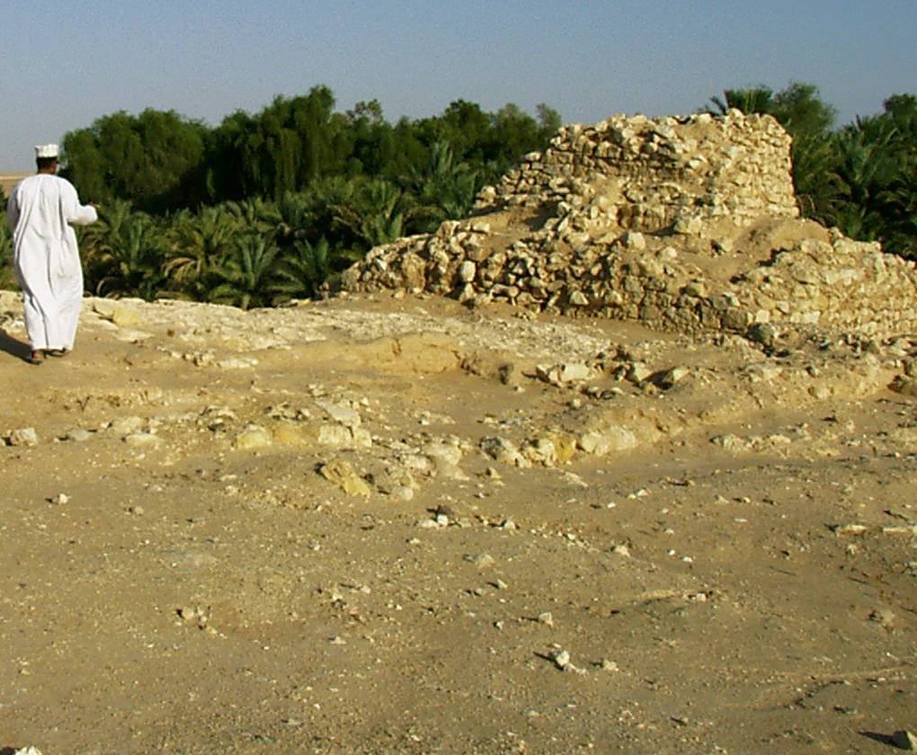
The visible remains at Shisr are the tumbled towers and walls of the fortress that collapsed into the sinkhole — an unusual and visually dramatic site where massive stone blocks lie at chaotic angles, many tilted into the subsidence depression at the centre of the site. The sinkhole itself, now partially excavated, reveals the cave system that both sustained the city by providing fresh water and ultimately destroyed it. The octagonal layout of the fortress, with its multiple towers, is partially traceable in the surviving stonework. The site is managed as an open-air archaeological park by Oman’s Ministry of Heritage and Tourism, with a modern visitor centre on site.
Finds from the excavation — including pottery, frankincense burners, metalwork, and coins spanning several centuries — are displayed in the Dhofar Museum in Salalah, approximately 160 km west. The NASA radar image that enabled the discovery, showing the ancient caravan tracks converging on Shisr, is one of the most frequently reproduced images in the history of remote-sensing archaeology.
Practical information
- Entry: Free; open site managed by Oman Ministry of Heritage and Tourism
- Best season: October to March (avoid June to September monsoon and heat season in Dhofar)
- Nearest city: Salalah, approximately 160 km west; day trip possible with 4WD
- Road: Paved road to Shisr from Thumrayt junction on Route 49
- Combined visit: Pair with Khor Rori / Sumhuram frankincense port, also in Dhofar
Getting there
Shisr lies approximately 160 km northeast of Salalah in the Dhofar interior. From Salalah, take Route 49 north to Thumrayt, then east on the desert road towards Shisr — the total drive is approximately 2 to 2.5 hours on paved roads. A standard car can reach the site in dry conditions, though 4WD is recommended after rain. No public transport serves the route; hire a car in Salalah or join an organised desert excursion from the city.
Nearby
- Khor Rori / Sumhuram — ancient frankincense port of Dhofar, near Salalah
- Salalah — nearest city; Dhofar Museum holds excavation finds from the site
- Wadi Dawkah — UNESCO-listed Boswellia frankincense tree grove, part of the Land of Frankincense World Heritage Site
Frequently Asked Questions
Has Iram of the Pillars been found?
A real city was found where the legend placed one. In 1992 Nicholas Clapp, working with the JPL scientist Ronald Blom, read NASA Shuttle Imaging Radar data that showed ancient caravan tracks converging on the oasis of Shisr, in southern Oman; excavations led by Juris Zarins between 1992 and 1995 uncovered an octagonal fortress city there. Whether that city is the Iram of the Quran is a question the archaeology cannot settle.
Where is Iram of the Pillars?
At the Shisr oasis, in the Dhofar Province of southern Oman, on the edge of the Rub al Khali — the Empty Quarter. Salalah, the nearest city, lies about 160 km west; a paved road reaches Shisr from the Thumrayt junction on Route 49.
Is Ubar real?
The ruins are. What stands at Shisr is a fortress of roughly 0.6 hectares with at least eight polygonal towers, built over a limestone cave system, and a waystation on the frankincense route between about 300 BC and 300 AD. The fabulous city of Arabian tradition — the “Atlantis of the Sands” of T. E. Lawrence — is a larger claim than the excavation supports.
Can you visit Ubar?
Yes. The site is an open-air archaeological park run by Oman’s Ministry of Heritage and Tourism, with a visitor centre and no entry charge. October to March is the season to go; the Dhofar monsoon and the heat run from June to September. Finds from the excavation are shown at the Dhofar Museum in Salalah.
Sources
- Zarins, J. (1997). “Atlantis of the Sands.” Archaeology 50(3).
- Clapp, N. (1998). The Road to Ubar: Finding the Atlantis of the Sands. Houghton Mifflin.
- Blom, R. et al. (1998). Remote sensing of ancient camel caravan routes in southern Oman. Remote Sensing of Environment.
- Quran, Surah Al-Fajr 89:6 to 8 (Iram of the Pillars).
- UNESCO World Heritage: Land of Frankincense (Oman) official documentation.
Find it on the map
See this place and what’s around it →📷 Become a Cultural Heritage Online photographer
Share your photos of places: they stay published under your name as the author. The more they're seen, the more you get noticed — and soon a contest will reward the most appreciated photos.
Log in or sign up free to add a photo