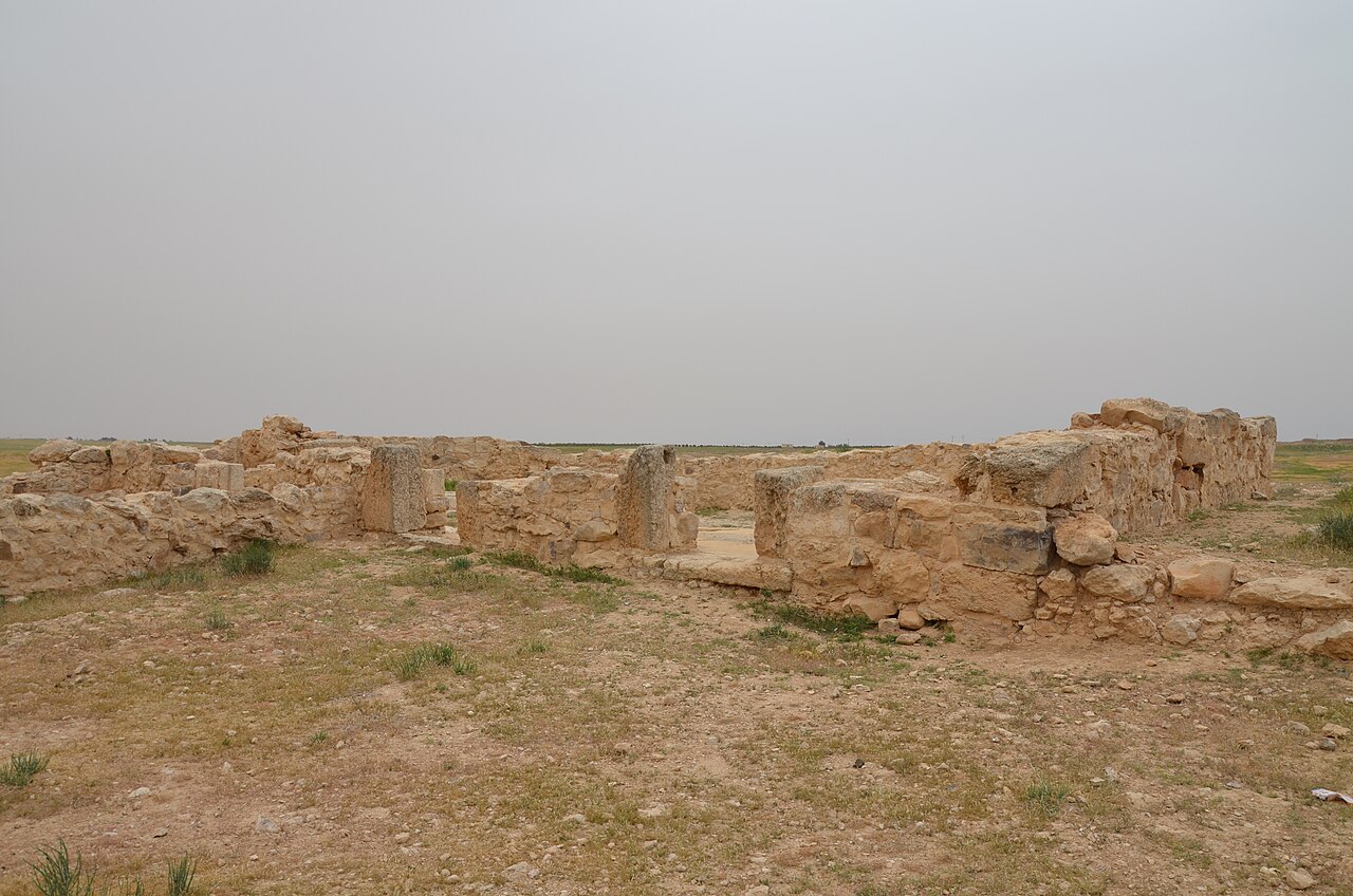
Um er-Rasas — the ancient Kastrom Mefa’a — is a partially excavated archaeological site on the Jordanian plateau, 30 km southeast of Madaba, occupied from the Roman period through the early Islamic period between approximately 300 and 800 CE. A UNESCO World Heritage Site since 2004, it is best known for the floor mosaic of the Church of Saint Stephen (718 CE), a 28-city panorama of the Levant and Nile Delta that was buried under soil around 785 CE and rediscovered in 1986. The site is mentioned three times in the Old Testament as Mephaath, and lies 100 km northeast of Petra and 80 km southwest of Quseir Amra.
The Church of Saint Stephen and the Mosaic Map of 28 Cities Central excavated area — accessible from the site entrance on foot
The Church of Saint Stephen was completed in 718 CE, during the Umayyad period of Islamic rule over Jordan — a fact that makes it significant beyond its artistic content, since it demonstrates that Christian communities in the region continued to commission large-scale ecclesiastical art for at least eight decades after the Islamic conquest of 634 CE. The church follows the standard Byzantine basilica plan: a nave flanked by two aisles, a semicircular apse at the eastern end, and a narthex at the west. The entire nave and aisles are covered with mosaic floor, making it one of the largest continuous mosaic surfaces in Jordan.
The central field of the mosaic is a geometric carpet in multiple colours — interlocking circles, scrolls, and stylised vine patterns of the type found across Byzantine churches in the region. The exceptional element is the border: a continuous frieze running around three sides of the nave floor depicting 28 named cities, each represented as a schematic architectural portrait. The cities are labelled in Greek. The arrangement is geographically organised: eight cities in Palestine and Transjordan (including Jerusalem, Nablus, Caesarea, and Esbus/Hesban), ten in Egypt’s Nile Delta (including Alexandria, with a distinctive lighthouse), and ten in the Jordan Valley. Each city portrait shows stylised buildings, churches with red roofs, and — in the Egyptian Nile Delta cities — boats on the river. The city portraits of the 8th century Levant and Egypt constitute a documentary record of urban geography at a specific historical moment, with no other visual source of comparable scope surviving from the same period.
Jerusalem is depicted in the frieze with particular care: the Church of the Holy Sepulchre is identifiable, and the city is shown as a major centre surrounded by walls. Gaza appears as a port city. Alexandria is shown with the Pharos lighthouse — still standing and still functioning in 718 CE, though it was damaged by earthquakes in the 9th and 14th centuries and finally collapsed in the 1300s. The inclusion of the lighthouse as an identifying landmark suggests that the mosaic artists worked from descriptions or visual references provided by travellers who had seen the Egyptian cities directly, rather than from purely schematic conventions.
The mosaic was covered with a layer of soil by the community around 785 CE. The most widely accepted explanation is protective: the Byzantine iconoclasm controversy, which resulted in the destruction of religious images across the Eastern Empire between 726 and 842 CE, created a climate in which floor mosaics with figurative content were at risk. Covering the floor with soil preserved it intact. Rediscovery came in 1986 during systematic excavations; the mosaic is now protected under a modern roof shelter. The covering soil, paradoxically, preserved the colours to a degree unusual for a floor that would otherwise have experienced 1,200 years of foot traffic and weathering.
The Walled Town, the Roman Fort and the Isolated Stylite Tower Tower accessible by walking path approximately 1.5 km northwest of the main walled site
The name Kastrom Mefa’a reflects the site’s Roman military origin: kastrom is a corruption of the Latin castrum, meaning fort. The walled enclosure visible today follows the outline of a Roman military installation established in the late 3rd or early 4th century CE, part of the Limes Arabicus — the defensive frontier system Rome built across the eastern desert margins. The walls are constructed from the local limestone characteristic of the Jordanian plateau, and sections of the perimeter remain standing to several metres in height. Within the walls, excavations have revealed residential quarters, storage areas, and the ruins of multiple churches built in successive phases from the 4th through the 8th centuries.
The name Mefa’a appears in the Old Testament three times: in Jeremiah 48:21, in Joshua 13:18, and in 1 Chronicles 6:79, listed among the towns of the tribe of Reuben east of the Jordan. Whether the biblical Mephaath is identical to the Roman-era Kastrom Mefa’a remains debated by biblical scholars, but the toponym’s persistence across the Roman, Byzantine, and early Islamic occupation layers — the name appears in Greek inscriptions within the site using the form Mefa’a — makes the identification strong. The site’s Old Testament association adds a separate layer of significance to its archaeological record, connecting it to texts that predate the Roman fort by centuries.
Approximately 1.5 km northwest of the walled town, standing in open desert, is the most visually striking feature of the Um er-Rasas site: a freestanding stone tower 14 metres tall with no surviving staircase or internal access structure. The tower’s purpose is understood by analogy with similar structures documented elsewhere in the Byzantine world: it was almost certainly the column or tower of a stylite — a Christian ascetic who lived on an elevated platform, inaccessible to casual visitors, as a form of extreme withdrawal from the world. The practice was pioneered by Simeon Stylites (390–459 CE) near Antioch in Syria, whose column attracted thousands of pilgrims during his lifetime. Stylites were supplied with food and water by followers who raised provisions on ropes; they descended their platforms only at death. The Um er-Rasas tower has no surviving evidence of a platform at the top, but the interior walls show traces of what may have been a room or shelter. No documentary source names the stylite who occupied this particular tower, and the date of its construction and use has not been precisely determined by excavation.
Practical information
Um er-Rasas is located approximately 30 km southeast of Madaba and 65 km south of Amman. There is no public transport to the site; access requires a private vehicle, taxi, or organised tour from Madaba or Amman. The site is open daily; entry is managed by the Jordan Tourism Board. The main excavated area includes the Church of Saint Stephen mosaic under its protective roof, the walled town perimeter, and the remains of several other churches. The stylite tower requires a separate walk of approximately 1.5 km across open terrain from the main site; the path is not paved. Combined with a visit to Madaba — which has its own 6th-century mosaic map of the Holy Land in the Church of Saint George, one of the most important Byzantine mosaic cartographic documents in existence — Um er-Rasas can be covered in a full day from Amman. The Kings Highway, the historic road running south from Madaba through Karak to Petra (approximately 100 km southwest), passes within 20 km of the site and offers a logical itinerary connecting Um er-Rasas, the Crusader castle at Karak, and Petra in a two-day drive.
Frequently Asked Questions
How does the Um er-Rasas mosaic compare to the Madaba Map, and why are both important?
The Madaba Map, displayed in the Church of Saint George in Madaba (30 km northwest of Um er-Rasas), is the oldest surviving cartographic representation of the Holy Land and dates to the 6th century CE — approximately 150 years before the St Stephen mosaic at Um er-Rasas. The Madaba Map covers a larger geographic area, from Lebanon and the Nile Delta in the north and west to the Sinai and the Transjordanian highlands in the east, and it represents topographic features including mountains, rivers, and the Dead Sea as well as cities. Jerusalem is shown in exceptional detail at the centre of the map, with the Cardo Maximus — the main Roman colonnaded street — and the Church of the Holy Sepulchre identifiable. The Madaba Map originally measured approximately 21 × 7 metres; only about a quarter survives. The Um er-Rasas mosaic is not a map in the cartographic sense — the 28 cities are arranged decoratively around the border of the nave floor rather than in geographic relationship to each other — but it functions as a visual gazetteer, a collection of urban portraits that documents how specific cities in the Levant and Egypt appeared, or were imagined, in the early 8th century. The two mosaics are complementary: Madaba shows territory and roads, Um er-Rasas shows urban character. Together, they form the most substantial surviving visual record of settlement in the region before the transformations of the medieval period.
What do the 28 city portraits in the mosaic reveal about life in the 8th-century Levant?
The city portraits in the St Stephen mosaic are schematic rather than architecturally accurate — they use conventions that Byzantine mosaic artists had developed for representing urban places, including standard building types (columned halls, domed churches, towers, walls) arranged to signal civic status and Christian character. Each city is identified by its Greek name, and several include distinguishing features: Alexandria has its lighthouse, Nablus (Neapolis) has a distinctive church, and the Nile Delta cities show boats that reference river commerce. The portraits collectively document which cities were considered significant enough to include in a church commission from a small town in the Jordanian highlands — a form of mental map of the Christian Mediterranean world as perceived from the eastern frontier. Cities in Egypt are included alongside those in Palestine and Transjordan, reflecting the ecclesiastical networks that connected churches across the region through pilgrimage, trade, and the administration of the Byzantine and later Umayyad empires. The inclusion of cities 718 CE that are well-documented from other sources — Jerusalem, Caesarea, Gaza, Alexandria — allows scholars to cross-reference the mosaic portraits against archaeological and textual evidence, which in turn calibrates the reliability of portraits of less-documented cities. The mosaic’s coverage of the Nile Delta is particularly valuable because many of those cities have been obscured by later development or deposited sediment, making the mosaic one of the few visual records of their 8th-century appearance.
Who were the stylite saints, and how did the practice reach Jordan?
The stylite practice — living permanently on an elevated column or tower — began with Simeon Stylites the Elder (390–459 CE), a Syrian ascetic from Sis in Cilicia who first climbed a column near Antioch in approximately 423 CE. Over the following decades he raised the column progressively, eventually to 18 metres. Simeon attracted huge pilgrim crowds and conducted extensive correspondence with emperors, bishops, and laypeople from the top of his column; his influence on 5th-century Christian theology and politics was substantial. After his death, the column became a major pilgrimage site, and the church built around it — Qal’at Sim’an, still partially standing in northwest Syria — is one of the largest 5th-century buildings in the world. The practice spread rapidly across the Byzantine world in the decades after Simeon’s death; dozens of stylites are documented in Syria, Anatolia, and the Levant. The Jordan region fell within the sphere of influence of the Palestinian and Arabian church networks, and the Um er-Rasas tower fits into a pattern of stylite towers documented at other sites in Jordan and Syria from the 5th through the 8th centuries. The stylite tradition declined after the Islamic conquest of the Levant, though isolated examples continued into the medieval period. The Um er-Rasas tower is one of the best-preserved surviving examples of this architectural form.
Sources
- S1 — Department of Antiquities of Jordan (DOA) — Umm ar-Rasas Archaeological Preservation — http://doa.gov.jo/
- S2 — Michele Piccirillo & Eugenio Alliata — Umm al-Rasas – Mayfa'ah I: Gli scavi del complesso di Santo Stefano, Studium Biblicum Franciscanum, Jerusalem, 1994, ISBN 978-9655160024
Spotted an error? Write to editorial@culturalheritageonline.com and we correct it the same day.