The nearest World Heritage properties to the Sado Island Gold Mines are the Shrines and Temples of Nikko, 172 km away on Honshu, and the Tomioka Silk Mill and Related Sites, 187 km away. The Sado Island Gold Mines themselves were inscribed in 2024. They preserve a rare case of manual mining and smelting technology that continued into a period when mechanisation was spreading elsewhere in the world.
The World Heritage sites near Sado Island Gold Mines
The distances below are straight lines between the reference points that UNESCO publishes for each property, measured to the nearest component of a serial site. They tell you what is close. They do not tell you how long the road or ferry takes, which depends on the route and the season.
| Site | Country | Distance | Inscribed | Type |
|---|---|---|---|---|
| Shrines and Temples of Nikko | Japan | 172 km | 1999 | Cultural |
| Tomioka Silk Mill and Related Sites | Japan | 187 km | 2014 | Cultural |
| Historic Villages of Shirakawa-go and Gokayama | Japan | 206 km | 1995 | Cultural |
| Fujisan, sacred place and source of artistic inspiration | Japan | 268 km | 2013 | Cultural |
| Hiraizumi – Temples, Gardens and Archaeological Sites Representing the Buddhist Pure Land | Japan | 269 km | 2011 | Cultural |
| The Architectural Work of Le Corbusier, an Outstanding Contribution to the Modern Movement | India, Japan, France, Belgium, Switzerland, Argentina, Germany | 276 km | 2016 | Cultural |
These sites span four centuries of Japan’s management of labour, materials and belief. Sado and Nikko are both linked to the Tokugawa Shogunate: one supplied the gold that funded the regime, the other enshrined its founder. Tomioka and the Le Corbusier component in Tokyo mark Japan’s entry into modern industrial and architectural production, while Shirakawa-go and Fujisan preserve older relationships between communities, sacred mountains and difficult terrain.
Two mining areas, three component parts, one manual system
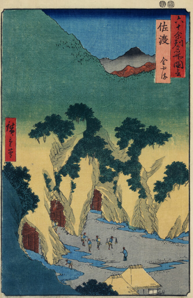
The property is a serial inscription built around two main mining districts. One, on the north-western side of the Kosado Mountains, was worked for placer gold and includes the water channels that the method required. The other, at the southern end of the Osado Mountains, covers underground and surface mining for gold and silver. Three component parts make up the whole, two of them linked by a route that is now broken for a short stretch.
The island itself owes its deposits to volcanic origins. Two parallel mountain ranges run from southwest to northeast with an alluvial plain, the Kuninaka Plain, between them. Hydrothermal water rose close to the surface and formed ore veins in the rock; later tectonic movement first carried surface deposits down to the seabed and then lifted them back up. Weathering exposed some veins to open air, while others were followed deep underground.
Why UNESCO inscribed the mines under criterion (iv)
UNESCO’s case rests on the technology and its organisation. In the 17th century the Shogunate’s arrangements at Sado made it possible to extract and process high-quality gold in quantities that met global standards, without the mechanised methods that mining was adopting elsewhere. The property shows how the authorities adapted extraction and processing to the character of the ore deposits on the island, and how they placed settlement, mining and processing functions close to one another to keep the operation efficient. Under criterion (iv), the site is judged an exceptional Asian example of manual mining and smelting continuing while mechanisation was progressively introduced in other parts of the world.
What survives above and below ground
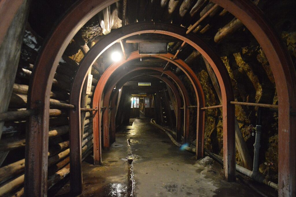
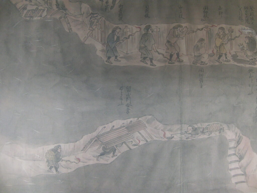
UNESCO records many landforms altered by human activity, archaeological traces of the mines themselves, structures used in mining operations, places where ore was dressed and smelted, and the remains of associated settlements, both on the surface and underground. The component parts have kept their key features and have not been destroyed or significantly altered within the property. The location of key activities, the layout of land arrangements and physical traces such as tunnels, waterways, headraces, terraces, post-holes and landforms show how past mining and administration worked. Understanding these remains depends heavily on ancient documentary records, especially drawings and images.
Frequently Asked Questions
Which UNESCO World Heritage sites are near Sado Island Gold Mines?
The nearest are the Shrines and Temples of Nikko at 172 km and the Tomioka Silk Mill and Related Sites at 187 km, both on Honshu. Next come the Historic Villages of Shirakawa-go and Gokayama at 206 km, Fujisan at 268 km and Hiraizumi at 269 km. All are in Japan.
When were the Sado Island Gold Mines inscribed on the World Heritage List?
They were inscribed in 2024 under cultural criterion (iv). The property covers three component parts across two main mining areas: the Nishimikawa Placer Gold Mine and the Aikawa-Tsurushi Gold and Silver Mine, both worked during the Edo period.
What makes the Sado Island Gold Mines different from other mining World Heritage sites?
They demonstrate how manual mining and processing technology continued and reached a high level in Asia while mechanisation was being introduced elsewhere. The Tokugawa Shogunate’s production organisation extracted considerable quantities of high-quality gold for 17th-century global standards without machines or chemicals.
Can visitors enter the gold mine?
Yes. The Historic Sado Gold Mine tourist facility looks after the Aikawa Gold and Silver Mine, the main part of the World Heritage property, and opens sections of it to visitors. It offers courses through two mine tunnels and guided tours.
Sources
- UNESCO World Heritage Centre — Sado Island Gold Mines (inscribed 2024). https://whc.unesco.org/en/list/1698/
- UNESCO World Heritage Centre — Shrines and Temples of Nikko (inscribed 1999). https://whc.unesco.org/en/list/913/
- UNESCO World Heritage Centre — Tomioka Silk Mill and Related Sites (inscribed 2014). https://whc.unesco.org/en/list/1449/
- UNESCO World Heritage Centre — Historic Villages of Shirakawa-go and Gokayama (inscribed 1995). https://whc.unesco.org/en/list/734/
- Historic Site Sado Gold Mine — Official Site. https://www.sado-kinzan.com/en/
Spotted an error? Write to the editors and we correct it the same day.