
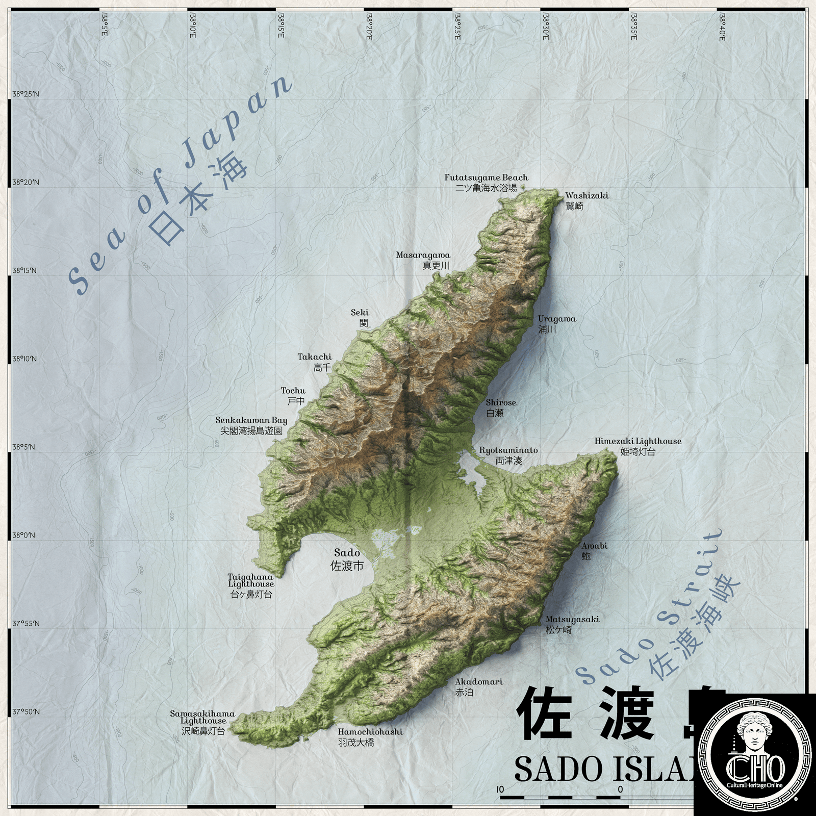
Japan’s sixth-largest island rises from the Sea of Japan with rugged peaks, a dramatic coastline, and a complex human history spanning centuries.
At a glance
Sado Island stretches across the eastern Sea of Japan, administered as part of Sado City in Niigata Prefecture. Its 262.7-kilometre coastline frames an area of 854.76 square kilometres. The island lies just 32 kilometres from Honshu’s western coast, close enough to share cultural ties yet remote enough to develop a distinct identity. As of October 2017, approximately 55,000 people called Sado home.
History
The SOURCE TEXT provides no historical narrative. Sado Island has been inhabited and administratively integrated into Niigata Prefecture, but detailed historical context requires additional sources.
What you see
Mount Kinpoku dominates the island’s landscape, rising to 1,172 metres and commanding views across the Sea of Japan. The island’s extensive coastline—among the longest relative to its area in Japan—features rocky shores and maritime formations shaped by centuries of tidal and weather patterns.
Cultural significance
As the sixth-largest island in Japan, Sado holds considerable geographic and cultural importance. Its position in the Sea of Japan has made it historically significant for maritime trade routes and cultural exchange across East Asia.
Key facts
- Country: Japan
- Prefecture: Niigata
- Area: 854.76 km² (330.02 sq mi)
- Coastline: 262.7 km (163.2 mi)
- Highest peak: Mount Kinpoku, 1,172 m (3,845 ft)
- Distance from Honshu: 32 km (20 mi) minimum
- Population: 55,212 (October 2017)
- Coordinates: 38.0675°N, 138.3975°E
- Rank: Sixth-largest island in Japan
Practical information & getting there
You can reach Sado Island by ferry from ports on Honshu’s west coast. The 32-kilometre crossing takes roughly one hour. Check local ferry schedules before planning your visit, as service varies seasonally.
Sources & resources
Find it on the map
See this place and what’s around it →📷 Become a Cultural Heritage Online photographer
Share your photos of places: they stay published under your name as the author. The more they're seen, the more you get noticed — and soon a contest will reward the most appreciated photos.
Log in or sign up free to add a photo