
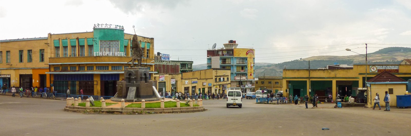
Beside the 17th-century castles of Fasil Ghebbi, Italian planners laid out a modernist piazza district in five years of occupation. It remains the most recognisable Italian-era ensemble in Ethiopia, and the empire ended here in November 1941.
At a glance
Italian troops entered Gondar on 1 April 1936, and the old imperial city became the capital of the Amhara governorate of Italian East Africa. The Florentine architect Gherardo Bosio (1903–1941) drew its master plan in 1936–37, together with plans for Jimma and Dessié. Only fragments were built: a new commercial and civic district north-east of the castle compound, known since as the “piazza”, with post office, cinema and offices in the simplified modernist manner of the 1930s. Within two years roughly 2,000 Europeans had settled in the town. In November 1941 Gondar was the last stand of Italian forces in East Africa; the surrender of General Guglielmo Nasi on 27 November ended the five-year empire.
Key facts
- Occupied: 1 April 1936; capital of the Amhara governorate of Italian East Africa
- Planner: Gherardo Bosio (1903–1941), master plan 1936–37; he also planned Jimma and Dessié, and later applied the same method in Tirana
- Built: the “piazza” retail and civic district beside the castle compound — post office, cinema, offices — plus roads toward Gojjam and Eritrea and an airstrip at Azezo
- Settlers: about 2,000 Europeans in Gondar within two years; about 11,200 Italians in the governorate by 1940
- End: Battle of Gondar, 13–27 November 1941 — the last stand of Italian forces in Italian East Africa
- Setting: at 2,133 m in the Ethiopian highlands, beside the UNESCO-listed Fasil Ghebbi castle compound
History
The context, stated plainly: Gondar’s Italian district is the product of a military occupation. Italy invaded Ethiopia in 1935–36 in a war of conquest, and its rule was never secure; the record of the Amhara governorate itself notes continuous armed resistance around Lake Tana and southern Gojjam through the entire period. The buildings described here belong to those five years, and they are documented as heritage, not celebrated.
Bosio’s plan treated Gondar as a “future city of the empire”: a European administrative and commercial centre set apart from, and above, the existing town. What was actually built was a fraction of the drawings — the piazza district north-east of the castles, a central road linking the Italian quarters with the Ethiopian merchant quarter and the Saturday market, a mosque with minaret by the market, roads out toward Gojjam and Eritrea, an airstrip at Azezo. The architecture came in the stripped, curved-cornered Moderne of the late 1930s, provincial cousin of what the same administration was building at far greater scale in Asmara.
The end came through the town. By late 1941 Gondar was the last Italian holdout in East Africa, held by General Guglielmo Nasi with some 41,000 troops. The final battle ran from 13 to 27 November 1941; once Allied and Ethiopian forces gained the heights over the town and broke in, Nasi surrendered, and the last outposts gave up by 30 November. Italian East Africa ended at Gondar. The piazza stayed on as the commercial heart of the growing city.
What you see
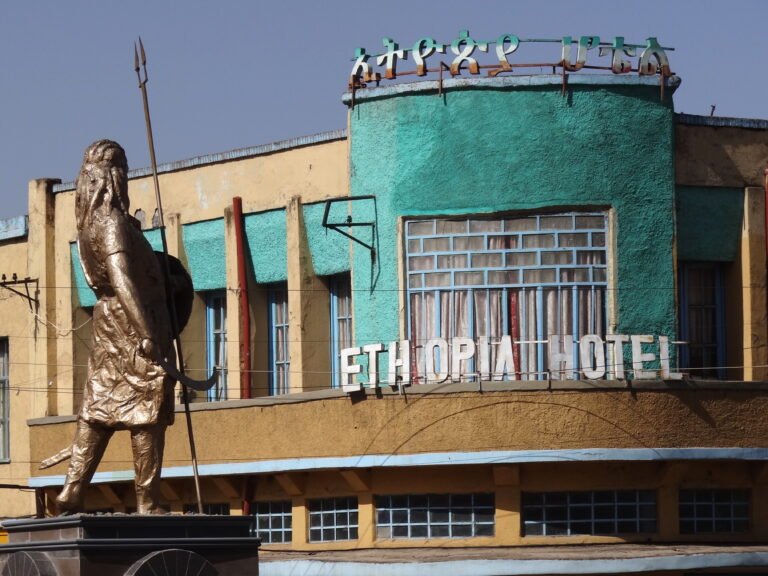
Downtown Gondar still reads as a 1930s ensemble: low commercial blocks with curved corners, horizontal string-courses and painted stucco fronts, gathered around the piazza and its roundabout. The Ethiopia Hotel, its rounded bay rising over the square in green and ochre, is the most photographed of the group; post office, cinema and office buildings carry the same simplified Moderne vocabulary. It is an architecture of modest means, and that is part of its interest: an imperial capital built in a hurry, at 2,100 metres, out of render and paint.
The sharpest experience is the walk between the two Gondars. Five minutes separate the stone towers of Fasil Ghebbi, raised by Emperor Fasilides in the seventeenth century, from the stucco curves of the piazza; the juxtaposition of the two — castle compound and colonial Moderne — is found nowhere else in Africa in such proximity.
Practical information
- The Italian-era district is Gondar’s downtown around the piazza; it is public street space, freely walkable at any hour.
- Most visitors come for Fasil Ghebbi and the Simien Mountains; allow an extra half-day for the 1930s ensemble.
- The buildings remain in everyday use as hotels, shops and offices; view them from the street.
Getting there
Gondar lies in the Amhara Region of northern Ethiopia, at 2,133 metres in the highlands north of Lake Tana. The airport is at Azezo, just south of the city, on the site first laid out as an airstrip in the late 1930s. GPS (piazza area): 12.61037, 37.46677 · Open in Google Maps.
Related places and reading
- Italian East Africa: Plans, Roads and the Short, Violent Empire in Ethiopia — the wider frame
- Asmara — the modernist capital the AOI’s builders took as their model
- Massawa — the Red Sea port of Italian Eritrea
Sources
- English Wikipedia, “Gondar” (occupation timeline, the piazza district, settler numbers, downtown’s Italian Moderne character).
- English Wikipedia, “Battle of Gondar” (13–27 November 1941, General Nasi, last stand of Italian forces in the AOI).
- English Wikipedia, “Amhara Governorate” (capital status, settler figures 1940, armed resistance around Lake Tana and Gojjam).
- Italian Wikipedia, “Gherardo Bosio” (master plans for Gondar, Jimma and Dessié, 1936–37).
- OpenStreetMap Nominatim (coordinates).
Find it on the map
See this place and what’s around it →Record researched and written by Luigi De Marchi for Cultural Heritage Online, 2026.
📷 Become a Cultural Heritage Online photographer
Share your photos of places: they stay published under your name as the author. The more they're seen, the more you get noticed — and soon a contest will reward the most appreciated photos.
Log in or sign up free to add a photo