
A Lunar Landscape on Earth
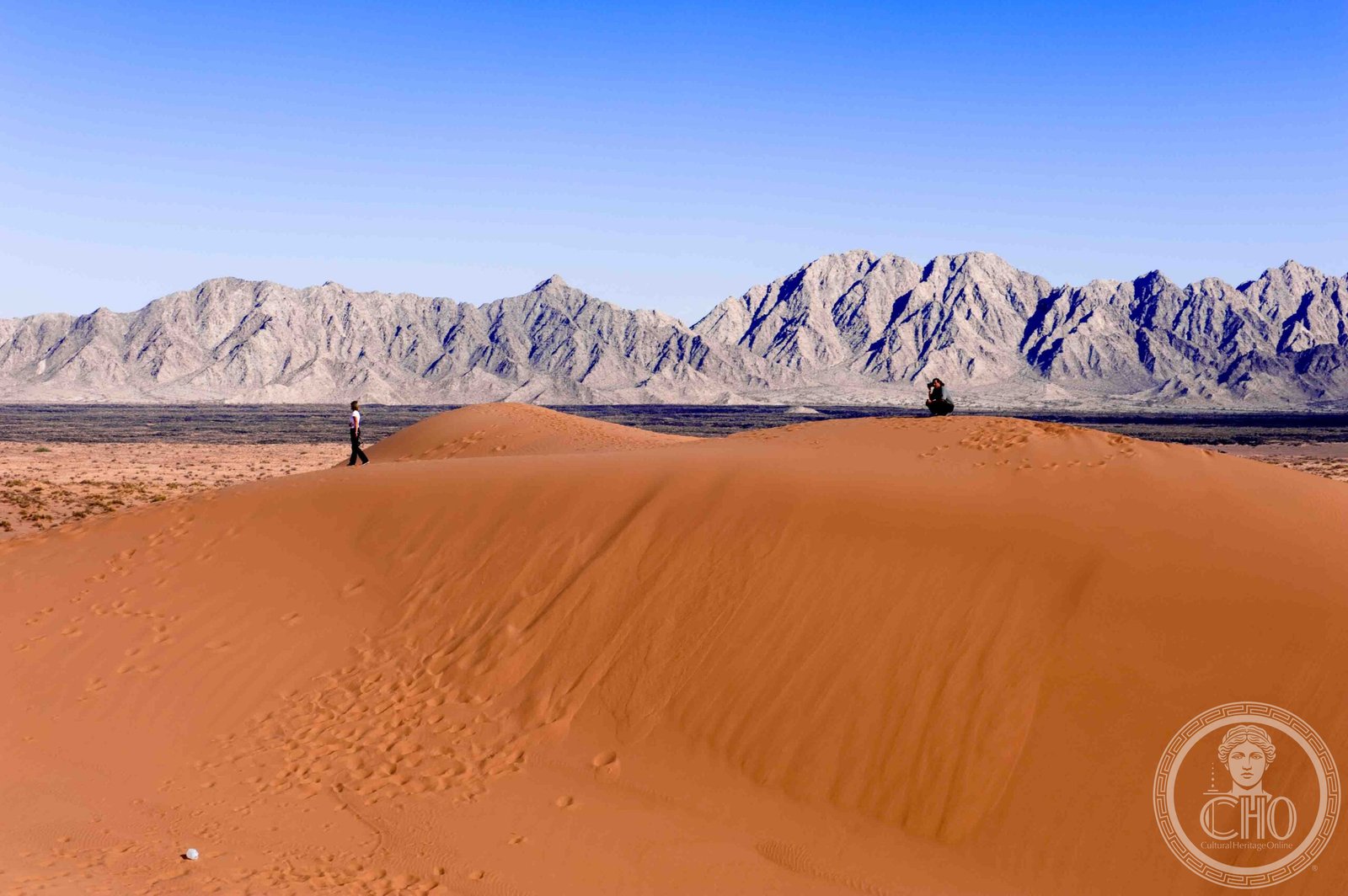
In the northwest corner of Mexico's Sonora state, where the US border meets the Gulf of California, two extraordinary geological phenomena converge: the volcanic shield and crater field of El Pinacate, and the vast sand sea of the Gran Desierto de Altar. Together they form a 714,000-hectare Biosphere Reserve that UNESCO recognised in 2013 as a natural World Heritage Site — a landscape so alien in appearance that NASA chose it as a training ground for Apollo astronauts preparing for their lunar missions in the late 1960s.
Volcanic Geology of El Pinacate
El Pinacate is built on a basaltic shield volcano, its dark surface studded with approximately 400 volcanic vents, cinder cones, and lava flows created over the past 4 million years. The most dramatic features are ten large maar craters — phreatomagmatic explosion pits formed when rising magma hit groundwater — some of which measure up to 1.6 kilometres in diameter and descend more than 100 metres below the surrounding plain. The black basalt contrasts starkly with the surrounding pale desert to create a landscape of exceptional visual drama.
The Gran Desierto de Altar: North America's Greatest Sand Sea
To the west of El Pinacate lies the Gran Desierto de Altar, the only true erg (active sand sea) in North America. Covering around 5,700 square kilometres, it consists of four distinct dune systems — star dunes, linear dunes, transverse dunes, and dome dunes — generated by the interplay of prevailing winds from different compass points. Some dunes exceed 200 metres in height. The sand originates primarily from the Colorado River delta and has been transported and reworked by wind over hundreds of thousands of years.
Sonoran Desert Biodiversity
Despite its extreme aridity — average annual rainfall is below 80 mm — the reserve supports a remarkable variety of Sonoran Desert life. The iconic saguaro cactus (Carnegiea gigantea) dominates the foothills and bajadas of El Pinacate, reaching up to 15 metres in height and living for 150 years. The reserve is home to pronghorn antelope, desert bighorn sheep, coyote, Gila woodpecker, elf owl, and multiple rattlesnake species. The endemic Sonoran pronghorn subspecies (Antilocapra americana sonoriensis) is critically endangered, with the reserve providing one of its last refugia.
Desert Plants: Masters of Water Economy
The flora of El Pinacate and the Gran Desierto includes over 500 plant species adapted to extreme heat and aridity through an array of physiological strategies. Succulent cacti store water in swollen stems; drought-deciduous shrubs shed leaves during dry periods; ephemerals complete their entire life cycle in the brief weeks following rare rains. The ocotillo, brittlebush, ironwood, and blue palo verde are among the characteristic species that create the characteristic visual texture of Sonoran Desert vegetation.
Archaeological Presence: The Tohono O'odham and Earlier Peoples
Archaeological evidence indicates human presence in the area dating back at least 11,000 years. The Tohono O'odham (formerly called Papago) people historically used the desert for seasonal hunting and gathering, and consider parts of El Pinacate sacred. Petroglyphs, stone tool scatters, and sleeping circles left by earlier peoples are found throughout the volcanic terrain. The biosphere reserve management includes provisions to protect these cultural sites and to respect the continuing spiritual relationship of Indigenous communities with the landscape.
Border Conservation Challenges
The reserve abuts the US border and connects with the Cabeza Prieta National Wildlife Refuge and the Barry M. Goldwater Air Force Range on the Arizona side, forming part of one of the largest contiguous desert conservation areas in North America. However, increased border enforcement infrastructure — vehicle barriers, lighting, and access roads — has fragmented wildlife corridors and disrupted seasonal animal movements, particularly for desert bighorn and Sonoran pronghorn. Binational conservation cooperation between Mexico and the United States is ongoing but complicated by immigration enforcement priorities.
Visitor Experience and Access
The reserve is accessed primarily from Puerto Peñasco (Rocky Point), a coastal city in Sonora roughly two hours south of the Arizona border at Lukeville. A paved road leads to the park entrance; most interior exploration requires high-clearance four-wheel-drive vehicles. Key visitor sites include the El Tecolote maar crater viewpoint, the lava tube caves, and the El Pinacate summit trail, which offers panoramic views over both volcanic fields and dunes. The reserve receives relatively few international visitors, making it an uncrowded destination for lovers of extreme desert landscapes.
Find it on the map
See this place and what’s around it →📷 Become a Cultural Heritage Online photographer
Share your photos of places: they stay published under your name as the author. The more they're seen, the more you get noticed — and soon a contest will reward the most appreciated photos.
Log in or sign up free to add a photo