Parco Nazionale W del Niger (sito naturale): la savana e la foresta riparia sul confine di tre paesi africani
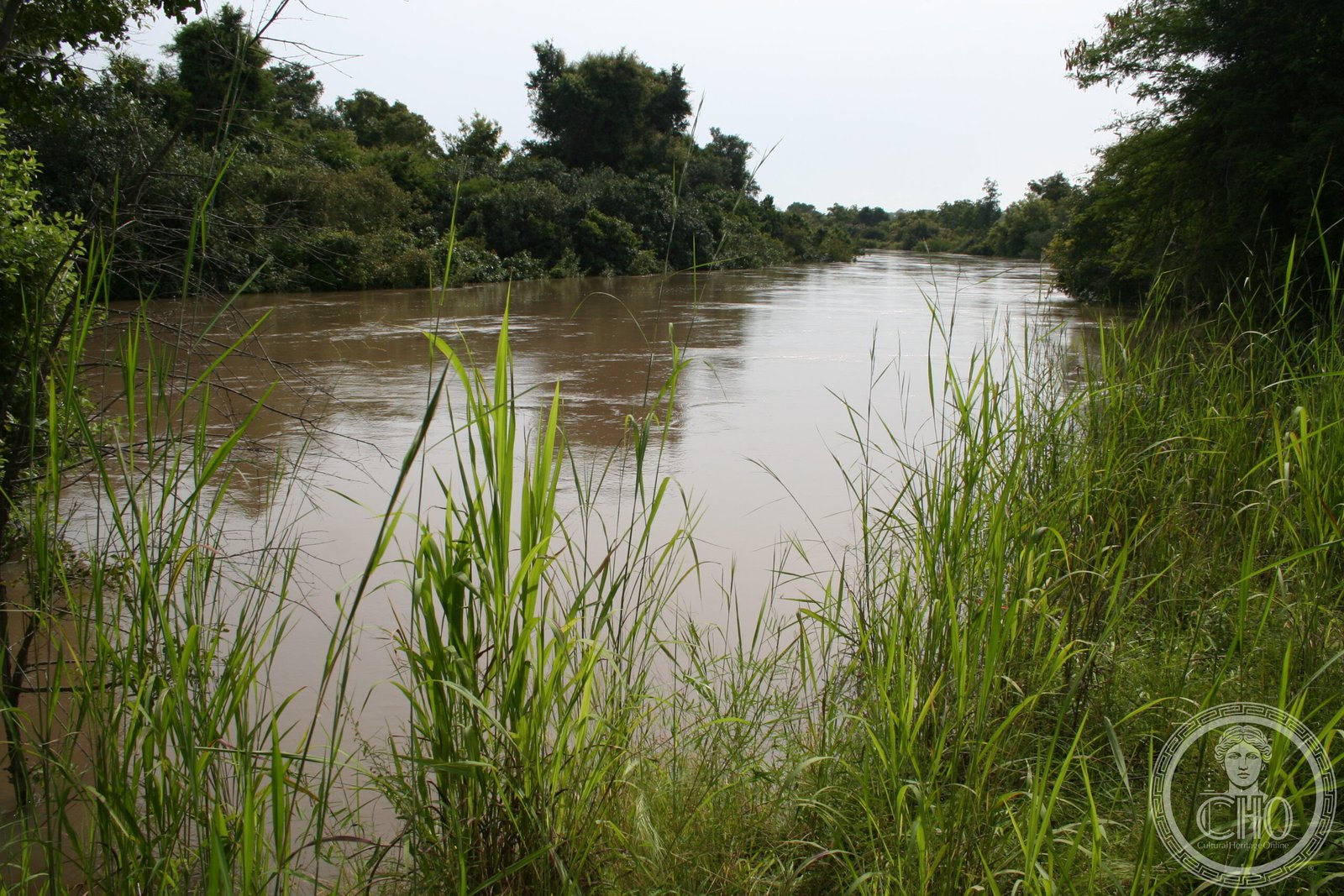
Dove il Niger, il Burkina Faso e il Benin si incontrano in un nodo di confini africani, il fiume Niger traccia una serie di anse a forma di W che hanno dato il nome a uno dei più importanti parchi naturali dell’Africa occidentale. Il Parco W del Niger — parte di un complesso transfrontaliero di quasi 10.000 km² insieme a Arli (Burkina) e Pendjari (Benin) — copre 3.300 km² di savana sudaniana, foresta-galleria e zone umide del Niger. Un ecosistema di frontiera dove il leone affianca il licaone dipinto, e gli elefanti migrano stagionalmente attraverso i confini nazionali ignorando la geopolitica. Patrimonio UNESCO dal 1996.
At a glance
W National Park in south-western Niger is a protected area of approximately 3,300 km² named for the distinctive W-shaped bend of the Niger River along its southern boundary. UNESCO inscribed it in 1996 (ref. 749bis) as part of the W-Arli-Pendjari (WAP) Transboundary Complex, a contiguous ecosystem covering nearly 10,000 km² across Niger, Burkina Faso and Benin. The park protects Sudano-Sahelian savanna, gallery forest and floodplain habitat, and is one of the most important wildlife refuges in West Africa, with populations of lions, African wild dogs, elephants, hippopotamuses, cheetahs and leopards.
Key facts
- UNESCO: World Heritage since 1996 (W National Park of Niger, ref. 749bis)
- Area: 3,300 km² (Niger sector); WAP Complex total approximately 10,000 km²
- Mammals: lions, African wild dogs (one of West Africa’s last populations), cheetahs, leopards, elephants, hippos, roan antelope, kob, hartebeest, warthog
- Named after: the W-shaped double bend of the Niger River at the park’s southern edge
- Trans-boundary: shares ecosystem with Arli National Park (Burkina Faso) and Pendjari National Park (Benin)
- River: the Mekrou River flows through the park to the Niger; critical dry-season wildlife corridor
History
The W region has been inhabited by the Dendi, Gourmantché and Peulh (Fulani) peoples for centuries. The French colonial administration established hunting reserves in the 1920s; the W reserve was created in 1954 and upgraded to a national park in 1976. UNESCO inscription in 1996 recognised both the Niger sector and its importance within the broader WAP ecosystem.
The park has faced persistent challenges from poaching, pastoral encroachment and human-wildlife conflict. In the 2010s and 2020s, security concerns in the Sahel region (related to armed groups operating across the Niger-Burkina-Benin border zone) severely restricted access to the park for tourists and even for conservation staff. Despite these challenges, the core wildlife populations — including lions and African wild dogs — have shown resilience.
What you see
The W Park landscape alternates between wide open savanna (ideal for long-range wildlife spotting), dense gallery forest along the Mekrou and Niger rivers (where hippos, waterbuck and buffalo concentrate), and rocky outcrops (inselbergs) that provide lion denning sites. The W-shaped bend of the Niger River, visible from high ground, is one of the most distinctive geographical features in West Africa.
Wildlife sightings are best in the dry season (November–April), when animals concentrate on the riverside. African wild dogs — arguably the hardest of Africa’s megafauna to see — have been documented in the WAP complex but require specialist tracking.
Practical information
- Security: check current FCO/State Department travel advisories for the Niger-Burkina-Benin border zone before visiting
- Base: Dosso (Niger) is the nearest major town; limited accommodation at La Tapoa lodge inside the park (when accessible)
- Best time: December–March (dry season; wildlife concentrated at water; roads passable)
- Alternative access: the Benin sector (Pendjari NP) is generally more accessible and has established tourist infrastructure
Getting there
From Niamey (Niger capital): drive south via Dosso (140 km) to the park entrance at La Tapoa. Alternatively, approach from Natitingou (Benin) through Pendjari National Park. GPS: 12.35° N, 2.36° E.
Nearby
- Pendjari National Park (Benin) — the best-managed part of the WAP complex; more accessible to tourists; excellent lion viewing
- Arli National Park (Burkina Faso) — the northern sector of the WAP complex
- Niamey — the Niger capital on the Niger River, with the Grand Marché and the National Museum of Niger
Sources
- UNESCO World Heritage Centre — “W National Park of Niger” (ref. 749bis)
- IUCN — WAP Transboundary Complex assessment
- Encyclopaedia Britannica — Niger River
Find it on the map
See this place and what’s around it →📷 Diventa un fotografo di Cultural Heritage Online
Condividi le tue foto dei luoghi: restano pubblicate con la tua firma come autore. Più vengono viste, più ti fai conoscere — e presto un concorso premierà le foto più apprezzate.
Accedi o registrati gratis per aggiungere una foto