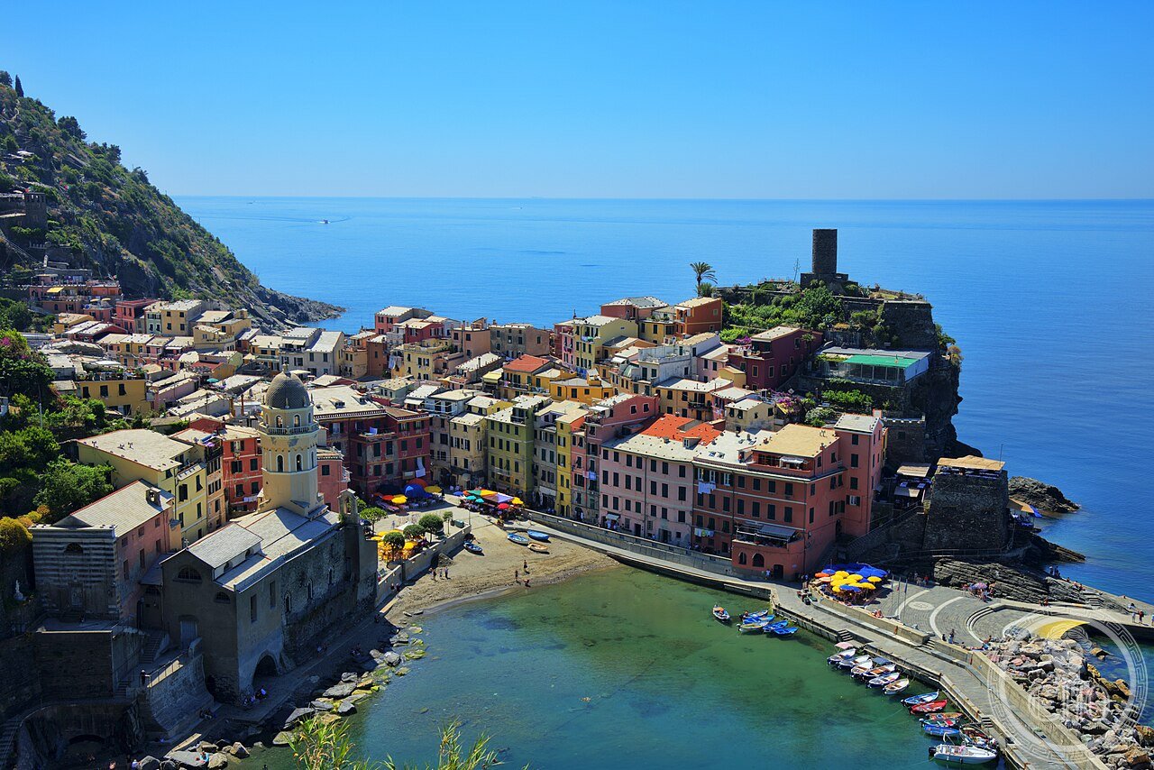
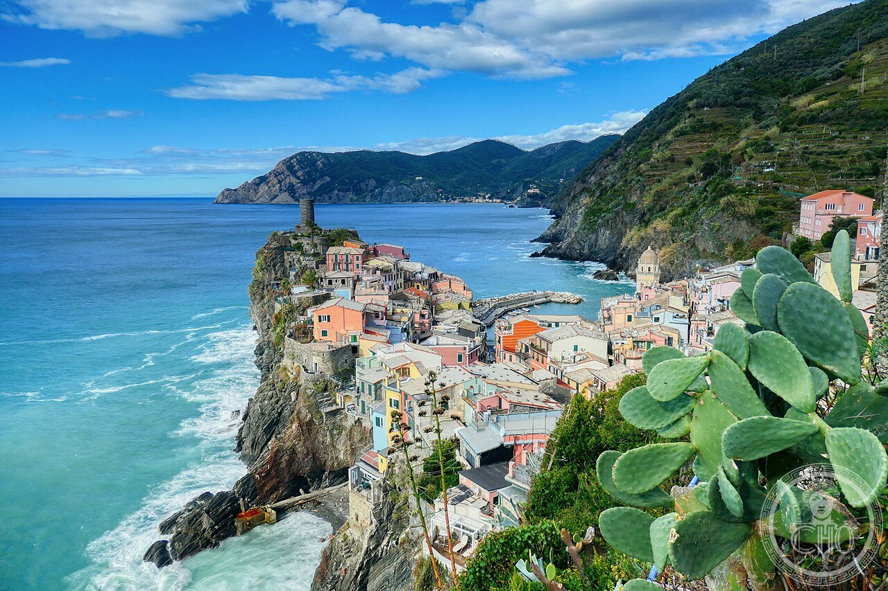
Cinque Terre
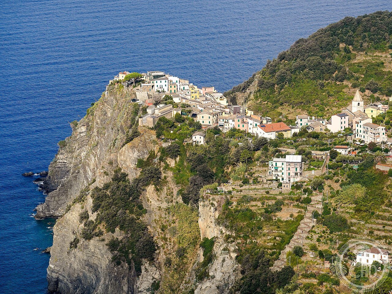
Le Cinque Terre (UNESCO 1997) sono il paesaggio culturale più rappresentativo della Liguria — cinque borghi medievali (Riomaggiore, Manarola, Corniglia, Vernazza, Monterosso) costruiti in verticale su falesie di roccia scura tra il 1000 e il 1400 CE, collegati da 7.000 km di muretti a secco di vigneti terrazzati (la maggiore concentrazione di dry-stone walling al mondo per area) e da sentieri che permettono di attraversare il Parco Nazionale delle Cinque Terre a piedi con viste sul Mar Ligure a 200–400 m di quota.
At a glance
Cinque Terre Sentiero Azzurro (the most precisely Cinque Terre zone Cinque Terre Liguria Italy 44.1019 N 9.7398 E UNESCO WHS 1997 reference 826: the terraced vineyards (the “ciappi” (the Cinque Terre dialect word for the dry-stone-walled terraces): the statistics: 7,000 km of dry-stone retaining walls (the muretti a secco) in the Cinque Terre national park (roughly the area of the Grande Muraglia (21,196 km) divided by 3); the walls were built without mortar (the stones are fitted together by weight and friction); the specific geology: the rock is the “calcari di Bonassola” (the Bonassola limestone): a grey-black metamorphic limestone with interlayers of green schist; the rock is extremely hard and provides long-lasting walls (the oldest intact terraces in Cinque Terre date to the 13th–14th century CE (documented in Genoese tax records of 1309 and 1385 CE)); the maintenance crisis (the maintenance of the walls requires continuous human intervention: walls collapse in winter rainfall without upkeep; the 2020 CE survey counted approximately 30% of the walls as in need of urgent repair; the Cinque Terre National Park funds a restoration programme with funding from the park entrance fee (the “Cinque Terre Card”: €7.50–€18.50 per day depending on season; 90% of the fee goes to trail maintenance and wall restoration))); the wine (the Cinque Terre DOC wines: (1) Cinque Terre Bianco (the white wine of the Cinque Terre: produced from Bosco (minimum 40%), Albarola, and Vermentino grapes; the first DOC: 1973 CE; the characteristic: high acidity, minerality from the slate soils, citrus finish); (2) Sciacchetrà DOC (the raisin wine: Cinque Terre grapes dried on bamboo mats in well-ventilated rooms (the “essiccatoi”) for 3–5 months; the resulting grape loses 40% of its water content; the pressed juice is then fermented and aged for minimum 12 months in 500-litre oak barrels; the result: 17–18% alcohol; 150–200 g/L residual sugar; the production is extremely limited: the total annual production is less than 10,000 bottles; price: €30–€80 per 375 ml bottle (the 375 ml (“half-bottle”) is the traditional Sciacchetrà format))); the Sentiero Azzurro (the Blue Trail: the coastal trail connecting the 5 villages: Riomaggiore–Manarola–Corniglia–Vernazza–Monterosso; total distance: 11.2 km; total ascent: 678 m; the sections: (1) Via dell’Amore (Riomaggiore–Manarola; 1.2 km; reopened 2023 CE after 10-year closure due to rockfall; requires the Cinque Terre Card €10); (2) Manarola–Corniglia (4 km; 3h; the toughest section; 377 steps to climb out of Corniglia; the trail enters olive and lemon groves above the village); (3) Corniglia–Vernazza (4 km; 3h; the most spectacular views: the trail traverses the cliff above the Cantina Sociale at 250 m altitude; the view encompasses all 5 villages in sequence); (4) Vernazza–Monterosso (3 km; 3h; the highest point 240 m; descends to the Monterosso beach)).
Key facts
- La Via dell’Amore: storia, chiusura 2012 e riapertura 2023: the Via dell’Amore history (the Via dell’Amore (the “Path of Love”): the 1.2 km trail between Riomaggiore and Manarola; the route was originally built as a maintenance path for the railway tunnel between the two villages (the tunnel was constructed 1870–78 CE); it was converted to a tourist trail in 1926 CE (the gravel path was paved with concrete slabs and guardrails were added); the naming (the Via dell’Amore name appeared in tourist literature by 1934 CE; it was reportedly given the name because the path could not be seen from either village (no surveillance from parents or family) and was therefore used for courtship by the local population); the closure (1 October 2012 CE: a rockfall (110 tonnes of limestone fell on the path; 4 injuries; the path was closed immediately); the closure lasted 11 years (2012–2023 CE); the reopening (September 2023 CE: €23 million of EU and Italian state funding; the cliff above the path was stabilized with a combination of rock netting (wire mesh panels fixed to the cliff face with bolts), drainage channels (to prevent water accumulation that causes freeze-thaw expansion), and a continuous rockfall barrier (an energy-absorbing steel net running the full 1.2 km length of the path at a distance of 2–3 m from the cliff face)); the current access (2026 CE: open daily; entry requires the Cinque Terre Card €10 (in addition to the general park card); maximum 150 visitors per hour are allowed on the path (a counter system controls entry at both ends); the most popular time: 10 AM–2 PM; the best light time: 7–9 AM (golden hour from the Riomaggiore end) and 5–7 PM (sunset from the Manarola end)))
- GPS (Riomaggiore, stazione): 44.0994° N, 9.7375° E
History
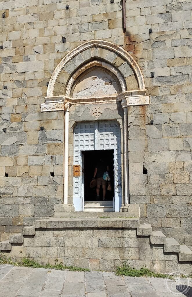
Dai Genovesi ai pescatori ai vigneti al turismo di massa all’UNESCO 1997 (the most precisely Cinque Terre zone history: the medieval origin (the 5 villages were founded between the 9th and 13th centuries CE: Riomaggiore (the oldest: documented 1080 CE; the name from “Rivus Major” (the large stream); the founding families were farmers from the inland Ligurian hills who moved to the coast for fishing); Manarola (documented 1338 CE; the name from Ligurian “mannara” (a shepherd’s stick)); Corniglia (the only one not on the sea; it stands on a spur of rock 100 m above the coastline; accessible from the Cinque Terre Card trail via 365 steps called the “Lardarina”; or by shuttle bus); Vernazza (the most famous: the natural harbor (the only safe harbor in the 5 villages); the Genoese castle (the Castello Doria: 12th century CE; used to defend against Saracen pirates)); Monterosso (the largest; the oldest: documented 643 CE in a charter of the Bishop of Luni)); the Genoese period (the Cinque Terre were part of the Republic of Genoa from the 11th century CE to 1797 CE (the French Revolutionary annexation): the Genoese used the 5 villages primarily as a naval supply base (the wines and anchovies of the Cinque Terre provisioned the Genoese fleet)); the railway revolution (1874 CE: the Genova-La Spezia railway line was completed; the railway tunnel through the Cinque Terre coast connected the 5 villages for the first time to the Italian rail network; before 1874 CE the only land connection between the villages was the mule tracks (the sentieri) that are now the tourist trails; the specific consequence: the railway removed the isolation of the villages but the cliffs prevented any road connection (the first road access for motor vehicles was not built until 1965 CE); the combination of railway access + no roads meant that the Cinque Terre developed as a tourist destination accessible only by train or boat until the 1970s CE)); 1997 CE UNESCO inscription reference 826.
What you see
I cinque borghi, il Sentiero Azzurro, i vigneti, la Via dell’Amore, lo Sciacchetrà (the most precisely Cinque Terre zone visit (2–3 days minimum for all 5 villages): the base town strategy (the best bases: Vernazza (the most central; the natural harbor; the best restaurant strip; the most “authentic” village as the only one with a natural harbor); Monterosso (the largest; the only sandy beach; the only supermarket; the best accommodation variety; the least “authentic” but the most comfortable); the Cinque Terre Card (the card is required to walk the Sentiero Azzurro: €7.50 (basic; trails only) or €18.50 (full; trails + train); the train (Cinque Terre Express: runs every 30 min between La Spezia and Levanto; stops at all 5 villages; single €1.60; day pass included in the Cinque Terre Card €18.50)); the best season (April–May: warm (18–22°C), not crowded; the terraces are green and flowering; June–September: peak season (the villages are extremely crowded 10 AM–5 PM; visit early morning or evening; the sea is warm for swimming); October: vendemmia (grape harvest) season; the Sciacchetrà grapes are dried; wine tastings at the Cantina Sociale Cinque Terre (Via Roma 2, Vernazza)); the anchovies (the “alice” (the anchovy of Monterosso: Engraulis encrasicolus; the Ligurian Sea is one of 3 areas in the Mediterranean where anchovies are taken by the palamitara net (a specific fixed-net technique); the salt-cured Monterosso anchovies (the “acciughe sotto sale di Monterosso”) are a Slow Food Presidium: the fish are caught June–July, gut-cleaned, layered with sea salt in clay pots (the “giare”), and matured for minimum 6 months)).
Practical information
- Come comprare la Cinque Terre Card e gestire l’affollamento estivo: la Cinque Terre Card (acquisto: online a card.parconazionale5terre.it (raccomandata: evita le code alle macchinette in stazione); oppure agli sportelli del Parco Nazionale a Riomaggiore, Manarola, Corniglia, Vernazza, Monterosso, La Spezia Centrale; prezzi: €7.50 Trekking (sentieri senza treno) + €1.60/tratta; €18.50 Trekking+Treno (illimitato su Cinque Terre Express 1 giorno)); la gestione folla (luglio-agosto i borghi raggiungono il limite fisico di persone tra le 10 e le 17; la soluzione: dormire nelle Cinque Terre (le pensioni e i B&B riducono il budget giornaliero del 30% rispetto a La Spezia o Pisa) e iniziare a camminare alle 7:30 AM; in alternativa, visitare via battello (il servizio battello La Spezia Navigazione Golfo dei Poeti: €28 tutto il giorno; accesso dai moli al livello del mare nei borghi senza code); l’alternativa meno nota: Portovenere (inclusa nella stessa iscrizione UNESCO rif. 826; 15 min da La Spezia in battello; 5.000 abitanti vs 2 milioni visitatori/anno delle Cinque Terre))
Getting there
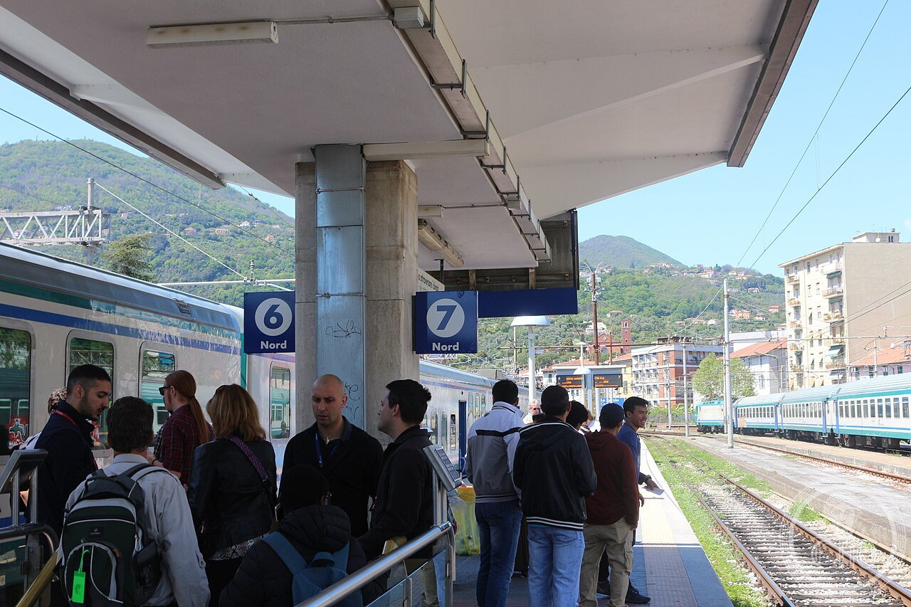
Trenitalia da Genova (1h30, €12, ogni 30 min) o da Pisa (1h, €10, ogni 30 min) fino a La Spezia Centrale, poi Cinque Terre Express (ogni 30 min, incluso nel Card €18.50 o €1.60/tratta). GPS Riomaggiore stazione: 44.0994, 9.7375.
Nearby
- Portovenere e Isole Palmaria-Tino-Tinetto — 15 km sud (incluse nella WHS UNESCO rif. 826; battello da La Spezia 20 min €12 a/r; la Grotta di Lord Byron; la Chiesa di San Pietro 1277; la Darsena dei Pescatori)
- Carrara: Cave di Marmo — 30 km est (il marmo di Michelangelo, Bernini e Canova; tour cave da Carrara centro; Trenitalia da La Spezia 25 min €4.10; il Museo del Marmo (via XX Settembre 85, ingresso €5.50))
Gallery
Sources
- Wikipedia, Cinque Terre; Via dell’Amore; Vernazza; Sciacchetrà, accessed June 2026
- UNESCO, Portovenere, Cinque Terre, and the Islands (Palmaria, Tino and Tinetto), WHS reference 826, inscribed 1997
- Parco Nazionale delle Cinque Terre, Piano del Parco 2021 (the dry-stone wall statistics are from the official park management plan)
Find it on the map
See this place and what’s around it →📷 Diventa un fotografo di Cultural Heritage Online
Condividi le tue foto dei luoghi: restano pubblicate con la tua firma come autore. Più vengono viste, più ti fai conoscere — e presto un concorso premierà le foto più apprezzate.
Accedi o registrati gratis per aggiungere una foto