
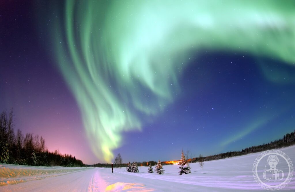
Iceland lies where the Mid-Atlantic Ridge breaks the surface of the ocean, a slow tear between two continents that shapes everything above it. Long winter nights bring the aurora borealis, while the Golden Circle route gathers the island’s geothermal violence and its oldest institutions into a single day’s drive from Reykjavik.
At a glance
Iceland sits directly on the Mid-Atlantic Ridge, the only place on Earth where this undersea mountain chain rises above the waves. The North American and Eurasian plates are pulling apart here at roughly 2.5 centimetres a year, so the island is, in a literal sense, growing wider with time.
Geothermal energy heats the great majority of Icelandic homes, and the national electricity supply comes entirely from renewable sources, chiefly hydropower and geothermal plants. Icelandic itself has changed so little since the twelfth century that modern speakers can still read the medieval sagas without great difficulty.
Key facts
- Aurora season: dark nights are essential, so October to February offer the best statistical chance; viewing improves well away from Reykjavik’s lights.
- Þingvellir: the Althing, Iceland’s parliament, was established here in 930 CE and is considered the oldest continuously functioning parliament in the world; the Almannagjá fault marks the visible rift between the two tectonic plates.
- Geysir and Strokkur: the word ‘geyser’ comes from Geysir itself, which now erupts only rarely; the nearby Strokkur erupts every few minutes to a considerable height.
- Gullfoss: the ‘Golden Falls’ drop in two stages and regularly throw up rainbows in their spray.
- World Heritage status: Þingvellir National Park was inscribed by UNESCO in 2004; Vatnajökull National Park followed in 2019.
History
Norse settlement is traditionally dated to the ninth century, with Ingólfur Arnarson credited as the first permanent settler. The Landnámabók, the Book of Settlements, records several hundred early Norse settlers and their landholdings, though Irish monks may already have been living on the island before their arrival.
The Icelandic sagas, prose narratives composed between the twelfth and fourteenth centuries, preserve much of this early history, including the Vinland Sagas describing Leif Erikson’s voyage from Iceland to North America around the year 1000, long before Columbus crossed the Atlantic.
Iceland’s volcanic character has repeatedly shaped its history: the Laki eruption of 1783 killed a quarter of the population and affected the climate across Europe, and the 2010 eruption of Eyjafjallajökull grounded air traffic across the continent for days.
What you see
The Golden Circle is a loop of roughly 300 kilometres from Reykjavik taking in Þingvellir, Geysir, Gullfoss and the volcanic crater lake at Kerið. At Þingvellir the rift between the continents is visible as a dramatic canyon, and divers and snorkellers come to the glacial-fed Silfra fissure for its exceptional underwater clarity.
The Blue Lagoon, a geothermal spa set in a lava field near Keflavik, owes its milky blue colour to dissolved silica and stays warm throughout the year; advance booking through its own channels is advisable. Further along the south coast, the black sands of Reynisfjara and the waterfall at Skógafoss, where a rainbow in the spray is almost guaranteed, extend the day’s circuit.
Practical information
- Airport transfer: Keflavik International Airport lies about 50 km from Reykjavik, reached by the Fly Bus service or by rental car.
- Ring Road: Route 1 circles the entire island over roughly 1,332 km; travellers typically allow one to two weeks to cover it properly.
- Aurora forecasting: the Icelandic Met Office, Veðurstofa, publishes a short-range aurora forecast that is worth checking before heading out after dark.
- Wildlife timing: puffins are present at coastal colonies such as the Westman Islands between spring and late summer only.
Getting there
Keflavik International Airport, around 50 km from Reykjavik, is the main gateway to Iceland, with connections from several European and North American cities; check current schedules with individual airlines. From Reykjavik, a hired car gives the most flexibility for the Golden Circle and the Ring Road, though organised coach transfers also run to the main sights.
Nearby
- Þingvellir National Park — about 50 km east of Reykjavik; the rift valley, the Althing site and the Silfra fissure for snorkelling in glacial water.
- Snæfellsjökull National Park — about 180 km northwest of Reykjavik; the glacier that opens Jules Verne’s Journey to the Centre of the Earth, and Kirkjufell mountain, known from television filming.
- Faroe Islands — roughly 420 km southeast of Iceland; eighteen islands with sea cliffs, puffin colonies and turf-roofed houses, and the Sørvágsvatn lake, which appears to hover above the ocean; the islands are not inscribed as a UNESCO World Heritage Site.
Sources
- Icelandic Met Office (Veðurstofa)
- UNESCO, Þingvellir National Park, World Heritage reference 1152, inscribed 2004
- UNESCO, Vatnajökull National Park, World Heritage reference 1604, inscribed 2019
- William Morris, Journals of Travel in Iceland 1871 and 1873, Longmans, 1911
Find it on the map
See this place and what’s around it →📷 Become a Cultural Heritage Online photographer
Share your photos of places: they stay published under your name as the author. The more they're seen, the more you get noticed — and soon a contest will reward the most appreciated photos.
Log in or sign up free to add a photo