Baptism Site of Jesus — Bethany Beyond the Jordan (Al-Maghtas)
The east-bank site where John the Baptist baptised Jesus, recognised as Bethany Beyond the Jordan, preserves at least twenty successive religious structures across eight centuries of Christian pilgrimage and monastic life.
At a glance
Known in Arabic as Al-Maghtas (“the baptism”), this UNESCO World Heritage Site (2015) on the east bank of the Jordan River has been identified through Byzantine pilgrim accounts and archaeological excavation as Bethany Beyond the Jordan — the site named in the Gospel of John (1:28) as the place where Jesus was baptised by John. Systematic excavation since 1996 has uncovered at least 20 successive religious structures spanning the 1st century BCE through the 8th century CE: baptismal pools, churches, monasteries, and hermit caves cut into the marl hillside. The hill above the river, Tell Mar Elias (Elijah’s Hill), preserves the ruins of a Byzantine church complex and is also venerated as the site of the prophet Elijah’s ascent to heaven, anchoring a further layer of Old Testament sacred geography to the location.
Key facts
- UNESCO inscription: 2015 (World Heritage Site)
- Period: c. 1st century BCE – 8th century CE
- Location: Al-Karama, Balqa Governorate, Jordan (east bank of the Jordan River)
- Structures: At least 20 successive religious buildings identified by excavation
- Key features: Baptism pools, Byzantine churches, hermit caves, Tell Mar Elias
- Pilgrimage: Active since at least the 4th century CE; papal visits in 2000 and 2009
- Visitor numbers: Hundreds of thousands annually
History
The Gospels name “Bethany beyond the Jordan” as the place where John the Baptist was active and baptised Jesus (John 1:28), clearly distinguishing it from Bethany near Jerusalem. Byzantine pilgrims were already marking and visiting this location by the 4th century CE, constructing the first of a series of churches and monasteries that would accumulate over the following four centuries. By the 6th century a major pilgrimage complex existed here, well-documented in the Madaba Map mosaic (c. 560 CE), which depicts the site with detail comparable to its depiction of Jerusalem. The site entered disuse following the contraction of Byzantine infrastructure in the 7th-8th centuries and was lost to active Christian memory until Jordanian and international archaeological teams, working in the new political context created by the 1994 Jordan-Israel peace treaty, identified and excavated it from 1996 onward. The stratified sequence of buildings, pools, and sacred landscape features confirmed the Byzantine identification.
What you see
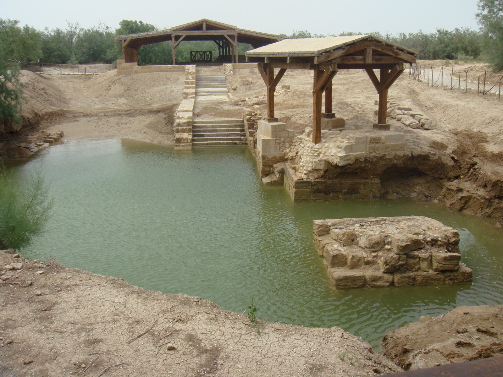
The site comprises two main areas connected by a path through the Jordan Valley scrubland. At the level of the river, rectangular stone-lined baptismal pools fed by freshwater springs from the Wadi Kharrar are surrounded by the layered remains of successive churches and chapels, the earliest of which may date to the 1st century CE. The pools are integrated into each successive building’s architecture, preserving a clear visual record of the site’s accumulating sacredness.
On the upper hill, Tell Mar Elias, the ruins of a large Byzantine church include mosaic floor fragments, a baptistery with a cross-shaped font, and the outline of a colonnaded nave. Hermit caves cut into the soft marl are accessible and convey the character of the monastic communities that served pilgrims here. A descent to the Jordan River itself is possible at a designated baptism point, where many visitors and pilgrims renew their baptismal vows.
Practical information
- Opening hours: Daily 08:00–18:00 (summer); 08:00–16:00 (winter)
- Entry: Fee applies; guided tour compulsory, available in English, Arabic, and other languages
- Facilities: Visitor centre, café, gift shop, changing rooms for baptism ceremonies, white robes for hire
- Accessibility: Paved and wheelchair-accessible paths to most areas
- Photography: Permitted throughout the site
Getting there
The site lies approximately 50 km west of Amman and 10 km north of the Dead Sea shore. From Amman, take the Desert Highway south and follow signs toward Karameh and Al-Maghtas; the site is clearly signposted from the main road. No regular public bus service reaches the site; JETT buses run from Amman to the Dead Sea area, from which a taxi covers the remaining 10 km. Most visitors combine the Baptism Site with the Dead Sea (10 km south) and Mount Nebo (20 km northeast) in a single day trip from Amman.
Nearby
- Dead Sea — the lowest point on Earth; approximately 10 km south
- Mount Nebo — biblical viewpoint; Byzantine Memorial Church of Moses with mosaic floors; approximately 20 km northeast
- Madaba — the City of Mosaics; Church of Saint George with the Madaba Map; approximately 30 km northeast
- Umm ar-Rasas — UNESCO WHS with the world’s largest late antique mosaic map; approximately 50 km southeast
Sources
- UNESCO World Heritage List, “Baptism Site ‘Bethany Beyond the Jordan’ (Al-Maghtas)” — whc.unesco.org/en/list/1446
- Wikipedia, “Al-Maghtas” — en.wikipedia.org/wiki/Al-Maghtas
- Waheeb, M. The Baptism Site of Jesus Christ. Royal Commission for the Baptism Site, Amman, 2001.
Find it on the map
See this place and what’s around it →📷 Diventa un fotografo di Cultural Heritage Online
Condividi le tue foto dei luoghi: restano pubblicate con la tua firma come autore. Più vengono viste, più ti fai conoscere — e presto un concorso premierà le foto più apprezzate.
Accedi o registrati gratis per aggiungere una foto