
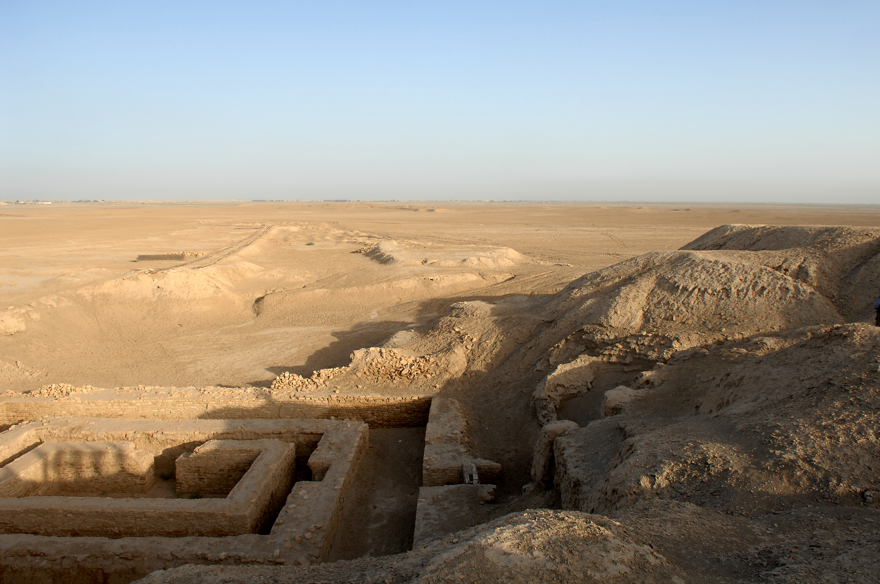
The world’s first true city. Uruk rose to dominance during Sumer’s early urbanization and may have sheltered 90,000 people at its peak—an unprecedented concentration of power, administration, and culture in the ancient world.
At a glance
Uruk, today known as Warka, is an ancient Near Eastern city that defines the Uruk period and stands as evidence of humanity’s first large-scale urban experiment. Located on a dried channel of the Euphrates in central Iraq, the archaeological site preserves layers of development spanning more than three millennia—from the mid-4th millennium BC until its abandonment in the early Islamic period.
History
At its peak around 3100 BC, Uruk may have housed up to 50,000 residents, with 80,000–90,000 people in its surrounding region, making it the largest urban area on Earth. The city led Sumer’s transformation from scattered settlements into organized civilization. According to the Sumerian King List, Gilgamesh ruled Uruk in the 27th century BC—a figure later immortalized in the epic bearing his name.
Uruk’s dominance waned with the rise of the Akkadian Empire after the Early Dynastic period. Yet the city endured, experiencing renewed prosperity during the Isin-Larsa period, the Neo-Assyrian and Neo-Babylonian eras, and throughout the Achaemenid (550–330 BC), Seleucid (312–63 BC), and Parthian (227 BC–AD 224) periods. Final abandonment came shortly before or after the Islamic conquest of 633–638.
What you see
The archaeological record at Warka reveals the material foundations of early urban life: administrative structures, religious precincts, and residential quarters spanning centuries of occupation and cultural change. The stratified remains document the evolution of architecture, governance, and technology across the ancient Near East.
Cultural significance
Uruk represents the threshold of human civilization. It was here that writing emerged, irrigation agriculture intensified, and the first complex hierarchical societies took shape. The city’s influence radiated across Mesopotamia and shaped cultural patterns that would persist for millennia.
Key facts
- Location: Muthanna Governorate, Iraq; 93 km northwest of Ur, 108 km southeast of Nippur, 24 km northwest of Larsa
- Coordinates: 31.32°N, 45.64°E
- Peak period: ca. 3100 BC (Uruk period)
- Estimated population at peak: 50,000–90,000
- First excavations: 1850–1854, led by William Kennett Loftus
Practical information & getting there
Uruk lies in central Iraq, 93 kilometers northwest of the ancient city of Ur. The archaeological site remains subject to Iraqi national oversight. Consult current travel advisories and local authorities regarding access and visiting conditions before planning a trip.
Sources & resources
Find it on the map
See this place and what’s around it →📷 Become a Cultural Heritage Online photographer
Share your photos of places: they stay published under your name as the author. The more they're seen, the more you get noticed — and soon a contest will reward the most appreciated photos.
Log in or sign up free to add a photoIs this page about you?
This page is read by travellers and heritage enthusiasts who find it on Google. Tell us how you are connected to this place and we will take it from there.