
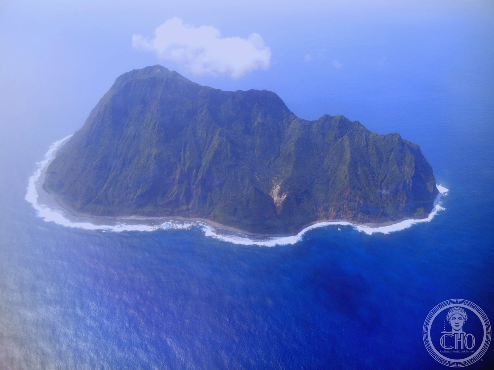
The northernmost island of Japan’s Volcano Islands, North Iwo Jima rises from the Pacific as a remote volcanic outpost now uninhabited since the mid-twentieth century.
At a glance
North Iwo Jima (北硫黄島, Kita Iwōjima, “North Sulfur Island”) is a small volcanic island formally administered as part of Tokyo Metropolitan Government through the Ogasawara Subprefecture. It lies 80 kilometers north of Iwo Jima and 1,170 kilometers south of Tokyo. The island’s remote location has shaped its entire history.
History
Named variously by foreign traders—Santo, San Alessandro, and Hooge Meeuwen Island (Dutch: “High Seagull Island”)—North Iwo Jima entered Japanese settlement in 1898. Two villages took root on the volcanic slopes, supporting modest populations for nearly half a century. By 1944, all inhabitants had departed, and the island has remained a desert island ever since. The reasons for abandonment reflect the broader upheaval of the Pacific War era.
What you see
Little information survives about structures built during the settlement period. The island’s defining feature remains its volcanic geology, characteristic of the Volcano Islands chain.
Cultural significance
North Iwo Jima exemplifies Japan’s far-flung island territories and the Japanese expansion into remote Pacific possessions during the Meiji and early twentieth centuries. Its abandonment reflects historical discontinuities in settlement patterns across the archipelago.
Key facts
- Country: Japan
- Administrative region: Tokyo Metropolitan Government (Ogasawara Subprefecture)
- Archipelago: Volcano Islands, part of the Ogasawara Archipelago
- Coordinates: 25.43°N, 141.28°E
- Settlement period: 1898–1944
- Status: Uninhabited
Practical information & getting there
North Iwo Jima is not accessible to tourists. The island remains a desert island with no facilities or regular transportation. Access is restricted; contact the Tokyo Metropolitan Government or Ogasawara Subprefecture for inquiries about permitted visits.
Sources & resources
Find it on the map
See this place and what’s around it →📷 Become a Cultural Heritage Online photographer
Share your photos of places: they stay published under your name as the author. The more they're seen, the more you get noticed — and soon a contest will reward the most appreciated photos.
Log in or sign up free to add a photoIs this page about you?
This page is read by travellers and heritage enthusiasts who find it on Google. Tell us how you are connected to this place and we will take it from there.