Dolomiti
Le Dolomiti (UNESCO 2009, rif. 1237) sono la catena montuosa più scenica del mondo — 9 sistemi separati per 141.903 ettari di torri carbonatiche verticali costruite da barriere coralline dei Triassico (240 milioni di anni fa) e poi sollevate dall’orogenesi alpina a quote tra 2.000 e 3.343 m.
At a glance
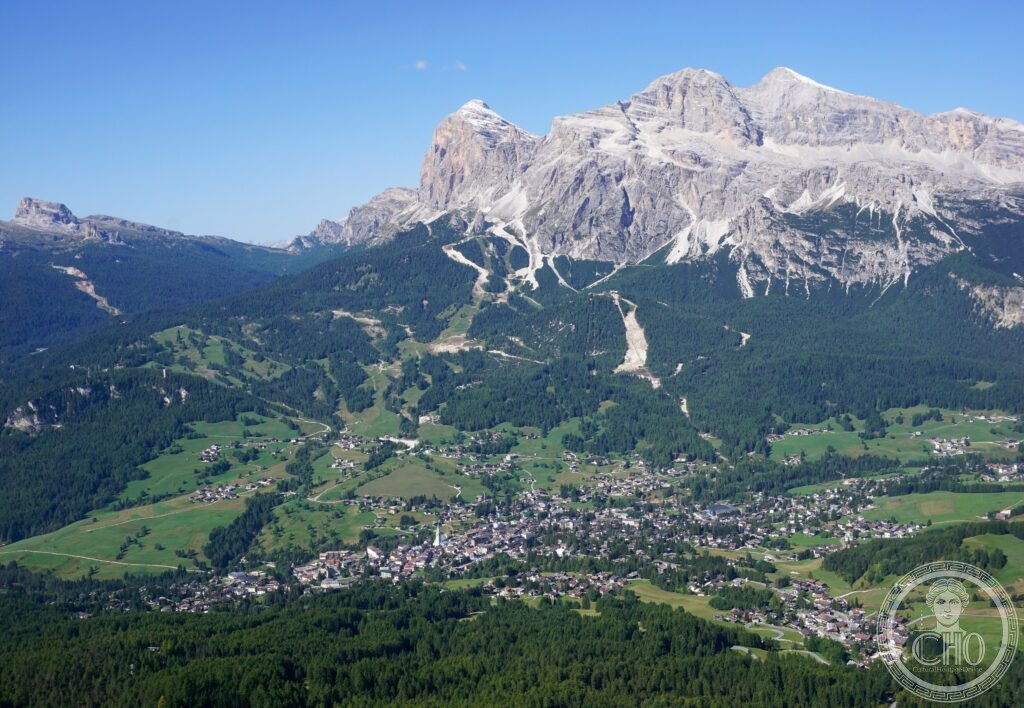
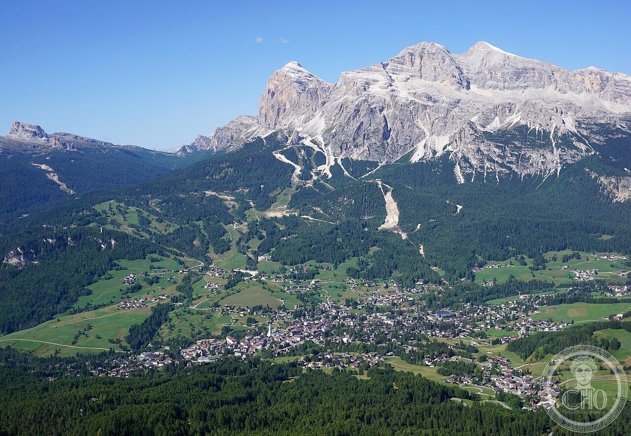
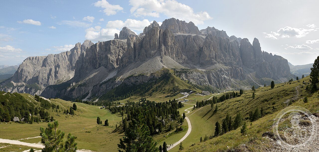
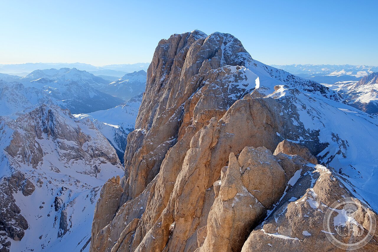
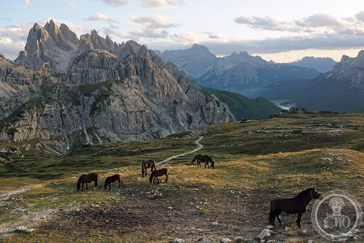
Dolomiti Trentino-Alto Adige Veneto (the most precisely Dolomiti zone northeast Italy 46.4000 N 11.9500 E UNESCO WHS 2009 reference 1237 The Dolomites: the site (the UNESCO inscription covers 9 serial systems: (1) Pelmo–Croda da Lago (Belluno; 31,671 ha); (2) Marmolada (Trento/Belluno; 3,342 ha: the highest point in the Dolomites: 3,343 m; the glacier: the Marmolada glacier has retreated from 5,000 m² (1888 CE) to 1,800 m² (2020 CE) = 64% reduction in 132 years; at the current rate of retreat, the Marmolada glacier will disappear by 2040–2050 CE according to the Università di Padova glaciology department); (3) Pale di San Martino–San Lucano–Dolomiti Bellunesi–Vette Feltrine (Belluno; 74,421 ha: the largest system; includes the Altopiano delle Pale (the Pale plateau: the largest dolomitic plateau in the Alps: 58 km² of karst tableland at 2,400–2,600 m altitude)); (4) Dolomiti Friulane e d’Oltre Piave (Pordenone/Udine; 43,573 ha); (5) Dolomiti Settentrionali (Bolzano/Belluno; 43,753 ha: includes the Tre Cime di Lavaredo (the 3 towers: Cima Grande 2,999 m; Cima Ovest 2,973 m; Cima Piccola 2,857 m; the north face of Cima Grande: the most climbed vertical face in the Alps (the first ascent of the north face: by Emilio Comici and the brothers Angelo and Giuseppe Dimai on August 14, 1933 CE: 14 hours; 550 m vertical; grade VI (the maximum grading in use in 1933 CE)); the Tre Cime circuit trail (2.7 km; +150 m elevation; 2.5 hours; access: the toll road to Rifugio Auronzo: €30 car; the starting point: parking at Rifugio Auronzo (2,333 m): one of the highest drive-up mountain car parks in the Alps)); (6) Puez–Odle (Bolzano; 10,092 ha: the most “alpine” system: the Odle (the “Geislerspitzen” in German): 9 towers between 2,500 and 3,025 m visible from the Seceda plateau above Ortisei (St. Ulrich)); (7) Sciliar–Catinaccio–Latemar (Bolzano/Trento; 16,289 ha: the Catinaccio (the “Rosengarten” = “Rose Garden” in German): the group that turns pink-red at sunset (the phenomenon: the calcite crystals in the dolomitic limestone scatter the low-angle red/orange sunlight in all directions at the 5–20 minutes of alpenglow; the legend: the “Enrosadüra” (the Ladin name for the alpenglow): the legend of King Laurin’s rose garden (the Ladin legend: King Laurin owned a rose garden on the Catinaccio; after being defeated in battle, he cursed the roses to be invisible by day and by night, leaving them visible only at dawn and dusk: the Enrosadüra))); (8) Rio delle Foglie–Puez–Odle; (9) Dolomiti di Brenta (Trento; 39,032 ha: the only Dolomiti system west of the Adige river; geologically separate from the main Dolomite block)).
Key facts
- Perché le Dolomiti si chiamano “Dolomiti” (dal geologo Déodat de Dolomieu 1790 CE), e la chimica del dolomite CaMg(CO₃)₂ che spiega i colori, i profili verticali e l’alpenglow: the naming (the Dolomites are named after the French geologist Dieudonné Sylvain Guy Tancrède de Gratet de Dolomieu (1750–1801 CE): nicknamed “Déodat de Dolomieu”: in 1790 CE, de Dolomieu examined rock samples from the Tyrolean Alps that had been collected by Nicolas-Théodore de Saussure and discovered that they had a different chemical composition from normal limestone (CaCO₃): the double carbonate CaMg(CO₃)₂ (calcium magnesium carbonate): a mineral that does not effervesce with cold dilute hydrochloric acid (unlike ordinary limestone); the mineral was named “dolomite” after de Dolomieu by Geneva mineralogist Horace-Bénédict de Saussure in 1792 CE); the chemistry (the consequences of the dolomite chemistry for the visual appearance: (1) the vertical walls: dolomite dissolves slowly in water (1/4 the rate of limestone): the result is that dolomitic mountains erode to sheer vertical faces rather than the rounded shapes of limestone mountains (compare the Dolomites with the rounded Prealps of the Carso or Lessini); (2) the Enrosadüra alpenglow: dolomite crystals have a cleavage angle of 73° (the angle at which crystal planes reflect light): at the sun elevation of 3–7° above the horizon (dawn and dusk), the crystals scatter light at exactly the right angle to produce the red-orange glow visible from valleys 50 km away; (3) the white cliffs: dolomite has a higher reflectance than limestone (0.5 vs 0.3): the Dolomite towers appear white to bright cream in direct sunlight
- GPS (Tre Cime di Lavaredo, Rifugio Auronzo di partenza): 46.6171° N, 12.3017° E; Marmolada ghiacciaio: 46.4322° N, 11.8592° E; Pale di San Martino altopiano: 46.2556° N, 11.8789° E
History
Da Déodat de Dolomieu 1790 CE al UNESCO 2009 (the most precisely Dolomiti zone history: the geology (the Dolomites: formed 240–230 million years ago (Middle to Late Triassic): the original material is a reef (a tropical coral reef in a warm shallow sea at 5°–10° south latitude (the current latitude of Libya or Egypt): the Tethys Sea); the reef species (the reef organisms that built the Dolomite rock: the Tubiphytes (a calcareous encrusting organism); the Megalodon clams (the bivalve mollusks up to 30 cm wide that filled the reef lagoons: their fossilized shells are visible in the rock of the Pale di San Martino); the corals; after the reef died, the calcite (CaCO₃) was replaced by dolomite (CaMg(CO₃)₂) through a chemical process called “dolomitization” driven by magnesium-rich fluids from below)); the alpinism chapter (the first ascents in the Dolomites: (1) Tofane (first ascent 1863 CE by Paul Grohmann and guides); (2) Croda da Lago (first ascent 1865 CE by Grohmann); (3) the north face of Cima Grande di Lavaredo (first ascent August 14, 1933 CE by Emilio Comici and the Dimai brothers: the most important event in 20th-century Alpine history after Hermann Buhl’s Nanga Parbat solo (1953 CE)); Reinhold Messner (born September 17, 1944 CE in Brixen/Bressanone, South Tyrol: the first person to climb all 14 “eight-thousanders” (the 14 mountains above 8,000 m) (completed October 16, 1986 CE with the ascent of Lhotse): the Dolomites (specifically the Odle and Geislerspitzen above his hometown) were his training ground; the Messner Mountain Museum (MMM) has 6 locations in South Tyrol + 1 at Monte Rite (Belluno)); the UNESCO inscription (2009 CE: reference 1237: the largest transboundary serial inscription in Italy and the first natural site in Italy inscribed primarily for geological values).
What you see
Tre Cime giro (2h30), Pale San Martino (1 giorno), Enrosadüra Catinaccio, Marmolada (the most precisely Dolomiti zone visit: the 5 best experiences (ranked by accessibility and impact): (1) the Tre Cime circuit (€30 toll road to Rifugio Auronzo; 2,333 m start; 2.7 km circuit; 2.5 hours; no major elevation gain; the best angle: the north face of Cima Grande visible from the Forcella Lavaredo pass (2,454 m); the timing: leave Rifugio Auronzo before 7:30 AM to avoid tour bus crowds; access from Dobbiaco/Toblach (20 km)); (2) the Pale di San Martino (cable car from San Martino di Castrozza: €18; the Altopiano delle Pale (2,600 m): 58 km² of flat karst tableland surrounded by 500–800 m vertical rock walls; the rock (the limestone karst: the surface is a field of “lapiaz” (grooved limestone) + snow patches in June and October; the crossing: the 2-day hut traverse (Rifugio Rosetta → Rifugio Velo della Madonna → Rifugio Pradidali); the best day walk: from Rifugio Rosetta to Rifugio Velo della Madonna (4h; +200 m; the most spectacular karst plateau in the Alps)); (3) the Enrosadüra (the Catinaccio alpenglow: the best viewpoint: Passo Costalunga/Karerpass (1,754 m; 40 km from Bolzano; parking; free; sunset viewpoint on the terrace of the Hotel Carezza del Lago): the alpenglow on the Catinaccio (the Rosengarten) peaks occurs 15–30 minutes before sunset: arrive 45 minutes before sunset; stay 20 minutes after (the afterglow is sometimes more intense than the direct glow)); (4) the Val di Fassa (the Sella circuit; cable car from Canazei (1,440 m) to Sass Pordoi (2,950 m): €22; the Sella massif at eye level from the terrace restaurant: the most accessible high-altitude panorama in the Dolomites); (5) Cortina d’Ampezzo (the Dolomiti Superski pass: €65/day in ski season: access to 12 ski areas; in summer: the “Cinque Torri” (5 towers): 1h hike from Passo Falzarego + the WWI museum in the rock (the “Museo all’Aperto Cinque Torri”: free; the original WWI trenches and artillery positions cut into the rock faces of the 5 towers in 1915–1917 CE)).
Practical information
- Come raggiungere le Dolomiti da Venezia, Milano e Monaco, e perché luglio-agosto è il periodo peggiore per le Tre Cime e il migliore per le alte vie: il trasporto (Venezia Marco Polo → Belluno: FlixBus (2h30; €12) o auto (150 km; 2h45; via A27 Venezia-Belluno); Venezia → Cortina d’Ampezzo: Cortina Express bus stagionale (luglio-agosto; 3h; €25; prenotazione su cortinaexpress.it); Monaco → Dobbiaco (Toblach, porta delle Tre Cime): DB Meridian treno (2h30; €45; diretto monaco – Dobbiaco; poi bus locale Dobbiaco → Misurina (30 min; €4))); la saturazione estiva (le Tre Cime in luglio-agosto 2023 CE: 5.500 visitatori/giorno (la stima della Provincia di Bolzano); la conseguenza: traffico immobile sulla strada a pedaggio dalle 9:00 alle 15:00; la soluzione: arrivare prima delle 7:00 o dopo le 16:00; parcheggio chiuso a capacità prima delle 9:00 nei weekends; il bus navetta da Misurina (15 min; €5; evita il pedaggio e il parcheggio)); la stagione migliore (le Tre Cime: giugno e settembre (neve residua a giugno sulle forcelle; colori autunnali a settembre); le alte vie (Alta Via 1: Braies → Belluno; 10 giorni; 120 km; luglio-agosto: la stagione dei malghe aperte e dei rifugi presidiati (verificare su rifugi.info le date di apertura); l’Alta Via 2: Bressanone → Feltre; 9 giorni; 150 km; entrambe accessibili senza attrezzatura alpinistica con buone scarpe da trekking))
Getting there
Venezia → Cortina (bus stagionale 3h, €25). Monaco → Dobbiaco (DB Meridian 2h30, €45). Tre Cime: pedagio €30 + parcheggio Rifugio Auronzo (2.333m). GPS Tre Cime: 46.6171/12.3017. Estate prenotare rifugi su rifugi.info.
Nearby
- Merano (Trauttmansdorff giardini + terme — XIX sec. Asburgo) — 80 km da Bolzano (auto; i Giardini di Trauttmansdorff (Castel Trauttmansdorff: il castello restaurato 1870 CE dove Sissi d’Austria trascorse la convalescenza 1870-1872 CE; i giardini 12 ettari: €16; la terrazza panoramica sul Burgraviato); le Terme di Merano (€29/5h; 25 piscine termali))
- Civdale del Friuli (Longobardi in Italia UNESCO 2011 rif. 1312) — 120 km (auto; il Tempietto Longobardo (736 CE: gli stucchi del VIII sec. CE; le Principesse; la scultura longobarda più intatta); il Museo Archeologico; il Natisone e i maclâfs (i lavatoi in pietra nel centro storico))
Gallery
Sources
- Wikipedia, Dolomites; Tre Cime di Lavaredo; Marmolada; Déodat de Dolomieu; Pale di San Martino, accessed June 2026
- UNESCO, The Dolomites, WHS reference 1237, inscribed 2009
- Università di Padova, Dipartimento di Geoscienze. Marmolada Glacier Mass Balance Report 2020 (64% retreat figure)
Find it on the map
See this place and what’s around it →📷 Diventa un fotografo di Cultural Heritage Online
Condividi le tue foto dei luoghi: restano pubblicate con la tua firma come autore. Più vengono viste, più ti fai conoscere — e presto un concorso premierà le foto più apprezzate.
Accedi o registrati gratis per aggiungere una foto