Castello delle Carpinete
The Castello delle Carpinete is a medieval fortified complex situated in the Apennine foothills of the Reggio Emilia province in Emilia-Romagna, overlooking the Secchia river valley. The castle preserves substantial remains of its defensive towers and curtain walls, standing as evidence of the network of mountain fortifications that controlled the trans-Apennine routes between the Po Plain and Tuscany during the medieval period.
At a glance
- Type
- Medieval fortified castle
- Period
- Origins in the 13th–14th century; modified through the 16th century
- Style
- Romanesque-Gothic military architecture; stone curtain walls and towers
- Location
- Reggio Emilia province, Emilia-Romagna — Apennine foothills near the Secchia valley
- Coordinates
- 44.4488° N, 10.5276° E
Overview
The Castello delle Carpinete occupies an elevated position in the Reggiano Apennines, commanding views across the valleys that historically served as transit corridors between northern and central Italy. Like many Apennine castles, it combined a defensive function with the administrative control of the surrounding rural territory. The complex is part of a wider landscape of medieval castles — the castelli reggiani — that punctuate the hills between Reggio Emilia and the Tuscan border.
History
The origins of the fortification date to the high medieval period, when the mountain routes crossing the Apennines between Reggio Emilia and Pistoia were of strategic importance to the Lombard communes and later the Este and Gonzaga lordships. The castle changed hands multiple times between local feudal families and the Commune of Reggio during the 14th and 15th centuries, with modifications to its defensive system reflecting the introduction of firearms in the 15th and 16th centuries. By the post-medieval period the castle had lost its military relevance and gradually fell into partial ruin.
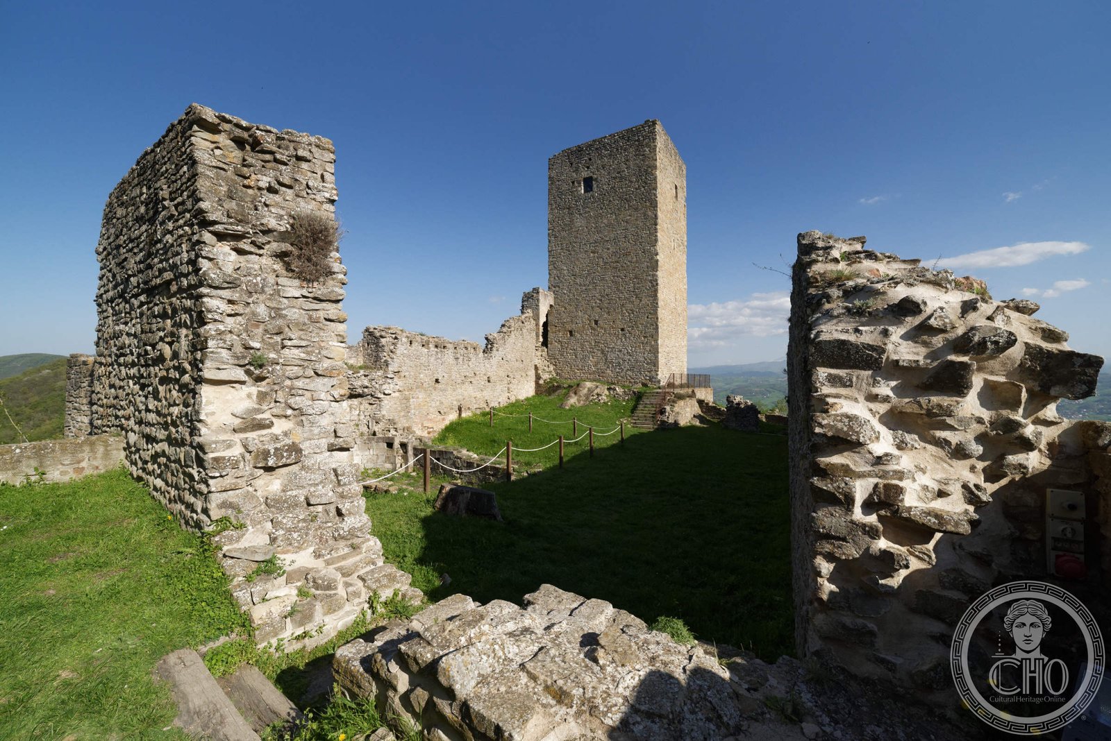
What you see
The surviving fabric of the Castello delle Carpinete includes sections of the original curtain wall in local stone, the ruins of one or more tower structures, and traces of the internal courtyard. The irregular hilltop site dictated the irregular plan of the fortification, with walls following the natural contours of the ridge. The surrounding landscape of chestnut and oak woodland, crossed by ancient mule tracks, gives the site a strong sense of its medieval context as a mountain stronghold.
Cultural significance
The castle is one of several Apennine fortifications in the Reggio Emilia area that document the complex territorial struggles of the medieval Po valley communes. It contributes to an understanding of how mountain passes were controlled and how rural communities in the Apennines were integrated into the broader political geography of medieval northern Italy. The site is included in regional heritage inventories of historic defensive architecture.
Practical information
The castle ruins are accessible via footpaths in the Reggiano Apennines. No permanent visitor facilities are on site. Check with local tourism offices in Reggio Emilia or the Comunità Montana for current access conditions, guided excursion programmes, and any seasonal restrictions due to weather or path maintenance.
Getting there
The site lies in the Apennine foothills accessible from Reggio Emilia by car via the SS63 toward Castelnovo ne’ Monti, then minor roads toward the Secchia valley. Public transport connections to the immediate area are limited; the nearest town with regular bus links from Reggio Emilia is Castelnovo ne’ Monti. Walking and mountain-biking trails connect the castle with other Reggiano Apennine heritage sites.
Sources & resources
Find it on the map
See this place and what’s around it →📷 Diventa un fotografo di Cultural Heritage Online
Condividi le tue foto dei luoghi: restano pubblicate con la tua firma come autore. Più vengono viste, più ti fai conoscere — e presto un concorso premierà le foto più apprezzate.
Accedi o registrati gratis per aggiungere una foto