
Curated Itinerary
Forlì–Predappio Rationalism RoadBook — Five Stops in the Regime’s Showcase (1925–1939)
Five stops across Forlì and Predappio, the two Romagna towns the regime rebuilt as its showcase: Bazzani’s post office on […]
Take this route into Google Maps
From Palazzo delle Poste di Forli — Bazzani 1932 to Casa del Fascio di Predappio, in the order we curated them.
➤ Turn on the navigator in Google MapsIt opens in the Google Maps app with every stop already loaded, in the order we put them in. From there the route is yours: pick how you travel — on foot, by bike, by public transport or by car — change where you start and where you end, drag the stops into a different order, and add places of your own along the way.
Five stops across Forlì and Predappio, the two Romagna towns the regime rebuilt as its showcase: Bazzani’s post office on Piazza Saffi, Cesare Valle’s Casa del Balilla and Collegio Aeronautico, and the post office and abandoned Casa del Fascio of the planned town of Predappio Nuova. Read the full story in the dedicated article Two Post Offices and a Thirty-Metre Tower: A Forlì–Predappio Rationalism RoadBook (1925–1939), by Stefano Vigolo.
Step by step
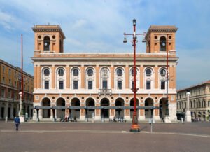
Palazzo delle Poste di Forli — Bazzani 1932
Cesare Bazzani signed the design in January 1931 and the building opened on 30 October 1932, a single twenty-month sprint that left Forlì with one of the…
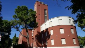
Casa del Balilla di Forlì
Built between 1933 and 1935 to the design of Roman architect Cesare Valle, the Casa del Balilla of Forlì was conceived as a full youth and sports complex for…
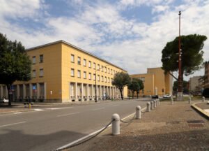
Collegio Aeronautico di Forli (Liceo Morgagni)
Cesare Valle's Collegio Aeronautico opened in 1939 as a boarding school for Italian Air Force cadets, set on the eastern edge of Forli's monumental civic…
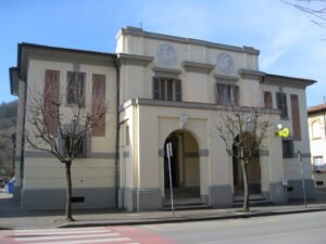
Palazzo delle Poste di Predappio
The Palazzo delle Poste of Predappio is the post and telegraph building of Predappio Nuova, the new town centre laid out from 1925 on the valley floor of the…
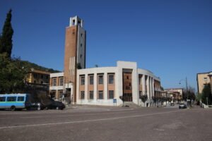
Casa del Fascio di Predappio
The former Casa del Fascio in Predappio is the largest party headquarters built in any small Italian town during the Fascist regime. Inaugurated in 1937 at…
Download for tour navigation
PDF is the stop list with GPS, to print or keep on the phone. GPX for Garmin / Komoot / OsmAnd. KML for Google Earth and Maps.
Walk it with the navigator on
It opens in the Google Maps app with every stop already loaded, in the order we put them in. From there the route is yours: pick how you travel — on foot, by bike, by public transport or by car — change where you start and where you end, drag the stops into a different order, and add places of your own along the way.
To keep the route in the app instead of opening it once, download the KML above and import it into Google My Maps — Create a new map, then Import: the route then sits among your own maps in Google Maps, with the stops and our notes attached to each one.