
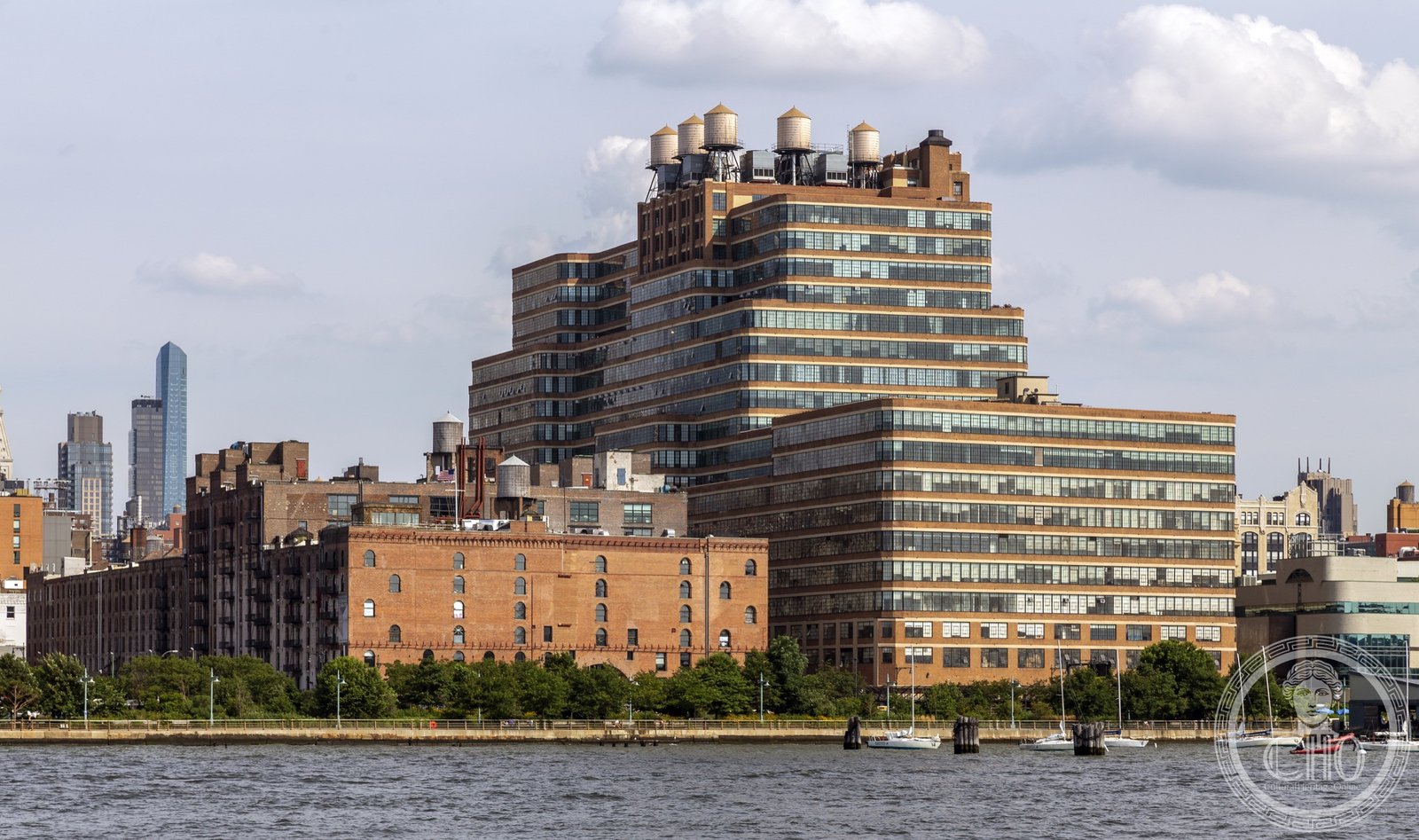
The Starrett-Lehigh Building is a full city block of continuous horizontal glass — 19 stories of ribbon windows wrapping a Chelsea freight terminal in a composition that looks as modern today as it did when it opened in 1931, and solved structural and logistical problems that had never been attempted at its scale.
At a glance
Completed in 1931 over the piers and rail yards of Manhattan’s West Side waterfront, the Starrett-Lehigh Building was built as a freight terminal and warehouse for the Lehigh Valley Railroad and the Starrett Investment Corporation. Architects Cory & Cory, with Yasuo Matsui as associate architect, wrapped the building’s 2.3-million-square-foot mass in a system of continuous ribbon windows that became the building’s defining visual feature — a curtain-wall system innovative enough to attract critical attention from European modernists at a time when the International Style was being debated in theoretical terms rather than executed at this scale. The building is a New York City Landmark and continues in active use as one of Manhattan’s major commercial office complexes.
Key facts
- Completed: 1931
- Architects: Cory & Cory; Yasuo Matsui (associate architect)
- Address: 601 West 26th Street, Chelsea, New York, NY 10001
- Original use: Railroad freight terminal and warehouse (Lehigh Valley Railroad)
- Style: Art Deco / proto-International Style industrial
- Status: New York City Landmark
- GPS: 40.7489°N, 74.0027°W
History
The West Side of Manhattan below 34th Street was, in the early twentieth century, a working waterfront: piers, rail yards, and freight facilities lined the Hudson River, and the delivery of goods into the city depended on a network of freight handling infrastructure that has almost entirely vanished. The Lehigh Valley Railroad ran elevated freight tracks above street level along the west side of Manhattan — a system known as the High Line for the elevated railway it followed — and the Starrett-Lehigh building was constructed directly over these tracks, with freight train access built into the building’s lower floors.
The building’s most celebrated engineering feature was its freight elevator system: rail cars could be driven directly into the building at grade, lifted to the upper floors by large freight elevators, and unloaded inside — a system that eliminated the need for street-level truck deliveries and allowed the building to function as an integrated freight terminal. The ribbon window system that gives the building its visual character was partly a function of the structural solution: with the freight infrastructure determining the column grid and floor-plate sizes, the architects rationalized the curtain wall as a continuous band rather than the punched-window system that typified conventional warehouse construction.
The freight terminal function became obsolete as rail freight collapsed in the mid-twentieth century; the building transitioned to commercial office use. Its designation as a New York City Landmark in 1986 protected it from redevelopment, and a major renovation converted it to the high-ceiling loft offices that proved extremely popular during the 1990s and 2000s technology and media boom. The elevated rail spur that once entered the building became, through community advocacy, the High Line park that now runs along the building’s eastern edge.
What you see
The building’s Hudson River elevation and West 26th Street face are the best vantage points: 19 stories of continuous horizontal window bands, each floor differentiated only by the slight shadow of a projecting sill, repeating around the full perimeter of the building without a single vertical interruption. The effect is of a building made of glass rather than masonry — an impression reinforced by the rounded corners where the facade turns without breaking the ribbon. At the time it was completed, the Starrett-Lehigh’s curtain wall was architecturally unprecedented at this scale; the building attracted attention from European modernist architects who were theorizing what such a facade might look like but had not yet built it at full scale.
From the High Line, which runs along the eastern edge of the building at roughly the second-floor level, the Starrett-Lehigh reads as a cliff of glass — its ribbons continuing above and below the park’s vantage point in both directions. The industrial character of the base — the massive loading bays and freight dock openings that once handled rail cars — is still readable in the lower floors, where the building’s original purpose is legible even as the upper floors have been completely repurposed for technology and media companies.
Practical information
- Exterior: The building’s facades are fully visible from West 26th Street, the High Line, and the Hudson River waterfront
- High Line access: The High Line park’s Chelsea Market segment runs adjacent to the building’s eastern face; the park is free and open daily
- Interior: The lobby is accessible during business hours; the office floors require tenant access
- Photography: Best photographed from the High Line or from the north end of West 26th Street looking west toward the Hudson
Getting there
The building is in Chelsea on West 26th Street between 11th and 12th Avenues. The nearest subway is the 1 train at 23rd Street (0.7 miles southeast) or the C/E at 23rd Street and 8th Avenue (0.5 miles east). The High Line’s 26th Street Chelsea Spur provides pedestrian access along the building’s eastern side. From Midtown, the building is accessible by the M11 bus along 11th Avenue.
Nearby
- The High Line (adjacent to east facade — former elevated rail corridor now public park)
- Chelsea Market (0.3 miles north — adaptive reuse of the Nabisco factory complex)
- Hudson Yards (0.7 miles north)
- Whitney Museum of American Art (0.8 miles south at Gansevoort Street)
Sources
- New York City Landmarks Preservation Commission designation report, Starrett-Lehigh Building, 1986
- New York Architecture Images, “601 West 26th Street — Starrett-Lehigh Building”
- Friends of the High Line, historical documentation of the West Side rail infrastructure
Find it on the map
See this place and what’s around it →📷 Become a Cultural Heritage Online photographer
Share your photos of places: they stay published under your name as the author. The more they're seen, the more you get noticed — and soon a contest will reward the most appreciated photos.
Log in or sign up free to add a photoDo you manage this place?
This page is read by travellers and heritage enthusiasts who find it on Google. Keep it accurate — and make it work for you. Free for non-profit heritage institutions.