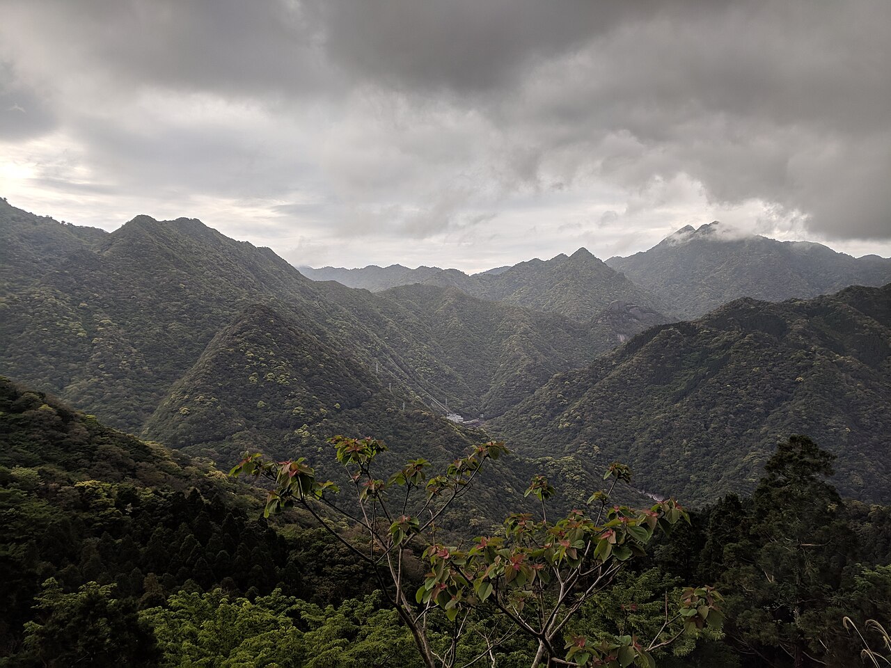
Yakushima, inscribed by UNESCO in 1993 as one of Japan’s first World Heritage Sites, is a 504-square-kilometre island in Kagoshima Prefecture that holds one of the last remaining old-growth subtropical-to-subalpine forest gradients in Japan. The island’s oldest Jomon cedar (Jomon sugi) is estimated at 2,170–7,200 years old — the range reflects dating uncertainty, but even the conservative estimate makes it one of the oldest living conifers on earth. Twenty percent of the island’s core zone was inscribed under UNESCO natural criteria: the extraordinary topography of peaks rising from sea level to 1,936 metres within 30 kilometres creates a vertical stack of climatic zones equivalent to transiting from Kyushu to Hokkaido in an afternoon’s walk.
The Ryukyu arc and southern Japan Okinawa · Amami · Nagasaki — 160 to 500 km
One hundred sixty kilometres southwest of Yakushima by ferry or short-haul flight, the Gusuku Sites and Related Properties of the Kingdom of Ryukyu in Okinawa Prefecture represent the southernmost UNESCO inscription in Japan’s main island arc. The five Ryukyuan castle ruins (gusuku) — including Shuri Castle on the outskirts of Naha — document the Ryukyu Kingdom (1429–1879 CE) that controlled the maritime trade routes between Japan, China, and Southeast Asia for 450 years. The political history of the Ryukyu Kingdom and the ecology of Yakushima’s ancient forests are connected through the same Quaternary biogeography: the oceanic island chain from Yakushima through Amami and Okinawa to the Yaeyama Islands is a relict corridor that preserved subtropical species during the Pleistocene glacial periods when much of mainland Japan was colder and drier. Yakushima’s ancient cedar forests and Okinawa’s coral-fringed gusuku castle plateaus are manifestations of the same island-chain ecology at different latitudes. From Yakushima, Naha (Okinawa) is reached by short-haul flight from Yakushima Airport (approximately 70 minutes) or by ferry to Kagoshima and Peach/JetStar to Naha.
Three hundred kilometres northeast of Yakushima by ferry (14 hours, overnight) or by ferry to Kagoshima and Shinkansen north, the hidden-Christian sites of the Nagasaki Region represent the cultural complement to Yakushima’s biological heritage in Japan’s southwestern history. The Goto Islands — five of the 12 UNESCO Christian inscription components — lie in the same East China Sea corridor that historically connected Kagoshima to Nagasaki, and the same monsoon current patterns that bring the warm Kuroshio Current past Yakushima’s coasts brought the Portuguese ships to Nagasaki and Tanegashima (50 kilometres north of Yakushima) in 1543 — the first European contact with Japan. Tanegashima, where the Portuguese demonstrated matchlock guns to a Shimazu domain lord, is visible from Yakushima’s northwestern coast; the two islands’ juxtaposition captures the moment of Japan’s entry into the global maritime world. From Yakushima, Nagasaki is most efficiently reached by ferry to Kagoshima and Shinkansen plus limited express (approximately 4 hours).
Four hundred kilometres north by ferry and road, Kagoshima City on Kyushu’s southern coast holds the Shuseikan complex — part of the Sites of Japan’s Meiji Industrial Revolution inscription. The Shimazu domain that governed Kagoshima and Yakushima in the Edo period established the Shuseikan reverberatory furnace in 1852 as Japan’s first Western-style industrial facility, pre-dating the Meiji Restoration by 16 years. The Yakushima cedar forests provided some of the timber resources that Shimazu domain administration had managed since the 16th century; the island’s forests were subject to Edo-period clear-cutting pressures that the Shimazu domain partially controlled through access regulation. The current UNESCO inscription’s core zone represents the relic of a forest system that human activity had already significantly reduced before the 20th century; the inscription in 1993 formalized a protection regime that reversed the commercial timber extraction that had continued into the 1950s. From Yakushima, Kagoshima is reached by Toppy/Rocket hydrofoil (approximately 2 hours) or by regular ferry (4 hours).
Five hundred kilometres west by ferry to Kagoshima and Shinkansen/ferry to Nagasaki and island ferry, the Amami-Oshima, Tokunoshima, Northern Okinawa and Iriomote Island natural inscription (2021) documents the same subtropical biodiversity corridor that Yakushima represents at its northern end. The Amami and Okinawa islands hold the Amami rabbit, the Iriomote cat, and the Okinawa rail — all endemic island species on the IUCN Red List — in the same pattern of island endemism that Yakushima’s yaku-jika (Yakushima sika deer) and yaku-zaru (Yakushima macaque) represent in the Osumi archipelago at the Ryukyu arc’s northern terminus. The two natural inscriptions — Yakushima (1993) and Amami/Okinawa (2021) — were separated in time by 28 years but together document a single biogeographic unit: the Ryukyu biodiversity hotspot, one of 36 global biodiversity hotspots recognized by Conservation International.
North toward Kyushu and the main islands Kyushu · Honshu Kansai — 200 to 700 km
Two hundred kilometres north by Toppy hydrofoil and Shinkansen, Kagoshima-to-Fukuoka (Hakata) by Kyushu Shinkansen takes approximately 80 minutes. From Hakata, the Sites of Japan’s Meiji Industrial Revolution are immediately accessible: the Higashida No. 1 Blast Furnace of the Yawata Steel Works is 20 minutes from Hakata by JR Kagoshima Main Line. The juxtaposition of Yakushima’s 7,000-year cedars and the 1901 Yawata blast furnace — 200 kilometres apart and 7,000 years apart in their respective significance — captures the full temporal range of Japan’s UNESCO World Heritage inventory in a single Kyushu itinerary. From Yakushima, Kitakyushu (Yawata) requires the Kagoshima hydrofoil connection, Shinkansen north to Hakata, and JR east to Yahata Station (approximately 5 hours total).
Seven hundred kilometres north by ferry/Shinkansen/Shinkansen, the Kii Mountain Range inscription in Wakayama, Mie, and Nara Prefectures is the nearest large-scale sacred mountain landscape to Yakushima in the Japanese cultural inventory. The Yoshino-Omine mountain asceticism tradition — the longest continuously practiced mountain pilgrimage route in Japan, documented since the 7th century CE — and the Yakushima cedar forests share a common element of extreme longevity: the Omine mountain pilgrimage has been walked for 1,300 years, the Yakushima cedars have been growing for 2,000 to 7,000. Both sites encode the Japanese cultural concept of forest as sacred space — the original Shinto principle of satoyama (sacred mountain forest) that pre-dates Buddhism. From Yakushima, the Kii inscription is reached via Kagoshima hydrofoil, Shinkansen through Hakata and Shin-Osaka, and Nankai or JR connections into the Kii Peninsula (approximately 7 hours total).
Practical information
Yakushima is reached from Kagoshima by Toppy or Rocket hydrofoil (90 minutes to Miyanoura port) or by car ferry (approximately 4 hours). From Fukuoka (Hakata), Yakushima requires a Shinkansen to Kagoshima-Chuo (approximately 80 minutes) and ferry connection — total travel time approximately 4 hours. Yakushima Airport is served by short-haul flights from Kagoshima, Osaka (Itami), and Tokyo (Haneda) via JAL/ANA subsidiaries. The island is circumnavigated by a coastal road (approximately 130 kilometres); public bus service covers most of the circuit with infrequent schedules. Rental cars are available at Miyanoura port and Yakushima Airport and are the practical choice for access to the interior trailheads. The Jomon Sugi cedar requires approximately 10 hours round-trip on foot from the Arakawa trailhead (bus from Miyanoura); a hiker’s pass system restricts daily access to the trailhead area to protect the trail. The Shiratani Unsuikyo Ravine, said to have inspired the forest setting of the Studio Ghibli film “Princess Mononoke,” is accessible in 3–4 hours from the entrance. Lodging ranges from accommodation in the port towns of Miyanoura and Anbo to mountain huts on the higher routes. The island receives approximately 200,000 visitors per year; the rainy season (May–July) brings the highest rainfall in Japan (up to 10,000 mm per year at the island’s peak) and is simultaneously when the forest is most atmospheric.
Frequently Asked Questions
How old is the Jomon Sugi cedar and how is its age estimated?
The Jomon Sugi (Cryptomeria japonica) is named for Japan’s prehistoric Jomon period (c. 14,000–300 BCE), implying an age reaching back to that era. Its age is genuinely uncertain because dendrochronology — counting annual growth rings — requires a core sample taken to the tree’s centre, and the centre of the Jomon Sugi is hollow. The estimates of 2,170 to 7,200 years come from two methods: carbon dating of the heartwood exposed in the hollow (which produced a minimum age of 2,170 years) and extrapolation from the tree’s circumference of 16.4 metres (the largest in Japan) using known cedar growth rates in comparable conditions, which produces a theoretical maximum approaching 7,200 years. The scientific consensus holds that the Jomon Sugi is at minimum 2,000 years old and possibly 3,000–4,000 years old; the 7,200-year figure requires growth rate assumptions that most forest ecologists consider optimistic. At any credible age, it is one of the oldest known living conifers in the world. The tree stands at 1,300 metres altitude in the island’s interior; it was unknown to the outside world until a forest survey in 1966 reported its existence, two years before the Yakushima Nature Conservation Area was established. The Jomon Sugi became the focal point of the 1993 UNESCO inscription and is the primary reason approximately 120,000 hikers per year make the 22-kilometre round-trip to the tree.
Why was Yakushima among Japan’s first UNESCO inscriptions in 1993?
Yakushima was inscribed in the same 1993 cycle as Horyu-ji and Himeji Castle — Japan’s very first UNESCO nominations — because of a specific policy decision by the Japanese Environment Agency to use the island’s biological values to establish Japan’s credibility in natural heritage nomination alongside its cultural heritage strengths. The inscription covers approximately 21% of the island (10,747 hectares) under two UNESCO natural criteria: criterion vii (outstanding natural beauty, specifically the ancient forest landscape) and criterion ix (outstanding examples of ongoing ecological and biological processes, specifically the vertical zonation from subtropical to subalpine in an island of 504 square kilometres). The remaining 79% of the island is managed under national forest designations that provide partial protection but allow selective timber extraction. The 1993 inscription was the outcome of advocacy by the Japanese branch of the IUCN and local conservation organizations that had campaigned since the 1970s against commercial cedar logging; the UNESCO nomination provided a legal framework for halting commercial extraction in the core zone that national forest management rules had not achieved. The combination of the Jomon Sugi discovery (1966), the campaign against logging (1970s–1980s), and the UNESCO nomination process (early 1990s) mirrors conservation campaigns at other early UNESCO natural sites worldwide.
What is the relationship between Yakushima and the film “Princess Mononoke”?
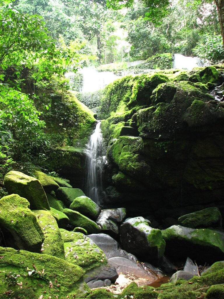
Studio Ghibli’s 1997 animated film “Princess Mononoke,” directed by Hayao Miyazaki, is set in a primordial Japanese forest — the Shirakami-Sanchi was Miyazaki’s primary stated reference, but the visual character of the film’s forest is widely attributed to Yakushima’s Shiratani Unsuikyo Ravine, where moss-covered granite boulders, ancient cedars, and dense undergrowth create a landscape that closely matches the film’s background art. Miyazaki and his production team visited Yakushima in the early 1990s during the film’s development; the production notes reference the Yakushima moss-forest landscapes as primary visual source material. Shiratani Unsuikyo is now promoted by Yakushima tourist authorities as the “Princess Mononoke forest,” a designation Miyazaki and Studio Ghibli have not formally endorsed but have not objected to. The film’s release increased Yakushima tourism significantly and contributed to the island’s status as a pilgrimage destination in Japanese popular culture. The forest of Shiratani Unsuikyo is the most accessible ancient-forest experience on Yakushima: the entrance is 30 minutes from Miyanoura port by road, and the circuit through the primary moss-forest section takes approximately 3 hours without hiking to the upper ridge.
Sources
- S1 — UNESCO World Heritage Centre — Yakushima (Ref. 662) — https://web.archive.org/web/20230601000000/https://whc.unesco.org/en/list/662/
- S2 — UNESCO World Heritage Centre — Statement of Outstanding Universal Value (Ref. 662) — https://whc.unesco.org/en/list/662/
Spotted an error? Write to editorial@culturalheritageonline.com and we correct it the same day.