The Ennedi Massif: Natural and Cultural Landscape, inscribed by UNESCO in 2016 as a mixed site, covers a vast sandstone plateau in the Ennedi Region of northeastern Chad — one of the largest and most remote UNESCO World Heritage Sites on Earth, separated from the capital N’Djamena by more than 1,300 kilometres of desert and requiring a multi-day overland expedition to reach. Rising to 1,450 metres above the surrounding Sahara, the Ennedi preserves Carboniferous sandstone eroded into extraordinary formations, ancient rock art spanning 7,000 years, and isolated wildlife populations that have survived the desertification of the Sahara including the last relict crocodiles in the entire Saharan zone.
Geology and landscape: sandstone arches, gorges, and hoodoos Northeastern Chad, Ennedi Region; 1,300 km from N’Djamena, 3–4 days by 4WD convoy
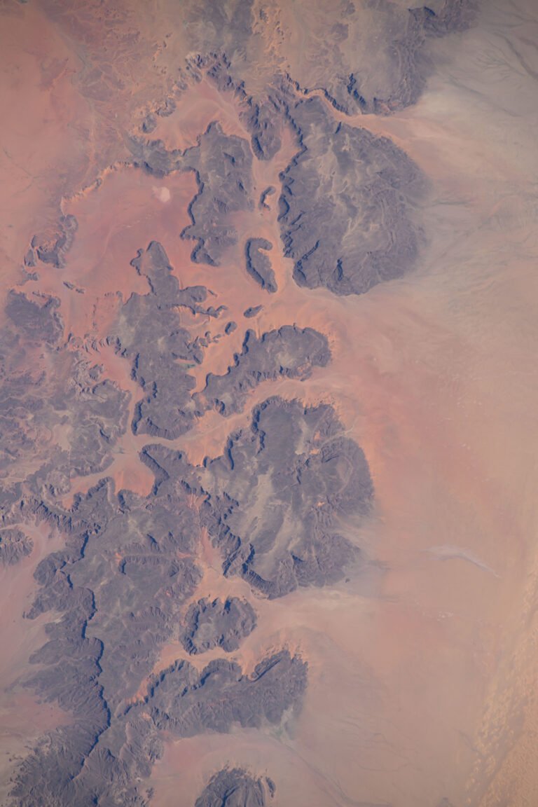
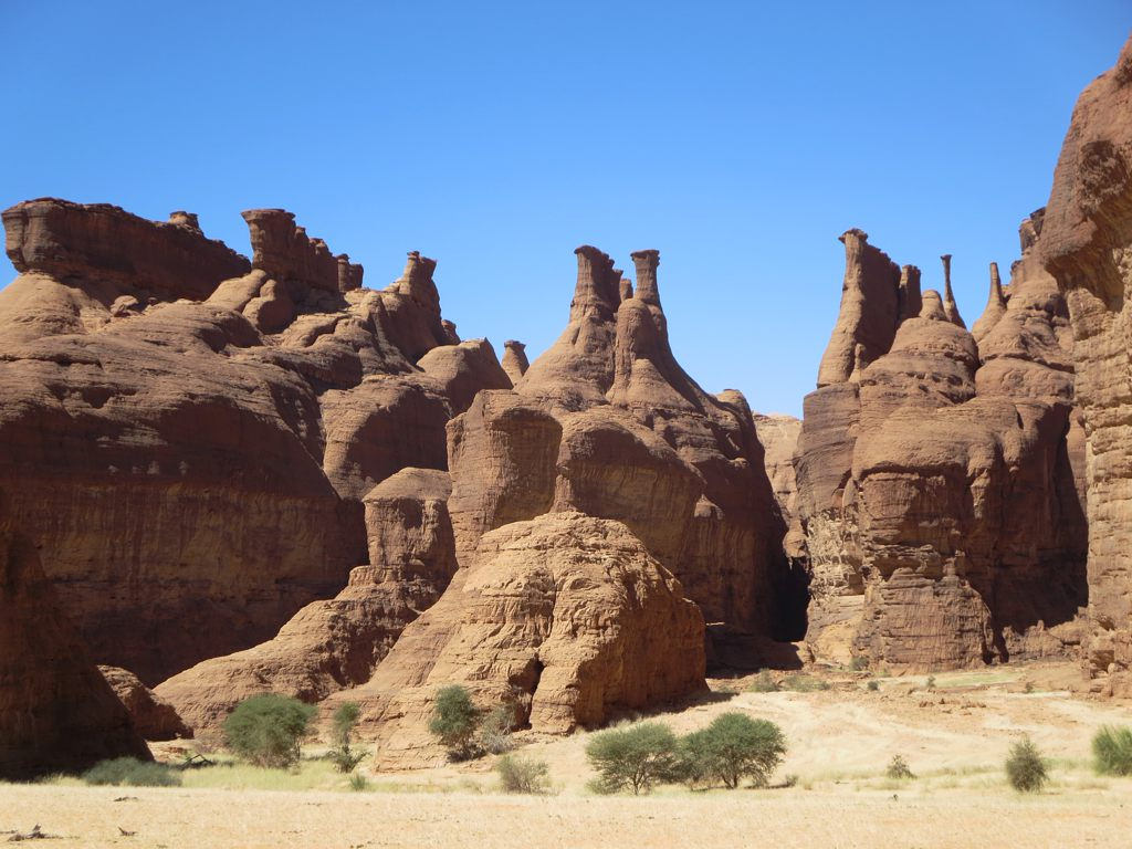
The Ennedi plateau formed from sandstone deposited during the Carboniferous period, approximately 300 million years ago, when the region lay beneath a shallow inland sea. The subsequent uplift of the plateau and the long, wet episodes of the Saharan Quaternary — periods during which the Sahara supported lakes, rivers, hippos, and cattle — allowed water erosion to sculpt the soft sandstone into its current dramatic topography. Deep slot canyons, natural bridges, towering fins of rock, and fields of hoodoos (isolated rock pillars whose harder caprock protects the softer column beneath from erosion) cover an area of roughly 100,000 square kilometres. The scale is difficult to convey: the Ennedi is not a single dramatic viewpoint but an entire landscape of sculptural formations extending over a territory larger than most European countries.
The most celebrated single geological feature is the Arche d’Aloba, a natural sandstone arch approximately 120 metres tall and 77 metres wide — dimensions comparable to the largest natural arches in Utah but located in one of the least-visited regions on Earth. The arch formed as water and wind eroded a thin sandstone fin from both sides simultaneously, eventually perforating the wall and then widening the opening as the process continued. The surrounding gorge system in which Aloba stands is itself a significant geological feature, its dark walls rising vertically from a sandy floor and sheltering the microclimate that makes the area marginally more hospitable than the open desert above. Reaching Aloba requires a descent into the gorge system, typically on foot from a 4WD vehicle left on the plateau rim, and the walk in combines narrow passages between vertical walls with open sandy floors where acacia trees grow in the seasonal drainage channels.
The plateau’s elevation and its position relative to regional weather systems give the Ennedi a slightly more humid microclimate than the surrounding Sahara, resulting in permanent and semi-permanent springs in the deeper gorges that make the landscape habitable for both wildlife and the Toubou nomads who have moved through it for thousands of years. The Toubou (also known as the Teda and Daza, referring to the two main subdivisions of the larger ethnic group) have inhabited the central Sahara from the Tibesti mountains east through the Ennedi since before recorded history, and continue to move seasonally through the massif with their herds of camels and goats. Their knowledge of the spring locations, the navigable passages between gorges, and the seasonal conditions is the practical foundation on which any expedition to the Ennedi depends.
Wildlife and rock art: Saharan crocodiles and 7,000 years of painting Guelta d’Archei approximately 120 km from Fada (the regional centre); multiple art sites distributed across the massif
The Guelta d’Archei is a permanent spring-fed pool occupying the floor of a deep gorge in the southern Ennedi. The pool is significant for two reasons that are entirely unrelated but equally extraordinary. First, it is the primary watering point for the camel and goat herds of the local Toubou population, and on any given day several hundred camels may arrive at the pool to drink — their owners guiding them through the narrow canyon entrance, the animals crowding to the water in a concentrated, chaotic gathering that has probably occurred at this spot for several thousand years. Second, the Guelta d’Archei is home to a relict population of Nile crocodiles (Crocodylus niloticus) that have survived in complete isolation from the nearest Nile crocodile populations since the Sahara began its most recent drying phase approximately 10,000 years ago. When the inland lakes and rivers that once crossed the Sahara contracted and eventually disappeared, the crocodiles that inhabited those waterways were progressively confined to whatever permanent water remained. The individuals at the Guelta d’Archei are the last survivors of this process in the central Sahara. Their population is small — estimates vary but are typically in the range of a few dozen adults — and they coexist with the daily arrival of hundreds of camels in a space that would seem too confined and too disturbed for a large apex predator. Whether the crocodiles are genetically distinct from Nile populations after 10,000 years of isolation is a question that has attracted scientific attention without yet producing a definitive published conclusion.
Distributed across more than 400 confirmed sites throughout the Ennedi, the rock art constitutes the cultural dimension of UNESCO’s mixed inscription. The paintings span from approximately 7,000 BCE to the present and collectively document the transformation of the Sahara from a wet landscape — the “Green Sahara” of the African Humid Period — through successive phases of desiccation to the hyperarid desert that exists today. The earliest paintings, in naturalistic styles that art historians associate with hunter-gatherer populations, depict cattle, hippopotamuses, and crocodiles in settings that are now absolute desert with no surface water. Subsequent phases show pastoralists managing large cattle herds, then a transition to camels as cattle became unsustainable in the drier conditions. Human figures appear swimming in what are now dry gorges. The paintings use iron oxide pigments (ochres of various colours), white kaolin, and charcoal applied directly to the sandstone walls; the dry desert air has preserved them in conditions that would be impossible in a humid environment. The Toubou continue to add to the tradition, and images of cars and aeroplanes appear alongside ancient cattle in some shelters.
Practical information
Reaching the Ennedi is a serious expedition-level undertaking. There is no tourist infrastructure in the massif: no hotels, no paved roads, no established visitor centres, and no reliable communication outside satellite systems. All expeditions depart from N’Djamena, requiring either a domestic flight to Abeche or Fada followed by a 4WD convoy, or a full overland drive of 3–4 days from the capital. Expeditions require a Chadian guide (obligatory under national law), experienced drivers familiar with the terrain and the spring locations, sufficient fuel (carried in jerry cans — there are no filling stations in the Ennedi), and food and water for the entire duration. The typical itinerary runs 10–14 days to allow meaningful time in the gorge systems and at the main archaeological sites. The political and security environment in Chad requires careful assessment before any travel: Chad borders Sudan (Darfur region) to the east, and the broader Sahel security situation fluctuates significantly. Travellers should consult their government’s current travel advisory and engage only with operators who have direct, current experience in the Ennedi. The optimal travel season is November through February, when temperatures on the plateau are moderate (daytime highs in the 20–30°C range) rather than the extreme heat of April through September.
Frequently Asked Questions
What is the Green Sahara, and how does Ennedi’s rock art document it?
The African Humid Period, informally called the Green Sahara, refers to a phase in the Earth’s climate history that lasted roughly from 11,000 to 5,000 years ago, during which the Sahara received significantly more rainfall than it does today. The cause was a shift in the Earth’s orbital parameters (the Milankovitch cycles) that altered the intensity of solar radiation reaching the Northern Hemisphere in summer, strengthening the West African monsoon and pushing its northern boundary deep into what is now desert. During this period the Sahara supported extensive savannah vegetation, large lakes (including a lake in the Chad basin, Lake Mega-Chad, that was larger than the Caspian Sea at its maximum extent), rivers flowing where only dry wadis exist today, and wildlife populations — hippos, crocodiles, elephants, and large bovids — that are now confined to sub-Saharan Africa or extinct in the region. The Ennedi rock art documents this transition with extraordinary directness: the earliest paintings, dating to the humid period, show swimmers, cattle in lush settings, and animals that cannot survive in contemporary conditions. As the climate dried over millennia, the art changes: cattle decrease and eventually disappear; camels appear (the camel was introduced to the Sahara from Arabia around 3,000 years ago, well into the drying phase); the human figures shift from swimmers and hunters to mounted warriors and herders. The Ennedi paintings are thus not merely aesthetic objects but a sequential record of ecological change, one of the most detailed in the Saharan region.
How do the Saharan crocodiles at the Guelta d’Archei survive?
The crocodiles at the Guelta d’Archei survive on a diet primarily composed of fish in the pool itself — the spring that feeds the guelta also supports a small fish population adapted to the isolated, shallow water conditions — supplemented by any birds or small mammals that come to the water’s edge. The pool’s surface area and depth fluctuate seasonally but maintain enough permanent water to sustain the crocodile population throughout the year, even in periods of below-average rainfall. The crocodiles’ small body size compared to Nile crocodile populations elsewhere has been noted by researchers, though whether this reflects nutritional limitation, genetic drift after long isolation, or simply the relatively young average age of the population has not been conclusively established. The co-occurrence of crocodiles and large camel herds at the same small pool raises obvious questions about predation, but the crocodiles appear to be habituated to the camels and the daily disturbance they cause, and attacks on livestock appear to be rare. Local Toubou tradition regards the crocodiles with a degree of respect consistent with a long-established coexistence. The practical implication for visitors is that the Guelta d’Archei provides two simultaneous wildlife encounters — the daily camel gathering and the presence of prehistoric-seeming apex predators in a desert context — that combine in a setting unlike anything visible elsewhere in the Sahara.
Who are the Toubou people, and what is their relationship with the Ennedi?
The Toubou are a Saharan people whose territory traditionally encompasses the Tibesti Mountains in northwestern Chad, the Borkou depression, and the Ennedi plateau — the central Saharan zone extending into parts of Niger and Libya. They are divided primarily into two groups: the Teda, associated with the Tibesti and Borkou, and the Daza, associated with the eastern and southern parts of the Toubou range including the Ennedi. Historically pastoralists and traders, the Toubou organised their society around the management of camels and the knowledge of the Saharan terrain — the location of springs, the navigable passes between plateaux, and the seasonal movement routes that made long-distance travel possible in an environment that would kill someone without that knowledge within days. Their resistance to outside political control was legendary: neither the Sultanates of Bornu and Wadai, nor the French colonial administration, nor successive Chadian governments have ever achieved thorough administrative integration of the Toubou into a central state structure. Within the Ennedi specifically, Toubou families maintain customary rights to particular spring locations and grazing areas transmitted across generations, and continue to move seasonally through the massif with their herds. Any expedition operating in the Ennedi works within this context: Toubou guides are obligatory not merely as a legal requirement but as a practical necessity, since the route knowledge that makes expedition survival possible resides with them.